Some of the first Ice Age humans to enter the Americas came from China, DNA study suggests研究发现冰河时期人类从中国迁徙到美洲和日本
Some of the first Ice Age humans to enter the Americas came from China, DNA study suggests
Ice Age groups on the northern coast of ancient China helped form the first wave of people to settle the New World, US media reported on May 10, a new DNA study suggests. According to the study, published May 9 in the journal Cell Reports, these ancient groups may have also migrated to Japan and the Americas, potentially helping to explain similarities in Stone Age artifacts from the Americas, China and Japan.
There are two main models of how people first migrated to the Americas. The earlier idea was that ancient Siberians made the trip when the Bering Land Bridge -- the landmass that once connected Asia to North America -- was relatively ice-free. Recent evidence suggests that multiple waves of humans traveled to the Americas from various parts of Eurasia, perhaps along the Pacific coast of Asia, the Bering land bridge, and the waterways of North America.
To understand the origins of Native Americans, the scientists examined the DNA of mitochondria, the powerhouses of cells. Mitochondria hold their own genes, which are passed down from the mother. The researchers analyzed more than 100,000 contemporary and 15,000 ancient DNA samples from across Eurasia. They focused on a rare line of mitochondrial DNA called D4h, which is currently found in only about 1 in 200 people worldwide. "This genotype has only sporadically been reported in different studies," study lead author Yu-Chun Li, a molecular anthropologist at the Kunming Institute in China, told Live Science in an email. "Thus, this female lineage, and its history of origin and dispersal—particularly its dispersal to the Americas—has received little attention until now. " "The ancestral origins of indigenous Asians are more complex than previously pointed out," Lee said.
By comparing mutations in mitochondrial DNA over time, and the geographic location and radiocarbon dates of fossils from which ancient DNA was collected, the scientists found that D4h3a likely originated in coastal areas of northern China. The new findings suggest that D4h3a's ancestors and closest relatives entered the Americas through at least two migrations. These two migrations apparently occurred when the passage from Asia to the Americas was blocked by ice blocks, so the researchers deduce that Ice Age people may have traveled through the Pacific coast and crossed the Pacific Ocean to the Americas. The researchers say the first migration likely occurred during the last ice age, the coldest part of the last ice age, between 19,500 and 26,000 years ago. At that time, ice sheets covered much of the planet, and humans living in northern China could prove difficult.
Here we see a map of Asia, mainland China with a red circle, and arrows showing how Ice Age humans migrated to Japan during the last degradation between 19,000 and 11,000 years ago. Scientists estimate a second event apparently occurred between 19,000 and 11,500 years ago, when the ice sheet began to melt. Previous work has suggested that this climate shift may have helped support the rapid increases in human populations seen in this era, which may have helped drive their spread to other regions.
Surprisingly, the researchers found that in the second wave, a lineage branched off from the northern coast of China and traveled to Japan, where they contributed to the Japanese gene pool, specifically the native Ayi Nuren. "This suggests an unexpected genetic link between Native Americans and Japanese," said Kong, one of the authors of the article. Loren Davis, an archaeologist at Oregon State University in Corvallis who was not involved The study, he told LiveScience in an email: "Overall, this new study fits very well with what we know about the Japanese archaeological record and adds to the current models of how humans entered the Americas. Persuasiveness".
The finding may help explain some of the archaeological parallels that previous work has controversially shown sometimes existed between Stone Age people in China, Japan and the Americas. Specifically, the researchers believe that the three regions share similarities in making the "stem-like impact point" of arrowheads and spears. While the scientists focused on mitochondrial DNA, other genetic analyzes they performed showed that the Native American male ancestors also lived in northern China around the same time as these female ancestors.
However, as exciting as this new research is, it's just "another piece of the puzzle" about how and when Ice Age humans first inhabited the Americas, Davis said. For example, the researchers emphasize that while these new findings suggest that this single northern Chinese ancestry may have contributed to Native American ancestry, "it does not represent the full history of all Native Americans," Li said. "Investigating other lineages showing genetic links between Asia and the Americas will help gain a complete picture of Native American history."
Thinking about the sudden outbreak of human civilization after the last ice age 12,000 years ago Archeology of Greater South China Yellow River Yangtze River Siberia Mongolian Plateau
About 150,000 years ago, many races and tribes were differentiated in East Africa, including the ancestors of the current black, brown, yellow, and white races. M168 on the Y chromosome is a very ancient mutation site discovered so far. This is a mutation that occurred when humans were about to leave Africa, which occurred about 100,000 years ago. It is with this ancient mutation that those brown and yellow people began to spread into the world. All modern humans except Africans have mutations at this site.
100,000 years ago, the earth was in the ice age, and most of the land was covered by glaciers. The entire sea level is about 120 meters lower than it is now, and many seabeds are exposed on the ground. In East Africa, various tribes crowded the parched land, competing for limited food. Perhaps because of the frequent occurrence of ethnic cleansing incidents similar to the current Rwanda, some people began to leave Africa.
"Thousands and tens of thousands of years later, modern humans have two more mutation types based on the Y chromosome gene mutation M168, M130 and M89. The former occurred 80,000 years ago, and the latter occurred 45,000 years ago. Humans have entered the Eurasian continent through North Africa." Li Hui said that the first to come out were the brown people. They mainly make a living by fishing on the seashore, and pick up high-protein food on the tidal flats. They walked along the shore of the Indian Ocean with Paleolithic tools and pitchforks. Before 50,000 AD, they had occupied the land and islands of South and Southeast Asia. In the following tens of thousands of years, the scattered life of fishing and gathering food allowed them to walk along the boundless coastline all the way to East Asia, and then they may cross the Bering Strait to reach North and South America.
Neanderthals (Neanderthal) provided clues to solve the above problems. The Neanderthals are an extinct ancient human race that lived in Europe and parts of Central and West Asia 25,000 years ago. Fossil evidence shows that Neanderthals and early modern humans probably coexisted for 20,000 years. For such a long period of coexistence, the habitats of Neanderthals and modern humans even overlapped in the Middle East and Europe, which greatly increased the possibility of gene exchange between Neanderthals and modern humans. One way to solve this problem is to directly compare the DNA sequences of Neanderthals and modern humans. The existing mitochondrial DNA data of many Neanderthals prove that Neanderthals have no contribution to the gene pool of modern humans without exception. But it is also possible that Neanderthals could interbreed with modern humans, but their mitochondrial genes were gradually lost through drift. In 2010, a research team led by Pääbo of the Max Planck Institute in Germany obtained slightly different results on the genome-wide analysis of Neanderthals. There was still no genetic component of Neanderthals found in modern Africans, but in modern populations outside Africa , have found 1% - 4% of the Nigerian genome components. Moreover, these gene exchanges occurred when modern humans just came out of Africa about 70,000 years ago, and have never happened since then, although modern humans and Neanderthals have coexisted in Europe for tens of thousands of years. Therefore, after leaving Africa, the populations all over the world that have been differentiated have preserved the same proportion of Negerian genes. The complete genome of the Denisovans (Dan, Denisovan) who lived in North Asia 40,000 years ago has also been successfully analyzed, and no genetic components of the Denisovans have been found in modern populations on the Asian continent. Instead, a genetic ratio of about 6% was found in the indigenous population of New Guinea in Oceania. It is very likely that the ancestors of the aborigines of New Guinea came into contact with the Dan people when they migrated through the Indochina Peninsula, and gene exchange occurred. Therefore, it can be determined that the Dan people have a wide geographical distribution, at least from North Asia to Southeast Asia, and they have a large population. They have the opportunity to pass considerable genetics to modern people in New Guinea. It is not easy to explain why East Asian modern humans did not have gene exchange with Dan people. Researchers had expected that early modern East Asians would have more Neanderthal or Danish genetic components. However, in 2013, the genome of the Tianyuandong Man in the Zhoukoudian area of Beijing, more than 40,000 years ago, was almost indistinguishable from that of the modern Chinese. There were no more genetic components of the Neanderthal or Dan people, and their mitochondria also came from Africa. one of the branches. From this point of view, gene exchange between modern humans and Neanderthals and Danes may have occurred, but it was very limited and contributed little to modern humans. These paleogenomic research results cannot overturn the evidence that modern humans originated from Africa based on mitochondria and Y chromosomes, and even less support the multi-regional origin theory that modern humans originated from ancient humans in various regions.
This is a very grand proposition. Compared with the origin of human beings, human migration is more complicated and difficult to infer, because human migration is hierarchical and repetitive, that is, multiple migrations and crowd return. For specific groups of people and specific migration routes There are many explanations for events and events, and of course there are more controversies. There are many different theories from archaeology, linguistics, ethnic history, genetics and other disciplines. I will only discuss the latest achievements in genetics here.
The migration and distribution of the population are closely related to climate change. In order to explore and understand the evolution of the population from different perspectives, here are some meteorological materials from the past 100,000 years. Between about 110,000 and 10,000 years ago, that is, from the Paleolithic Age to the Mesolithic Age in archaeology, the earth was in the last ice age. During that time, the sea level was much lower than it is now. Many islands are now connected to the mainland. It has become an important channel for human migration. The period from 26,500 to 19,000 to 20,000 years ago was the last glacial maximum, the period with the coldest climate and the largest glaciers in the last glacial age. Most of Asia, Northern Europe and North America were covered by ice and snow, and the living space of human beings was also reduced. It gradually shrinks as the glacier spreads. About 15,000 years ago, temperatures began to warm and glaciers began to retreat, ushering in the golden age of migration for modern humans.
First of all, from the perspective of autochromaticity, the world population can be divided into two categories, one is the African population, the other is the Eurasian population after leaving Africa, and the Eurasian population is further divided into the western Eurasian population with great genetic differences And Eurasian eastern population, Eurasian western population mainly includes Europe, the Middle East, etc. Eurasian eastern population mainly includes East Asian, Southeast Asian, Oceanian, etc., while Central Asian, South Asian and some Siberian populations can basically be regarded as the result of a mixture of the East and the West .
In western Eurasia, there are three groups of people: gathering and hunting people in Western Europe, gathering and hunting people in Siberia (such as the ancient MA1 of Lake Baikal more than 20,000 years ago), and agricultural people in the Near East. The agricultural populations of the Near East differed from the hunter-gatherers in that they had an ancient genetic component from the bottom of the Eurasian population, which was a sibling lineage to the Eurasian population. The Native Americans who arrived in the Americas more than 15,000 years ago were a mixture of Siberian hunter-gatherers and East Asians, with East Asians accounting for 60%-70%. In eastern Eurasia, there are mainly two groups of people: one is the East Asian group (mainly Chinese, Japanese and Korean, and some Indochinese Peninsula groups), and the other is the indigenous peoples of South Asia, Southeast Asia, and Oceania islands, such as the Andamans , Papuans, Australians, etc. The focus of the current academic debate is whether the aborigines on these islands arrived before the Eurasian people along the "southern route"? Or were the unique physical traits (short stature, dark brown complexion, etc.) simply due to adaptation to the local environment?
Secondly, from the perspective of the paternal Y chromosome, males all over the world can be traced back to a late Homo sapiens man in East Africa more than 200,000 years ago. Furthermore, the world can be divided into 20 backbone types, called haplogroups, numbered from A to T. The oldest A and B haplogroups did not go out of Africa, C and D haplogroups first came to Australia and Asia, E haplogroup came to Asia and returned to Africa (Figure a), F haplogroup derived GHIJ The same haplogroups form the Europa race in the west, and the K haplogroup is derived to form the NOPQ and other haplogroups to form the Mongolian race in the east (Figure b). Among them, the O haplogroup has become the mainstream of the Chinese, while the Q single Bequn became mainstream with Native American Indians.
Only a few SNP sites were found between the DE/CF and C/F clades, suggesting that DE, C, and F were probably generated successively within a millennium. Since the separation of haplogroups F and C, we have not seen a large branching event in the F clade for 18,000 years, indicating that the F clade has experienced a strong bottleneck effect. It is worth noting that all primary haplogroups, namely G, J, N, O, Q and R, branched off before the last Ice Age (about 20,000 years ago), and most of the now known Eurasian The eastern branch of the continent was produced in the late Paleolithic (10,000 years ago). The 7,000-year-old branches on the evolutionary tree are all binary, suggesting that slow population growth rates, bottleneck effects, or genetic drift during the Paleolithic era eliminated most of the once-existing clades.
After the last ice age, especially after agriculture entered the Neolithic Age, the human population began to grow a lot, which is reflected in the appearance of a large number of downstream branch nodes on the Y chromosome. The most striking thing is that three star-shaped expansions were found under O-M324, both downstream of M117, downstream of the M134xM117 compound haplogroup, and downstream of 002611. We named them Oα, Oβ, and Oγ in sequence (Figure d). The lineage successfully expanded in a very short period of time (within 500 years). These three branches have a high frequency in most East Asian ethnic groups today, accounting for 40% of the total Han people today, of which Oα accounts for 16%, Oβ accounts for 11%, and Oγ can account for 14%. Says there are about 300 million males today who are paternally descended from three late Neolithic men. The expansion times of these three branches were 5,400, 6,500, and 6,800 years ago, and the time when northern China fully turned to the agricultural stage was exactly 6,800 years ago, which is also similar to the Yangshao Culture and the Yellow River Culture 6,900-4,900 years ago in the middle reaches of the Yellow River. The Majiayao culture from 6000-4900 years ago in the upper reaches and the Dawenkou culture from 7400-6200 years ago in the lower reaches of the Yellow River coincided with the Dawenkou culture. Therefore, we believe that these three clades that expanded rapidly during the Late Neolithic laid the paternal inheritance foundation in East Asia. Compared with hunting and gathering, agriculture provides a more stable food supply, enough to feed a larger population, and keeps men away from dangerous hunting activities, so hunting-related male mortality is reduced.
After the last ice age, that is, within a time scale of about 10,000 years, these branches (Figure d) can well correspond to language groups. For example, O-M119 is found in the southeast coast of China, the Dong-Dai ethnic group, and the aborigines of Taiwan. centralized distribution. O-M95 is widely distributed in South China, southern ethnic minorities, Indochina Peninsula and Indian Munda population. O-M176 is most concentrated in the Korean peninsula, Koreans and Japanese. O-M7 occurs frequently in Miao Yao and Mon Khmer populations, but less than 5% in Han populations. In the historical period, that is, in the time scale of thousands of years ago, the Y chromosome can also trace the origin of the family. The Y chromosome type (C-star cluster) may be the paternal type of Genghis Khan or his close relatives, which appeared in a vast area extending from the Pacific Ocean to the Caspian Sea, accounting for 0.5% of males in the world. The type of Aixinjueluo family may belong to the type of C-M401.
Finally, from the perspective of maternal mitochondrial DNA (mtDNA), the branch distribution of mtDNA is also very geographically specific. For example, the African continent-specific haplogroup L is older than the type found in the Eurasian population, and the L haplogroup It is divided into L0, L1, L2, L3, L4, L5 and L6, which were produced more than 130,000 to 200,000 years ago, among which L3 is the ancestral type of mtDNA in the Eurasian population. All mtDNA outside of Africa are divided into two super haplogroups, M and N, derived from the L3 haplogroup about 60,000 to 70,000 years ago, where N includes all Eurasian-specific lineages H, I, and J , K, T, U, V, W and X, East Asia-specific A, B, R9, N9 and Oceania-specific P haplogroups also belong to the N clade; the downstream branch of the M haplogroup is distributed in East Asia C , D, G, M7, M8, M9, etc., and M root clades common in South and Southeast Asia. The analysis of Native American populations shows that most of them only belong to the four haplogroups A, B, C, and D, and very few individuals belong to the X haplogroup.
We mentioned earlier that the paternal Y chromosome began to expand on a large scale after the advent of agriculture in the Neolithic Age, while the maternal mtDNA began population expansion just after the end of the last ice age, that is, more than 15,000 years ago. The differences in geographical distribution of the types are becoming more and more obvious. The distribution of mtDNA haplogroups in northern and southern East Asia is very different. The northern part of East Asia is mainly composed of A, C, D4, D5, G, M8, M9, N9, Z branches, while the southern part is B4, B5a, F, M7, R9 and other haplogroups.
C, D, G, M8, and M9 in the northern pedigree are all downstream branches of the M haplogroup, and the M haplogroup only exists in East Africa, South Asia, Oceania, East Asia, and Central Asia, while in western Eurasia Regions are almost completely lacking. The main mtDNA haplogroups in North Asia are C, D, A, B4, G, and N9, and some haplogroups that also occur frequently in East Asia. The main branches are J and U. The North Asian haplogroups of East Asian origin include C, D, G, M3, M7-M11, M13 and Z haplogroups under M, A, N9a and Y under the N branch, and B under the R branch, F, R9, R11. Haplogroups C and D are abundant in Northeast Asia, accounting for more than 50% or even more than 80% of some groups. By fully sequencing the samples of haplogroups C and D, it was found that the ancestral lineages of C and D were born in East Asia as early as 30,000 to 50,000 years ago, and then entered South Siberia, while most of the C and D in North Asia Clade D expanded only after the Last Glacial Maximum. Although the mainstream haplogroups in North Asia are C and D, haplogroup A is also distributed frequently in some groups, such as accounting for 73% of the Chukchi people. The branches of haplogroup B in North Asia are mainly B4 and B5, and these two branches are distributed in the south of Korea and Mongolia. mtDNA haplogroup A accounts for a fairly high proportion in Tibetans, with an average of 10%-14%, while the frequency is higher in Monba (23.5%) and Lhoba (15%). The proportion of haplogroup D is higher than that of A, reaching 10%-20%, and even as high as 30% in Lhoba. Haplogroup C can also account for about 5% of the Tibetan population. Haplogroups A, C, and D in Tibetans on the Qinghai-Tibet Plateau were most likely brought in by people who entered the plateau from north to south in East Asia 10,000 to 20,000 years ago.
In the south, both the Zhuang-Dong and Austronesian languages have a high frequency of M7, and the frequency of the F haplotype in the Austronesian languages is also much higher than that of other language families. Among Zhuang Dong populations, the haplogroups with the highest frequencies are B4a, F1a, M7b1, B5a, M7b*, M*, R9a, R9b, and the sum of the frequencies of these haplogroups accounts for about half. The Miao-Yao ethnic group is similar to the Zhuang-Dong ethnic group, haplogroups B5a, B4a, M*, M7b*, C, B4b1, M7b1, F1a, B4*, R9b can also account for half of them, while in the South Asian population, the higher frequencies are F1a, M*, D*, F1b, N*, C, M7b*, M7b1, F1a1a, the first three accounted for 50.8%, slightly different from Zhuang Dong and Miao Yao. The total frequency of haplogroups B, M7, F, and R can account for 70% in Taiwan aborigines, and 66.4% in Zhuang Dong, which is higher than 58.9% in Miao Yao and 48.9% in South Asia. The value of the group going north is smaller, for example, it accounts for 40.8% of the Han people, 37.5% of the Tibeto-Burman group, and only 16.3% of the Altai group. It can be seen that the four groups B, M7, F, and R Plogroups are characteristic haplogroups that can represent southern China.
During the expansion of prehistoric humans, many people have heard of the famous "Out of Africa", but a new genetic study shows that there was a previously unknown large-scale expansion about 50,000 to 40,000 years ago , much larger in demographic terms than Out of Africa.
The British Sanger Institute announced on the 29th that researchers at the institution conducted genetic analysis on the Y chromosomes of males from Africa, Europe, Asia and the Americas. Since the Y chromosome is unique to males and is inherited only through the paternal line, its genetic and evolutionary history is relatively easy to analyze.
The results show that the diversity of genes on the male Y chromosome suddenly increased significantly between about 50,000 and 40,000 years ago, indicating that there was a large-scale population expansion at that time, because only when the population increased, the genes would be more diverse. sex.
Previously, archaeological evidence has shown that ancient humans had a major expansion "out of Africa" about 70,000 to 60,000 years ago, and were geographically dispersed to all parts of the world, which was an important event in human history. This study shows that the newly discovered large expansion of prehistoric humans is much larger than that of "Out of Africa".
Researcher Qassem Ayub believes that the route of human beings out of Africa is mainly along the coast, and after reaching all continents, they first move in the coastal areas, and the conditions of the seaside are not enough to support a large population. Ten to twenty thousand years after that, humans gradually entered and adapted to the inland areas, and the abundance of space and food on the continent led to rapid population growth.
Ancient Egypt, located in the northeastern part of Africa and at the intersection of the three continents of Europe, Asia and Africa, has always been a battleground for military strategists and a place of frequent transnational trade. Unique geographical and historical factors make Egypt a model for studying population dynamics in history. Beginning around 1000 BC, Egypt has been continuously invaded and ruled by foreigners, including the Ptolemaic dynasty established by the Greeks (332 BC-30 BC) and the Roman Empire established by the Romans (30 BC — 395 A.D.). However, the extent to which these major historical events of foreign invasion and domination influenced the genetic composition of native populations remains an unsolved mystery.
Recently, a study on the DNA of ancient Egyptian mummies showed that although ancient Egypt was repeatedly invaded and ruled by foreigners, the impact of these historical events on the genetic composition of the local population was quite limited. On May 30, the journal Nature Communication published the study online.
The mummy sample comes from the small town of Abusir el-Meleq in Egypt (Figure 1), which is located in a narrow river valley on the west bank of the Nile. According to radiocarbon dating, the mummies span from 1388 BC to 426 AD, which includes the Ptolemaic Dynasty and the Roman Empire.
Researchers at the Max Planck Institute for the Science of Human History and the University of Tübingen analyzed the mitochondrial genomes and three nuclear genomes of 90 Egyptian mummies and found that over 13 centuries, the genetic composition of populations in this region has There was a lot of continuity, and there was no big shock with the change of dynasty. The influence of foreign populations, such as the Greeks and Romans, on the genetic makeup of ancient Egyptians may have been more pronounced in areas where colonization was more concentrated or in the upper class of ancient Egypt, the researchers wrote in the paper.
After the researchers further compared the genome of the mummy with the genome of today's Egyptians, they found a remarkable feature: the African genetic components in the genome of modern Egyptians are about 8% more than those of mummies, "This is the most interesting finding in the study one," says corresponding author Johannes Krause, director of the Max Planck Institute for the Science of Human History in Germany.
Population genetic analysis pointed the source of this African genetic component to sub-Saharan regions. "This is probably related to the intensified trans-Saharan slave trade in the 8th and 9th centuries AD," Johannes explained. In fact, over 1,250 years, more than 6 million slaves were transferred from sub-Saharan regions to northern Africa.
This study provides us with a vivid example of how historical anthropologists can also unravel some historical mysteries through the study of mummies' genomes. "This is the first reliable study of ancient DNA from an ancient Egyptian mummy," emphasizes Johannes. "This pioneering study will open up a new field of mummy genome research."
However, given that the mummy samples used in the study were all from the Abusir el-Meleq region, the authors of the study said that the genetic data used came from a single location and likely could not represent all populations in ancient Egypt.
In recent years, with the important technological breakthroughs in the study of ancient DNA, molecular genetics has provided important evidence and conclusions for the study of human history in different regions and periods in the world. It is worth mentioning that the birth of Egyptian mummies and ancient DNA research also has interesting origins: the main person in charge of this study, Johannes Krause, followed Svante Pääbo, an evolutionary geneticist at the Max Planck Institute of Evolutionary Anthropology in Germany, to conduct ancient DNA research , and the latter is one of the main pioneers in this field. Professor Svante once stated in his autobiography that it was the mysterious Egyptian mummy that attracted him to this field and continued to cultivate it, achieving technological breakthroughs one after another.
The time when humans left Africa has been rewritten again
The oldest modern human remains outside of Africa have been unearthed in Israel, providing evidence that genetic studies have speculated that humans migrated out of Africa much earlier than previously thought. Figure/Visual China
Related reports Zhou Dadi: Fossil energy will eventually withdraw from the stage, China should develop nuclear power and other low-carbon energy across Tibet| bird fossil
When did Homo sapiens leave Africa, and which route did they take? Answering these questions is the key to understanding the process of human evolution. The earliest Homo sapiens fossils were previously found outside of Africa in the Skhul and Qafzeh regions of present-day Israel on the eastern Mediterranean coast. A number of skulls were unearthed in the site, dating back to the late Middle Pleistocene, the earliest can be traced back to 120,000 years ago.
Recently, another maxilla with dentition was unearthed in a prehistoric cave in Israel. According to morphological analysis, it belongs to modern Homo sapiens. The fossil dates back to 177,000 to 194,000 years ago. This evidence suggests that Homo sapiens may have left Africa earlier than previously thought, according to a study published last week in the journal Science.
In the Misliya Cave in Israel, archaeologists discovered the left half of the upper jaw of an adult (numbered Misliya-1), which was unearthed in the middle and early Paleolithic layers, together with Mo Accumulation of stone tools from the Stester culture (Tapon D type). The maxilla discovered this time preserved most of the alveolar bone, zygomatic process, part of the jawbone and the bottom of the nostrils, and the left dentition (from the first incisor to the third molar) was also preserved intact (except for the broken first incisor only the root of the tooth remains).
The side and chewing surface of the maxilla unearthed this time, the left side is a virtual 3D reconstruction (with the enamel and surrounding bedrock removed), and the right side is a physical photo of the fossil.
The researchers used three dating methods in three independent laboratories to infer its age: thermoluminescent dating of the flint unearthed at the site, uranium-thorium dating of the dentin of the second incisor and Electron spin resonance dating of the tooth enamel gave similar dating results—between 177,000 and 194,000 years ago. It is more consistent with the time range of the early Paleolithic in this area.
The researchers conducted morphological observation and principal component analysis on the maxilla and its teeth, and found that the muscle attachment point at the zygomatic root of the maxilla is relatively anterior (close to the position of the first molar), and the shape of the canine fossa and the bottom of the nostril are similar to those of the maxilla. Modern man is closer. Premolars have Homo sapiens-like, tall, narrow crowns. The size of the protocusp and subcusp of the molars is consistent with that of modern humans, but different from that of Neanderthals.
Reduction of the subcusps of the first to third molars, which is very common in Homo sapiens. The size of the entire dentition is at the maximum in the range of modern humans, and the size and shape of the roots also fall within the range of variation in modern humans. The 3D morphological analysis of the enamel-essential interface and the cementum-enamel interface also falls within the range of Homo sapiens.
Generally speaking, the maxillary teeth discovered this time are inconsistent with the fossils unearthed from the Eurasia and Africa continents in the Middle Pleistocene. Compared with Neanderthals, they are closer to modern humans.
In the history of human evolution, the geographical location of Southwest Asia is like a corridor. The site in Israel has a very close geographical relationship with Africa. Therefore, the unearthed fossils probably reflect the expansion of Homo sapiens under environmental pressure.
The new study changes the time we once thought Homo sapiens left Africa, and it matches recent genetic testing. New evidence from DNA suggests that Homo sapiens may have left Africa 220,000 years ago.
In addition, at the location where the maxillary fossil was unearthed in the Mislia Cave in Israel, stone tools made by the mature Levallois technique were also unearthed. The rise of this stone tool manufacturing technology is also likely to be related to the arrival of Homo sapiens.
The first human exodus from East Africa was about 300,000 years ago (Home Erectus, Homo erectus).
They went north from East Africa to the Middle East, and then divided into two groups:
It reached most of today's Europe to the west, and became the ancient human Neanderthal (Neanderthal) in archaeology;
They reached Siberia to the east and became the archaeologically known ancient human beings, Denisovans (Denisovan).
The ancient human teeth recently discovered by the Institute of Vertebrate Paleontology of the Chinese Academy of Sciences in Dao County, Hunan Province were dated 80,000 to 120,000 years ago (see the British "Nature" magazine on October 15, 2015). Descendants who left Africa 300,000 years ago.
Whether we have the inheritance of Daoxian ancient humans still needs further tests to know.
But both Neanderthals and Denisovans died out 30,000 years ago, and they are not the ancestors of modern humans today.
The ancestors of modern humans today are modern humans (or Homo Sapiens) who left Africa from East Africa about 70,000 years ago.
They went north again to the Middle East through today's Egypt or the southern narrowest part of the Red Sea.
Then the troops were divided into two groups, going west to Europe and east to Asia.
Although the ancient humans are extinct, their blood still flows in each of us.
When our modern human ancestors left Africa and reached the Eurasian continent, they met their "distant relatives" separated by 200,000 years. Due to their long-term evolution, they are already completely different races.
The bodies of modern humans are not as tall as the ancient humans, but their brains are brighter than theirs. In the process of getting along with each other for about 30,000 years, the ancient humans completely disappeared into the dark tunnel of history through conquest and mating.
Due to the interbreeding between ancient humans and our ancestors, all the people in the world today except those who stayed in their hometown in Africa have 1% - 4% of the genes of ancient humans.
I am no exception, as shown in Figure 1:
I have 1.3% Neanderthal genes and 1.6% Denisovan genes in me. The average of 750,000 people who participated in the test is 2.1% and 2.1%, respectively.
The reason I am below average is that the Neanderthals were mainly active in Europe and the Middle East. My ancestors left there about 60,000 years ago, and the Neanderthals did not become extinct until 30,000 years ago.
So the people who stayed there had a chance to mate with the Neanderthals for another 30,000 years, and the Neanderthal genes in the aborigines there would be higher.
Denisovans are currently only found in Siberia. My ancestors entered China from the south, so the Denisovan genes in me are also smaller than the average.
Figure 1 The proportion of ancient human genes in me is smaller than the human average
2. Where did Homo Sapiens enter China?
There are three routes for modern people to enter China.
As shown in Figure 2 (the area marked with "East Asia" is China):
The first southern line: Burma-Yunnan Entry
All the way from the Middle East to the east, it passes through Southwest Asia (Iran, Iraq) and enters South Asia.
One branch was blocked when they reached the Karakoram-Himalayas. They bypassed the Himalayas along the southwest foot of the mountains, entered the Guangxi area of Yunnan from Myanmar and Vietnam, and headed east and then north along the coast (at that time, the sea level was lower than it is now. 100 meters, the coastline is greatly extended)
The other group went north and entered Sichuan and Gansu, and then divided into two groups. The west route went to the Qinghai-Tibet Plateau, and the east route entered the Central Plains from the Loess Plateau.
The branch from the Central Plains went northward to Korea and Siberia. This branch is currently considered the most "mainstream" Chinese.
The second northern line: Mongolia-Inner Mongolia entry
This branch goes northward from Iran to Central Asia, from Turkmenistan and Uzbekistan to the Kazakhstan steppe, and then goes west all the way to Mongolia, and one branch turns south from Inner Mongolia to China.
The other branch continued eastward and crossed from the Bering Strait Road Bridge (the sea was shallow at that time) to America about 15,000 years ago, along the west coast of America all the way from Alaska to the southernmost tip of Chile. (The Oroqen are a bit like the American Indians, right?)
The third branch, the Eastern Route: Japan-Northeast Entry
This branch was the first when it entered the country from Yunnan, and another group continued to go south to the Indochina Peninsula, crossed the sea to Indonesia, and then went north by sea to Taiwan, Japan, and then by sea (possibly from the Sakhalin Peninsula of Russia) ) into the northeast or the coast of the Bohai Sea.
Like the second branch, there is also a group that continues northward and enters America through the Bering Strait.
Figure 2 Migration routes of modern humans
3. Which route did my ancestors take?
The test results are divided into patrilineal migration routes and matrilineal routes.
Only men have a Y chromosome, which is passed down through the paternal line, and both men and women have mitochondrial DNA, which is passed down through the maternal line.
The paternal migration route can be known by measuring the genetic variation in the Y chromosome of a man; the maternal line can be known by measuring the mitochondrial DNA of men and women.
The simple and crude principle of the test is this: Genes will mutate when inherited, and this variation will be passed down stably from generation to generation.
During tens of thousands of years of migration, humans have continuously produced mutations, and these mutations will be carried to the next area by the migrants.
The people who have moved to the new environment will have new mutations, and the new mutations in the descendants of the people who stayed in the original place are different from those who moved away.
Because of the long history of staying in the same place, the genetic diversity is high (that is, the genetic differences among the population are large), and a small branch that is separated out brings the same genes to the new place for a relatively short time, and their genetic diversity is low .
So today Africans have the highest genetic diversity, while American Indians have the lowest diversity.
Based on the genetic diversity characteristics of these regions, coupled with archaeological evidence, a rough migration route can be spelled out.
It is estimated that there are more men who participated in the test, so the results of the father's line are more detailed.
My father was born in Tianshui, Gansu, where his father, grandfather and great-grandfather were all born.
Then let's take a look at how my father's line came from Ethiopia step by step:
The first journey started 100,000 years ago in Africa
Figure 3 "Son" P305 of "Adam" set off from East Africa to the southern end of the Red Sea
The common ancestor of all men in the world today is a handsome guy in East Africa who lived 150,000 to 300,000 years ago.
Scientifically, he is called "Y Chromosome Adam".
He was actually not the only man at that time, let alone the first person who created the world, but only his descendants have been passed down to this day.
This is the greatest achievement of a man.
After "Adam," a genetic mutation labeled P305 occurred in an East African man about 100,000 years ago.
This mutation is the earliest gene mutation known today that is not shared by men all over the planet.
About 99.9% of the people on the earth are his descendants.
As his descendants spread across the globe, there were many new mutations in different descendant branches.
Figure 3 is the departure map from East Africa, which is divided into three branches. The northward one reaches the southern end of the Red Sea, where Ethiopia and Yemen are separated by the sea today (the two sides may be connected by land at that time), and the other can go from Africa to Asia. The place is to go to the northernmost head of the Red Sea, coming from Egypt.
The second leg was 70,000 years ago, starting from East Africa
Figure 4 The first M168 branch out of Africa
When humans left Africa, they continued to branch during the migration process, and each branch had its own unique genetic variation markers.
The gene marker of the first branch out of Africa is M168. The man with the M168 mutation may have lived in the Great Rift Valley of Northeast Africa 70,000 years ago, which is today's Ethiopia, Kenya, or Tanzania.
Today all men in the world except Africa bear the M168 markings.
Although today we cannot be sure of the exact routes of their migrations, our nomadic ancestors followed the good weather and the animals they could hunt.
Scientists believe that, in addition to the powerful climate at that time, human intelligence has made great progress, especially the emergence of language gave our ancestors a great advantage, allowing them to more easily cooperate to hunt and defeat other ancient humans such as Nyan Deutsche.
It can be seen from Figure 4 that two branches crossed the Red Sea and reached the Eurasian continent.
The most likely place where they crossed the Red Sea was the southernmost and narrowest part of the Red Sea (probably land at that time)
That is, in the Bab-al Mandeb strait where Ethiopia and Yemen face each other today
Why did the ancestors leave the familiar hometown to go to a strange place?
The answer is to follow what you eat.
It is very likely that the drought caused by the ice age in Africa forced them to leave their homes.
Exodus from Africa is not a continuous flow, but waves.
When the climate is humid, the Sahara desert becomes a savannah, which is passable; but when the ice age comes, the Sahara becomes impassable, and the door to migration is temporarily closed.
Sometimes it may take tens of thousands of years once it is closed.
The third leg was 60,000 years ago, starting from Southwest Asia:
Figure 5. From the Middle East, the troops are divided into two groups
The 143 variant logo is the oldest branch of human beings after they came out of Africa. After humans crossed the Red Sea and arrived in Asia, they split into two groups. The arrow facing east in the picture entered Southwest Asia, which is today's Iraq and Iran.
Today's Asians, Australians and South Pacific people (aboriginal) are all their descendants.
They traveled east along the coastline to India and Southeast Asia, and reached Australia about 50,000 years ago.
These people who arrived in Australia were probably the direct ancestors of today's Australian Aboriginal people.
The fourth journey was 50,000 years ago, starting from Southwest Asia
Figure 6 I can't go back to my hometown in Africa; all the way to Nanyang
After living in Southwest Asia for thousands of years, the ancestors began to migrate in all directions:
To the southeast to the Indian Ocean, to the north to Anatolia (Turkey), the Black Sea and the Caspian Sea.
The M578 mutation occurred prior to migration from Southwest Asia.
About 40,000 years ago, the climate became cooler and drier again.
There was a severe drought in Africa and the Middle East, and the grasslands turned into deserts.
This drought lasted until 20,000 years ago.
During the past 20,000 years, the ancestors could not return to their homeland in Africa. They had only two options: either stay in the Middle East, or leave.
The fifth journey started from Central Asia 35,000 years ago
Figure 7 The M214 branch is divided into three routes: go south, go north, and go west
The M214 branch was divided into three routes: going north into the Central Asian steppe (via Turkmenistan, Uzbekistan into Kazakhstan.
After this branch went north, it was divided into two branches:
A branch goes eastward through Siberia and enters East Asia (China)
The other turned around and headed west to Scandinavia in Europe.
The other branch continued to go southeast to South Asia, and another branch of this branch entered China from Yunnan.
The sixth journey, from 41,000 years ago to 28,000 years ago, started from Southeast Asia:
Figure 8 Welcome to our ancestors to China!
186 This branch is very important, because they entered China about 40,000 years ago.
The big arc in Figure 8 is from South Asia to the west and encounters the insurmountable Karakoram and Himalayas.
These two mountain ranges are folds formed by the Indian continental plate drifting north from the Indian Ocean and squeezing into the Eurasian continental plate.
The Himalayas are still growing by one centimeter every year. 40,000 years ago, these mountains were only less than 400 meters lower than they are now.
These two mountain ranges include dozens of the highest peaks in the world at 7,000 meters and 8,000 meters. At this altitude, oxygen is only 1/3 of sea level.
The ancestors could only take a detour, going north to the north of the Tianshan-Qilian Mountains, and going south along the southern foothills of the Himalayas all the way to Myanmar and Vietnam (is there any reason for the Chinese border formed by history?).
Most Chinese people today have the P186 mutation.
Is this branch the first to enter China?
I don't know, if more Chinese people take part in the test, they will definitely be able to find people entering China from the Mongolian plateau northern route and the Japanese eastern route.
Only by looking at their migration routes and time can we know which one is the earliest.
Today, the lineage of P186 also appears in South Asia.
23% of Indian males belong to this lineage.
In Northeast Asia, the frequency of this bloodline is much higher.
The proportion of people with this bloodline in different regions of Japan ranges from 47% to 65%; that of Koreans is 70%-82%, and that of Chinese Han people is 69%-86%.
So P186 is a typical Northeast Asian ancestry.
The seventh journey, from 38,000 years ago to 21,000 years ago, started from East Asia
Figure 9 The ancestors of South China who invented rice spread all over Southeast Asia
After the ancestors entered Yunnan and Guangxi, China, one branch (M119) went east and then north along the coastline (the sea level at that time was 100 meters lower than now, and the coastline was much farther away). This branch may be the ancient Baiyue people in the south. and the ancient Yi people in the east.
Another variant, M122 (and later M197), was further divided into two branches:
One branch continued northward to Sichuan, Gansu, Shaanxi, Henan, Hebei, northeast, and finally to North Korea, Japan, and Siberia (probably part of it also went to America, and in the upper half of the north, another branch branched westward to become Tibetan and Qiang people in Sichuan and Gansu);
Another branch turned south and entered the Indochina Peninsula, continuing to Indonesia and Papua New Guinea.
Twenty thousand years ago was the peak of the last ice age. A large amount of seawater was frozen in the North and South Poles and land glaciers. The sea level was 130 meters lower than today. into a continent.
So at that time, most of the "Going to Nanyang" just walked over.
It can be speculated that during the Ice Age, the north was cold and dry, and the tropics and subtropics were very suitable for survival. Therefore, during the Ice Age, a large number of people should have migrated south, and they would migrate north only after the weather warmed.
About 10,000 years ago, when the peak of the Ice Age passed and the earth warmed, the ancestors in southern China and people in the Fertile Crescent of Southwest Asia started farming almost at the same time.
The Fertile Crescent (today's Iraq, Syria, Lebanon, Jordan, etc.) was the first to breed wheat and most of today's grains from wild wheat, while the ancestors of southern China were the first to breed rice.
Rice husks were found from the Jiahu site in Wuyang County, Henan Province (about 9,000 years ago).
The cultivation of rice made food rich and controllable, and the population exploded, and the dense population exacerbated migration.
Most of the aborigines in the Indochinese Peninsula and Southeast Asia today migrated from southern China in the past 10,000 years.
Today, 57% of the Han people in China have M122 ancestry, and 32% of the people in Polynesia (South Pacific island country).
Where do I have the most "cousins"?
Figure 10 is a distribution map of people who are genetically similar to me. The darker the color, the more people are genetically similar to me.
Figure 10 Where do my "cousins" live?
The colors and corresponding percentages are marked in the upper left corner of Figure 10.
This percentage is the proportion of people with the same gene branch as me in the population of various places.
(Branch: Haplogroup, the last mutation of my branch, P197, is at least 20,000 years old. So these branches are still relatively thick. If more people participate in the test, more recent mutations will be discovered, so the branches can be divided into finer and smaller )
It can be seen that the top three places where my "cousins" are most densely distributed are (i) Beijing-Tianjin/eastern Inner Mongolia (ii) Northeast and North Korea (iii) Yunnan and Sichuan.
What's more interesting is that I also have quite a few "cousins" in Tibet and Kazakhstan.
My farthest "cousin" reaches Japan in the east, the Caspian Sea in the west, Malaysia and Indonesia in the south, and Siberia in the north.
4. How pure is my seed?
The above is the migration map of my father's line obtained by testing the Y chromosome.
Another test is to compare all the mutation markers in my genes except the Y chromosome with the typical mutations in various regions, and look at the migration and marriage history of my recent ancestors (hundreds to a thousand years).
National Geographic's genetic geographic testing program divides the world into nine typical regions.
They found the most representative variant markers in these 9 typical regions (that is, the group of variants occurs most frequently in this region).
The plan also established a standard sample of 60 countries, that is, samples were taken from various countries, and the average value of the samples was used as the standard sample.
When your results come out, they give you the two countries that are closest to you.
Due to migration and mating, everyone's genes have multiple regional attributes. Figure 11 is my regional attribute and the comparison with the Chinese standard sample.
The above is the Chinese standard sample sampled in Beijing, and the following is my test result.
In Figure 11, the red ones are "Northeast Asia", the yellow ones are "Southeast Asia", and the brown ones are Southwest Asia.
Figure 11 Comparison of my gene region attributes and the standard Chinese sample
My genetic region attribute is Middle East Asia 69%, Southeast Asia 29%, Southwest Asia 2%.
That is to say, among all the variant markers I tested, those variants belonging to Northeast Asia accounted for 69%, and so on.
What does this mean?
This means that most of my "cousins" are located in Northeast Asia, and Southeast Asia is my distant cousin.
Southwest Asia is the third most distant cousin, and people from the other 6 regions of the world are farther away from me or have nothing to do with it.
Why do Chinese people have so many Southeast Asian characteristics (28%)?
The reason is that most of the aborigines in Southeast Asia migrated from southern China after the rice agricultural revolution.
The 29% Southeast Asian attributes in me do not necessarily mean that one of my parents or grandparents is Southeast Asian, but that my parents, grandparents, great-grandparents, and everyone in turn have these Southeast Asian attributes.
The closest country sample to me is unsurprisingly China. My Northeast Asian attributes are slightly less than the Chinese standard sample.
The most interesting thing is Southwest Asia, which is 2 percentage points more than the Chinese standard sample.
Going back to the "Cousins Distribution Map" in Figure 10, you can see that there are a little bit of my cousins at the northern end of the Caspian Sea and the western end of Kazakhstan.
I guess it might be that the Chinese standard sampling is in Beijing, while my bloodline is in the Northwest, which is closer to Southwest Asia.
My grandmother was also born in Tianshui, Gansu. She has curly hair.
I went to the village where she was born when I was a child. Her relatives seem to have higher cheekbones than the local Han people.
This is perhaps where my 2% Southwest Asian ancestry comes from.
This analysis also provides the second closest reference country, which is Japanese.
Figure 12 Comparison of my gene region attributes and the standard Japanese sample
It can be seen that the Japanese have more Northeast Asian genes than the Chinese, so there are fewer Southeast Asian genes.
Because South Korea was not used as a sample country in this study, otherwise my genes must be closer to South Korea than to Japan.
Among the sample countries in Northeast Asia, besides China and Japan, there is also Mongolia.
The following is a standard sample of the Mongolian
Fig. 13 The standard samples of genetic area attributes of Mongolians
The distribution of genetic regions of Mongolians is much more complicated than that of Chinese and Japanese.
Except that the Northeast Asian attributes are similar to ours, their genes in the Southeast Asian region are less than half of ours, 12%.
This shows that they entered East Asia westward from the Central Asian steppe.
They only have half of the Southeast Asian genes when they mate with our ancestors and those who went north (some of them went to Southeast Asia).
They have 9% Southwest Asia which also explains their path from Central Asia.
Seeing this, I speculate that the 2% Southwest Asian genes in me are probably the genes of the Mongols. After all, a large number of Mongols entered the Central Plains during the Yuan Dynasty.
The most interesting thing is that they have 4% American Indian genes, which means they are the ancestors of Indians.
In the end, they still have 6% of the Nordic genes. What's the matter?
This is the modern imprint left by the marriage between Russians from Europe and locals during the former Soviet Union.
Conclusion
This research is in the present tense.
Every time, as the test sample increases, new variations and information will be discovered, and everyone's results will be slightly updated.
At present, some results are not particularly consistent, and some analysis expressions are not so strict.
An important regret is that since this research is about the migration routes of human beings around the world, the Chinese part is unavoidably careless.
The School of Life Sciences of Fudan University and the Center for Modern Anthropology also joined this global testing cooperation plan.
Fudan University has more sampling in China and more information on migratory clades within China.
In the future, I hope to test again in Fudan to see the migration route of my ancestors after they came to China.
But in general, this test provided a huge amount of information, and it was a shocking experience that subverted the three views.
How did Western Eurasian populations spread to Central Asia and Siberia?
In this paper, using the method of multivariate analysis, 220 sets of Eurasian Neolithic and Bronze Age male skull data were analyzed. The results support the notion that cave tomb culture populations had a significant influence on the origin of the Avanasievo culture. In addition, the following populations are mainly of indigenous Siberian origin: peoples of the Okunev culture in the Minusinsk Basin, peoples associated with the Karaku, Ust-Tartas and Kolotov cultures, and those in Che Crowds in Avanasevo-type cemeteries found in Erno-Ozeye and Yelovka and watersheds. The skulls of the Samu group are most closely related to the remains from the Poltavka necropolis. The Okunev population in the Tuva area, which may also include the Yelunino cemetery population, is likely to be the direct descendant of the shaft tomb culture population (Yannaya culture) and the early cave tomb population in the Ukrainian region. The Araku cultural group in western Kazakhstan is also descended from these groups. The Araku culture population has similarities to a large number of Neolithic and Bronze Age populations of Central and Western Europe. The people who created the typical Fedorov cultural remains are descendants of the Avanasievo tribe in the Altai Mountains, while other Fedorov cultural groups are obviously the late shaft tomb culture and caves of the North Caucasus and the northwest coast of the Caspian Sea Descendants of the tomb culture group. The Gumugou population is closest to the Fedorov culture population in northeast Kazakhstan and the Altai-Rudny region, implying that the Caucasian culture population entered Xinjiang from the north rather than from the west. It is misleading to describe the Caucasian-type skulls of Siberia and eastern Central Asia as "Mediterranean"—these populations are not directly related craniologically to populations from the Middle East, southwestern Central Asia, and Transcaucasus. All the evidence proves that they belong to the Noridc type of the Caucasian population.
Kozintsev still spent a lot of energy on the collation and analysis of the skull data. There are still many new discoveries in this article.
For example, the article states that "the people who created the remains of the typical Federovo culture are descendants of the Avanashevo tribe in the Altai Mountains, while other Fedrovo culture groups are obviously from the North Caucasus and the northwestern coast of the Caspian Sea. Descendants of late shaft tomb culture and cave tomb culture.” This point is very consistent with Mr. Guo Wu’s analysis of many archaeological materials. Mr. Guo Wu believes that the shape of the straw baskets of the Xiaohe Culture is very close to the pottery of the Fedorovo Culture. Combined with other evidence, it is believed that the Xiaohe culture is most closely related to the Fedrovo culture, not to the Chemulchek culture.
In addition, the Andronovo cultural community is a group of archaeological cultures that are close to each other, but the differences in internal cultures show that they do not have the same origin. Previously it was also generally believed that the Andronovo cultural community was created by the ancestors of the modern Indo-Iranian speaking peoples. But that may not be the case. In short, there is still no accurate and clear conclusion about the origin of various cultures under the Andronovo cultural community and their relationship with modern people. To be continued research.
The tombs in the Xiaohe cemetery are arranged in five layers, and the relics change significantly between morning and evening, which can be roughly divided into two periods: morning and evening. Wu Xiaohong and others dated nearly 30 samples of plant seeds and animal furs from different layers in the Xiaohe cemetery. The age range obtained through data fitting is 1950 BC to 1400 BC, and the boundary between the early and late periods is around 1700 BC; The dating results of 5 samples from the northern Keriya cemetery whose cultural appearance is consistent with the Xiaohe cemetery in the hinterland are 1880BC~1700BC; the dating results of 4 samples collected from the Xiaohe cultural remains on the north bank of Lop Nur are 2200BC~1880BC. In addition, combined with environmental archaeology, the bark, reed, and shell samples of Populus euphratica collected near the cemetery were dated. The results show that the Xiaohe area was 3,000 years ago, 1,500 years ago, 1,000 years ago, and in the 1850s. There are water resources.
According to these dating data, the early stage of the Xiaohe Culture is 1950BC~1700BC, and the late stage is 1700BC~1400BC.
However, the Fedorovo culture (Fedorovo) existed from 1500BC to 1300BC, and was mainly distributed in the northeast of Kazakhstan to the northwestern foot of the Altai Mountains. Such a time range cannot affect the formation of Xiaohe culture in any case.
It can be inferred that Federovo culture as a whole is likely to be produced by the confluence of the earlier Avanasianwo culture and the later Andronovo culture.
According to Han Kangxin's research, the Xiaohe cemetery is not a kind of culture, but is close to the Afanasian culture in the early stage, and close to the Andronovo culture in the late stage.
Therefore, the most likely scenario is that both the Fedorovo culture and the Xiaohe culture were produced by the joint action of the Ah and An cultures in different places.
In addition, from the analysis of terrain and water system distribution, the migration across the Altai Mountains from the north road is much more difficult than the migration from the west road.
Logically speaking: if two cultures have similar elements, it must be the inheritance relationship between father and son, or son and father. It is also possible that there is a brotherhood of common ancestors, or there is still some interaction between the two cultures.
In addition, the natural environment of the Altai Mountains is too harsh. It is impossible for human beings not to take the relatively easy western route, but to break through the more difficult northern route first.
"The stone man discovered at the Shimao site also has similarities with the stone man in northern Xinjiang. The similar stone man in Xinjiang is generally believed to belong to the Chemurchek culture (about 2500-1500 BC?). Qiemuerqie One of the characteristics of the Ke culture is that most of the tombs have a rectangular cemetery surrounded by stones, and stone figures are planted on the east side of the cemetery. , some of the front are engraved with the image of a cow, some with one head, some with two heads, and one case is engraved with a two-wheeled ox cart. Stone statues can be divided into males and females according to whether they have beards or chest features. Female breasts are inverted triangles. Indicates udders. Cows are generally carved on male stone statues. Perhaps at a later stage, a simplified stone man appeared, which is somewhat similar to the small burial stone man of the Okunev culture, that is, it is simply shallow on the upper part of a stone pillar. Carved a human face. There is a complete rectangular sarcophagus in the Altay Regional Museum, which is surrounded by four stone slabs, and four human faces are carved on the sarcophagus board on the narrow side. Judging from the characteristics of the human face, Chemur The stone figures of the late Chek culture are relatively close to those found at the Shimao site."
"The most spectacular stone man of this period was popular in the Okunev culture in southern Siberia (about 2500-1700 BC). According to the analogy of cultural factors, some people speculate that the Okunev culture came from the northern forest. Some scholars believe that The entire Okunev culture may have originated from the Ust-Belaya culture (Ust-Belaya) in the middle reaches of the Yenisei River, and can be divided into four stages: the first stage belongs to the Chalcolithic Age, with more cultural reservations In the second stage, it coexisted with the Avanasevo culture; in the third stage, it was completely its own tradition; in the fourth stage, it gradually integrated into the Andronovo culture.
Then, the ages of the four stages are:
The first stage belongs to the Chalcolithic Age, 2500BC~2300BC.
The second stage coexisted with the Afanasevo culture, 2300BC~2100BC.
The third stage is completely its own tradition, 2100BC~1900BC. This stage is typical of Okunev culture.
The fourth stage gradually integrated into Andronovo culture, 1900BC~1700BC.
The early remains from the Chemurchek necropolis, including Group I and Group II remains, belong to the Chemurchek culture. For the remains represented by M16, the age range "may be between the early 2nd millennium BC and the middle of the 2nd millennium BC", that is, ~2000BC~1500BC. In addition, some remains may have continued to the second half of the 2nd millennium BC, that is, 1500BC~1300BC (?).
The third group of the Chemurchek cemetery is very different from the first two groups, entering the Iron Age and not belonging to the Chemurchek culture.
After the Chemurchek culture, the only archaeological remains in the Altai region are the Kush site, whose archaeological data are very weak. According to the argument, the Kushi site was produced under the influence of the Karasuk culture, and the age range should be close, that is, the upper limit is no earlier than 1300BC, and the lower limit is 1000BC.
*************
In addition, Mr. Guo Wu demonstrated in detail the rise and spread of Sandao Haizi culture in his book "Archaeological Research on Late Prehistoric Society in Xinjiang".
The rise of the Sandaohaizi culture and the northwest of Mongolia and the Tuva region expanded strongly to the southwest between 1000BC and 500BC, covering the east and west of the Junggar Basin in northern Xinjiang.
After 500BC, it was close to entering the era of written records. During the time period from 500BC to 200BC, the following groups of people were distributed from east to west in northern Xinjiang:
1, Yuezhi people in the eastern part of East Tianshan.
2. In the west of the East Tianshan Mountains - near Urumqi is Wusun.
3. The Ili River Basin is a Cypriot people.
4. People from Cheshi/Gushi in the Turpan Basin.
5. The Altai Mountains region is Hujie.
The subsequent history is largely recorded in writing.
In summary, the archaeological culture of the Altai-Northern Xinjiang region:
Early Chemulchek culture, ~2000BC~1500BC.
Late Chemulchek culture, ~1500BC~1200BC.
Kushi site like Karasuk, ~1200BC~1000BC.
Sandao Haizi Culture, ~1000BC~500BC.
Three stages of the Andronovo Community:
1. The first stage is 1700BC~1600BC. Represented by the Petrovka type Petrovka, it is distributed in the southern Urals, northern and central Kazakhstan. It is the rising period.
2. The second stage is 1600BC~1300BC. Represented by Alaku type (Alaku) and Fedorovo type (Fedorovo). It is a prosperous period. Spread to the Yenisei River Basin and southern Central Asia.
3. The third stage is 1200BC~900BC. It declined under the influence of the rise of wooden tombs in Eastern Europe and the Karasuk culture in Siberia. Represented by the Alekseevka type (Alekseevka) in central Kazakhstan and the Seven Rivers type in the Seven Rivers region.
The burial custom of the Turkic Ashina family is a sarcophagus tomb surrounded by stone men and stones, which is also a typical burial type of the Chemurchek culture. It is by no means an accidental phenomenon that this type has re-emerged nearly a millennium after the decline of Chemlchek.
The Okunev culture, Karasuk culture and Sandao Haizi culture are powerful cultures that spread westward with the Mongoloid as the dominant ethnic group.
Since the various branches under the paternal line C3 spread only at a very late time, the eastern component should be represented by the Q Mainly, N is auxiliary.
In southern Xinjiang and eastern Xinjiang, the oriental elements consist only of Han-Tibetan people.
The Xiaohe-Gumugou cemetery can be divided into the following three phases:
1. The first phase is the early Xiaohe culture, dating from 1950BC to 1700BC.
2. The second period is the late Xiaohe culture, dating from 1700BC to 1400BC.
3. The third period is Sandaohaizi Culture, dating from 1000BC to 500BC (?).
Part of the evidence shows that the formation of the Xiaohe culture is related to the Chemurchek culture, while at the same time there is evidence that some relics of the Xiaohe culture are closest to the Fedrovo type of the Andronovo community. The Chemurchek culture itself is the product of the combination of the Avanasievo culture and the Okunev culture, and the influence of the Andronovo culture has been observed since the late period of the Chemurchek culture.
Therefore, my personal thoughts on the complex relationship between archaeological and cultural origins in this area are as follows:
1. The people of the Avanasievo culture migrated from Eastern Europe to the east, and finally reached the Minusinsk Basin. During this period, this type of culture, and its relatives, assimilated various indigenous peoples encountered during migration, including those in the Altai Mountains.
2. In the later period of Avanasievo culture, Okunev culture rose and expanded strongly. In the Altai Mountains region in the southwest, the local Avanasievo culture was integrated to form the Chemulchek culture. This culture adopts Okunev's special burial style and Avanasevo type pottery, which should be regarded as the foreign Okunev residents conquering the local area and adopting some original local cultural factors.
3. Chemulchek culture spread to the whole northern Xinjiang. In the east, it reaches the Hami area, and directly participated in the formation of the following cultures: the local northern Tianshan culture, the Hanqigou type of the Yanbulak culture, and the later Nanwan type remains of the Balikun grassland. In the south, it reached the lower reaches of the Kongque River and formed Xiaohe Culture. In the northeast of Kazakhstan, there are archaeological remains very close to Chemurchek (data to be investigated in detail).
The origin of the oriental elements of the Fedrovo culture in the Andronovo community is probably the same as the reason for the formation of the Chemurchek culture.
4. The residents of the western foot of the Altai Mountains (the fusion of the residents of the Avanasievo culture and the residents of the Okunev culture, the status is the same as that of the Chemurchek culture group), and received the Andronovo culture from the west. Cultural factors (Petrovka type), formed the typical Fedorovo culture. However, this culture rose rapidly and formed a powerful culture in the Andronovo community.
The Federovo culture, as part of the Andronovo community, influenced eastward the Late Chemurchek culture in the Altai Mountains (emergence of copper bells). The factors similar to Fedrovo culture in Late Xiaohe culture may be derived from a common origin, rather than the result of migration of Federovo culture populations (the age of Late Xiaohe culture is earlier than that of Fedorovo culture).
Mrs. Okune was originally a Q-dominated North Asian ethnic group. It is problematic to infer the original origin of cultural populations from skull measurements alone, such as "the Okunev population in the Tuva area, ... probably the shaft tomb culture population (Yamnaya culture) in the Ukrainian area and early caves direct descendant of the Tomb Crowd."
Also, from the "Ancient mtDNA of the Bronze Age in Southwest Siberia" you reposted, and the previous analysis of mt-c found in Neolithic tombs in Ukraine, the Andronovo people are not purely proto-European, but have been mixed. Matrilineal components of some Eastern Eurasians. This may be the reason for the rounder head shape of the Andronovo type compared to the Avanasianvo type.
As for your statement that "the Andronovo cultural community is a group of archaeological cultures that are close to each other, but internal cultural differences show that they do not have the same origin", I disagree with this. My point of view is: Andronovo culture must have a common origin, but during the formation of Andronovo culture, there were already influences from other races and cultures, and in the process of developing eastward, further assimilation The integration makes the race and appearance of An culture more diverse. A good illustration is what I wrote in "Bronze Age Ancient mtDNA in Southwest Siberia":
(From the perspective of mtDNA) Andronovo culture people seem to be very close to the matrilineal components of the late Krotovo culture, and maybe the late Krotovo culture people are the vanguard of the Andronovo people who accepted the indigenous culture.
That is to say, culture and race must have a relatively clear correspondence at the beginning. Only in the later integration and conflicts will the correspondence between culture and race be gradually disrupted. This is a law of dynamic change. Therefore, when analyzing a culture, we should pay attention not to look at the problem statically, because the variation types in different periods cannot be considered equally.
===================================
Nomadic Horse Riding Culture in North Asia
[Japanese] Shigehiko Fujikawa, Hideo Takahama, Junxiong Lin, Koichi Yuki
From the Mongolian plateau to the continuous Eurasian grasslands in the lower reaches of the Danube, until modern times, it has been an active stage for nomads. Nomads domesticated sheep, goats, horses, cattle, camels, etc. as domestic animals, and while learning horse riding skills and managing domestic herds, they experienced countless seasonal migrations from winter camps to summer camps, thus creating a unique nomadic pastoralism. Riding culture. They settled with farming in the south
The tribes and the northern forest hunters traded or fought wars, and even led neighboring tribes to form a powerful tribal alliance. The Xiongnu who were famous for their bravery in the Mongolian Plateau in ancient times, the Seka in Central Asia, the Scythians on the northern shore of the Black Sea, and the Turks in the early Middle Ages are all outstanding members of this national community. Their unique animal patterns and distinctive weapons, Stone people, etc., have continued across the ages, thus forming a cultural series similar to each other.
Southern Siberia in the east of this steppe belt is one of the first areas where nomadic horse riding cultural relics were discovered. In the first half of the 18th century, there were documents documenting the situation in this area. In the second half of the 19th century, academic investigations began formally. The basis of the study of various cultures, thus forming the center of archaeological research in the grasslands today. At the same time, surveys were also carried out on the adjacent upper and middle reaches of the Ob River, Altai, Tuva, and the southeastern shore of Lake Baikal, and the Bazelek tombs were unearthed, which led to a leap in the study of nomadic horse riding culture. progress.
Formation and Change of Animal Husbandry Culture
In South Siberia centered on Minusinsk, before the formation of nomadic horseback riding culture, it is natural that various cultures with animal husbandry as the main body were born.
The ancient relics and relics of Minusinsk should be introduced to the world in particular, because as the center point of the East and West in the steppe zone, it has provided a lot of information for experts in the history of cultural exchanges. At present, the cradle period of animal husbandry culture is generally considered to be Avanasievo (middle to late 3000 BC), Okunev (first half of 2000 BC), Andronovo ( The middle of 2000) carried out cultural alternation for sequence, and its initial stage has already entered the Copper or Bronze Age. Among the above-mentioned cultural relics, almost no ruins have been found, so the research can only be carried out with the tomb as the center. There are two types of burials in the Avanasievo culture, one is to build a stone wall with slab stones around the square or oval tomb, and the other is to pile up stones only. Among the unearthed copper products are needles, cones, and knife-shaped thin copper sheets, as well as thread-shaped and small plate-shaped decorations and ornaments on wooden containers. Although ornaments such as gold and silver earrings have also been unearthed, practical sharp tools still rely on stone and bone horn products. In addition to sheep, cattle, and horses, animal bones unearthed in the tombs also include wild animals such as deer, birds, and fish. Stone arrowheads, bone-horned arrowheads, and stone scrapers were also unearthed, which shows that hunting was carried out at that time. The Avanasievo people belong to the Europa race. As for their animal husbandry and the metal tools they used, there are two opinions: the theory of local origin and the theory of foreign introduction. The burials of the Okunev culture are different from those of the Avanasievo culture. The stone walls of the tombs are square in plane, and the tombs are box-shaped sarcophagi made of stone slabs.
The Okunev culture and the Avanasievo culture are quite different in terms of cultural nature. Rather than saying that the Okunev culture was dominated by hunting, including fishing, and basically did not rely on animal husbandry, it is better to say that Neolithic cultural factors still accounted for a large proportion of this culture. In fact, there are very few remains of sheep, cattle, and horses unearthed in the tombs of the Okunev culture, and more remains of wild animals such as bears, wolves, elk, deer, panthers, and foxes, and there are also amulets made of wild animal teeth. , decorations and distinctive stone statues and other stone carving works, in addition, there are more stone arrowheads and fish darts. All these facts show that Mrs. Okuni is considered to belong to the Mongoloid race.
The tombs of the Andronovo culture come in many forms. Therefore, it is considered to have the characteristics of the early burial system, and there are many stone walls connected to each other. The animal husbandry economy of this culture has been in the settled stage, mainly raising cattle and sheep, and also raising horses and goats. Deer bones have also been unearthed, but some people think that the purpose of this kind of hunting is only to obtain raw materials for making bone horn tools.
The distribution area of Andronovo culture: From Minusinsk in the east to the Urals in the west, from Turkestan in the south to the forest and steppe in the north, it is considered to be the animal husbandry and farming culture in this vast area. During this period, many practical sharp tools such as casting moulds, axes, swords, gun heads, knives, bracelets, trumpet-shaped earrings and other decorations were also unearthed, showing skilled bronze metallurgy technology. The Andronovo people are considered to belong to the Europa race. No concrete evidence of farming has yet been found in Siberia.
The Development Process of Nomadic Horse Riding Culture
In Minusinsk, the successor of the Andronovo culture is the Karasuk culture. The main remains of this period are tombs, and there are many of them, but ruins have also been excavated. In addition to pottery, there are many bronze wares such as daggers, knives and ornaments. Regarding the Karasuk culture, there are still origins, system
relationship and many other unresolved issues. Scimitars and short swords with geometric patterns in this culture are similar to similar artifacts from the Yin and Zhou dynasties in the southeastern region of Lake Baikal, Mongolia, and northern China, and bronze bows of unknown use unearthed in China were also found in this area. Therefore, some people think that this is evidence that Siberia was influenced by northern Chinese culture. However, on the other hand, the inheritance of its own early cultural traditions reflected in the burial system and pottery of the Karasuk culture should also be paid attention to. The short swords and knives of this culture are also found in the Ural region and Eastern Europe, which shows that the exchange relationship is quite extensive. Karasuk culture is further divided into Karasuk type and Shixia type (or Lugavka culture - author's note). There are many theories about the Shixia type, but researchers generally regard it as the subsequent stage of the Karasuk type.
People of the Karasuk culture are also known outside the Minusinsk Basin. One of them is the Ilmeni culture, which is distributed in the Siberian forest and near Novosibirsk in the Ob River basin.
With regard to the formation of nomadic horseback riding culture, important discoveries have been made in Tuva, south of Minusinsk and upstream of the Yenisei River in recent years. This is a large ancient tomb with a diameter of 120 meters called "money". Scythian and Siberian animal plaques and ornaments were unearthed from the tomb, and as many as 160 horses were buried with them. According to the unearthed harnesses and arrowheads, the excavators estimated its age to be from the 7th to the 8th centuries BC. If this is true, then before the Scythian culture along the Black Sea coast, a typical nomadic horse riding culture had already formed in the Tuva area.
In the Altai Mountains in the west of Tuva, the prosperous nomadic horse riding culture is the Bazelek culture. Its representative relics include ancient tombs such as Bazelek, Tokta, and Bashadar. There, burial chambers, well preserved due to the freeze, were unearthed woodwork, fiberwork and mummified bodies. Burial horses were also found outside the tomb, with harnesses with animal patterns on their bodies. In wood and fiber products, the same animal patterns and animal battle patterns as the Scythian culture are decorated. The culture is already a fairly developed nomadic horse riding culture. This kind of burial with horses, the use of mummification to preserve the remains of the patriarch, and the setting up of tents for smoking marijuana are all consistent with the Scythian customs described by the Greek historian Herodotus. Silk fabrics thought to have been made in Persia by the Akhimenes Dynasty and bronze mirrors and embroidery imported from China during the Warring States period were also unearthed, indicating that this kind of international trade can be traced back to before the opening of the "Silk Road". In the Altai Mountains, in addition to these ancient tombs, ancient tombs have also been excavated in Eustord, Ulan Dork and other places in recent years, and wooden products with animal patterns have been unearthed.
In Minusinsk, following the Karasuk culture, the Tagal culture emerged. In the early days, this culture still retained many characteristics of Karasuk culture, but at the same time, it gradually merged into the Scythian and Siberian cultural categories that were popular in Eurasia. The characteristic animal decorations in Scythian culture are very popular in Tagal culture. The number of bronze wares is relatively large, most of which are three-winged arrowheads, daggers with lattice heads, and knives. However, it is different from the Scythian culture in other regions, that is, there are fewer harnesses. Instead, traces of farming and irrigation were found. Moreover, iron had been introduced during this period and began to be used as sharp weapons. Based on the shape of the tombs, the Tagal culture was divided into four periods. In the latest period, bronze decorations prevailed, and their styles were the same as those used by the Huns in the Western Han Dynasty in northern China.
North Asia after the Hun era
In North Asia, the Huns, a nomadic horse-riding nation, were the first to complete national unification. It was the 3rd century BC, and it is hard to imagine that it existed at the same time as the Han Dynasty, the unified country that was born in China in the south. Later, the history of eastern Asia developed in the form of confrontation between the equestrian nation-states in the north and the Chinese empire in the south.
What nationality are the Huns? Although there are different opinions on this, the statement that it belongs to the Turkish language family is more reliable. In short, at that time, nomadic horse-riding peoples were active in the vast Occidental grassland from the Danube River in the west to the Mongolian Plateau in the east, and the culture and society of the Huns should have more in common with this people.
The Xiongnu conquered the surrounding nomads by relying on their powerful cavalry corps, and their rule reached the oasis of the "Silk Road", thus enjoying the exclusive benefits of trade between the East and the West. In addition, the Xiongnu repeatedly carried out predatory expeditions to China and let the looted Chinese do farming. Some people think that the site of the Ibalkon settlement in the southeast of Lake Baikal was left by the settled Huns, but it may also be left by the Chinese who were forcibly relocated.
After the Han Dynasty destroyed the Xiongnu in the 2nd century A.D., there was no nomadic country as powerful as the Huns in North Asia. However, in the middle of the 6th century A.D., the Turks of the Turks emerged and established a great empire reaching as far as the Caspian Sea. Soon, the Turks split into two parts, the east and the west. Although the power did not expand further, they made great progress in culture. As nomads, they were the first to create writing, and many inscriptions inscribed in Turkic script have been found in the Mongolian Plateau and southern Siberia.
The representative relics of the Turkic era are stone man tombs. The four sides are erected with slab stones, built into a square, and the middle is caved in. There are stone or wooden pillars buried, and charcoal ash is unearthed. On the eastern side of the tomb, there are many stone figures (stone statues) standing facing east, so they are called stone figure tombs. There are many explanations for this kind of remains, but as far as the stone man is concerned, it may represent the dead buried here. Each of the stones holds a cup-like container in his hand, probably indicating that the deceased himself is also present at the banquet mourning the deceased. Following the Turks, the Uighur State ruled North Asia. As a nomadic country, it established cities for the first time and reclaimed farmland around them in order to settle down. But the steppe zone cannot provide a basis for farming. In order to obtain the supply of agricultural products, there is no other way but to secure land suitable for farming. As for the Liao established by the Khitan, and the Jin established by the Jurchen, they also aimed to acquire the land in the south. When it came to the Yuan Empire established by the Mongols, they went on to conquer the whole of China.
Northern China: Climate Change in the Changbai Mountains-Mongolian Plateau-Hetao Region
Peat-recorded climate change in the Changbai Mountains since the mid-late Holocene
Liu Jia
Note: B.P. (before the present, before now, from now...years; from 1950 years ago...years)
【Abstract】 The Holocene is the period most closely related to human civilization, and mastering its climate evolution patterns and laws can provide a reliable basis for predicting future climate. The Northeast Changbai Mountain area is located in a sensitive area of global change. Due to its unique climate and hydrological conditions, peat swamps are widely developed, and it is one of the areas where peat swamps are widely distributed in my country. The peat bogs in this area are characterized by continuous and well-preserved deposits, and are ideal carriers for studying paleoclimate changes.
In this paper, two peat profiles from Dongfanghong and Jinbei peatlands in Changbai Mountain area were selected as the research objects, and the relationship between plant macrofossils, humification degree and ignition loss of 137 peat samples from Dongfanghong and 157 peat samples from Jinbei were analyzed. Combining with AMS~(14)C dating technology, the climate change history of Changbai Mountain area since 6800yr BP was reconstructed, and the driving mechanism of climate change in Changbai Mountain area was preliminarily discussed. The following main conclusions are drawn:
(1) The distribution characteristics of plant macrofossils in the Dongfanghong and Jinbei peat sections show that the plant residues in the two peat sections are mainly herbaceous, and the main type is Cyperaceae. Peat moss is mainly concentrated in the surface layer, while woody ones are mainly distributed in the bottom layer of the section. The DCA analysis of Dongfanghong and Jinbei plant fossils shows that the DCA1 axis score can be used as a proxy indicator of swamp surface moisture. According to the indications of DCA1 axis score, degree of humification and loss on ignition, the surface moisture changes of Dongfanghong and Jinbei peat swamps were analyzed.
The surface humidity change process of Dongfanghong peat swamp since 6800yr BP is: wet stage-dry-wet alternate stage-wet stage-dry stage.
The change process of surface humidity in Jinbei peat swamp since 6000yr BP is: wet stage-dry-wet alternate stage-wet to dry development stage.
(2) Deduced from the surface humidity of Dongfanghong and Jinbei sections,
Since the mid-late Holocene, the climate change in the Changbai Mountains has mainly experienced the following four stages:
6800-3600yr BP, slightly humid period.
3600-1400yr BP, wet period.
1400-400yr BP, wet and dry fluctuation period.
400-0yr BP, the transition period from wet to dry.
(3) Dongfanghong and Jinbei peat have recorded the "5.9Ka BP" event, "4.2Ka BP" event, "2.8Ka BP" event and "1.4Ka BP" event in the North Atlantic ice floes since the Holocene.
The Dongfanghong peat section records a major volcanic eruption event that occurred between 1014 and 1019 AD, so the record of the medieval warm period is missing, and the record of the Little Ice Age event is not obvious. The Jinbei peat profile does not reflect the Medieval Warm Period and the Little Ice Age.
(4) The mid-late Holocene climate change in the Changbai Mountains reconstructed from Dongfanghong and Jinbei peat sections is not only affected by the East Asian summer monsoon, but also related to changes in solar activity. In addition, the North Atlantic ice raft event may also have an impact on the climate evolution in this region.
Holocene Climate and Environmental Changes in the Mongolian Plateau
Zhai Xinwei
【Abstract】In the past, one of the key points of global change research was Holocene climate change research. As a key area sensitive to the Holocene climate change—the Mongolian Plateau, deep in the interior of the East Asian continent and affected by three climate subsystems, its Holocene research has an irreplaceable role.
However, so far, research on the Holocene in the Mongolian Plateau is still quite weak, lacking high-precision climate change sequences controlled by reliable dating. The research on the Holocene climate change in the Mongolian Plateau will help to deepen the understanding of the global climate change process and mechanism.
For this reason, this paper selects the Gun Nuur lake sediments in the northern Mongolian Plateau and the Qigai Nur lake sediments in Ordos in the southern Mongolian Plateau as the research objects. Through the analysis of the geophysical and geochemical indicators of the two sections, combined with the AMS ~(14)C To reconstruct the history of climate and environment changes in the Mongolian Plateau since the Holocene under the control of age.
The main conclusions and understandings of this study are as follows:
1. Based on the research on the 9.28m lake core of Gun Nuur in the northern Mongolian Plateau, the Holocene temperature and humidity changes in the northern Mongolian Plateau are as follows:
9.27-8.46ka BP, cold and dry climate environment;
8.4-7.1ka BP, a mild and humid climate environment;
6.9-5.6ka BP, a warm and dry climate;
5.6-4.9ka BP, cold (cool) humid climate environment;
4.9-4.1ka BP, warm dry;
4.1-3.65 ka BP, cool and humid climate;
Since 3.65ka BP, the climate in the northern part of the Mongolian Plateau has fluctuated greatly, and several relatively cold (cool) wet and warm and dry climate fluctuations have occurred. wet period.
2. Based on the study of the 8.2m lake core of Qigai Nur in the southern part of the Mongolian Plateau, the climate change of the Ordos Plateau since 12ka BP is as follows:
12-11.4ka BP climate is relatively humid, the temperature is not high, the climate is cool and humid;
11.4-10.2ka BP, humid climate, high temperature;
10.2-9.2ka BP, the climate is very harsh, cold and dry, corresponding to the Younger Dryas (YD) event;
9.2-6.8ka BP, the climate changed frequently, relatively cold, less precipitation;
6.8-5.6ka BP: cool and dry;
5.6-2.9ka BP has a warm and humid climate, which is the most suitable period for the Holocene climate;
2.9-0.7ka ~(14)C yr BP, the climate is dry and cold;
0.7-0.4ka BP: cool and dry;
Since 0.4ka BP, the climate has been generally warm and dry.
3. The climate in the south and north of the Mongolian Plateau is comparable, but the climate change is not completely synchronized.
The Bolling/Allerod event is roughly at 15-13ka BP in the northern Mongolian Plateau, and roughly at 12-11ka BP in the southern Ordos Plateau,
The northern part of the Mongolian Plateau warmed earlier than the southern part;
The YD event is not obvious in the northern part of Mongolia, but quite significant in the southern part;
The 8.2ka event was reflected in both the north and the south of the Mongolian Plateau; the Holocene environmental changes in the northern Mongolian Plateau were mainly manifested as warm-dry-cold-wet hydrothermal combinations,
The south has a combination of warm and humid-cool and dry climate.
4. The wet climate period shown in the core of GunNuur lake can be compared with the paleosol developed in Shaamar eolian deposition in the northern Mongolian plateau at 0.6, 1.4-1.6, 3, 3.8, 4.7, 8.3 ka.
The Ordos Plateau in the south of the Mongolian Plateau developed six layers of paleosol at 9.56ka BP, 8-5ka BP, 4.8ka BP, 4.4-3.5ka BP, 2.8-2.3ka BP and 1.6-1.1kaBP, among which the 8-5ka BP paleosol was the most Corresponding to the core of Qigai Nur Lake, the climate is relatively humid at 8.36-7.9, 7.6-7.25, and 7-6.8kaBP, the climate at 6.6-2.9kaBP is the most suitable, and the climate at 2.6-1.9kaBP is slightly humid.
5. The sandy deposits at the bottom of the Gun Nuur lake core reflect the harsh early Holocene climate in northern Mongolia, and the temperature increased thereafter.
Qigai Nur lake core shows that the Ordos Plateau Holocene began at 9.2ka BP, which is not consistent with the adjacent eolian-wetland sedimentary records, and is later than other records.
6. The Gun Nuur lake core in the northern part of the Mongolian Plateau shows that the lake was formed at 8.4kaBP, while the Qigai Nuur lake core shows a relatively humid climate at this time.
,
Paleoenvironment and man-land relationship in the Late Pleistocene and Holocene prehistoric periods in the upper reaches of the Xiliao River
Author: You Yaqin
Summary:
The West Liaohe River Basin is located in the southeast of Inner Mongolia, at the northern edge of the East Asian monsoon region. The cultures in the prehistoric and historical periods of the West Liaohe area developed, respectively developed the Xiaohexi culture-Xinglongwa culture-Zhaobaogou culture-Hongshan culture-Xiaoheyan culture-Xiajiadian lower culture-Xiajiadian upper culture, the rise and fall of these cultures Inseparable from the evolution of the environment, the origin of dry farming may be in the Xiliaohe area. the
The ancient environment in the Xiliaohe area, and its relationship with the occurrence and evolution of human civilization have always been a research hotspot. In this study, a series of environmental factors such as dating, pollen, and particle size were collected from the Hongshan Reservoir and Qigan Lake borehole samples in the Chifeng area. Based on index analysis, the paleovegetation and paleoenvironmental data of the Xiliaohe area were obtained at the end of the late Pleistocene and the early and middle Holocene. the
The natural section thickness of Hongshan Reservoir is 155cm, grain... Expand The Xiliao River Basin is located in the southeast of Inner Mongolia, at the northern edge of the East Asian monsoon region. The cultures in the prehistoric and historical periods of the West Liaohe area developed, respectively developed the Xiaohexi culture-Xinglongwa culture-Zhaobaogou culture-Hongshan culture-Xiaoheyan culture-Xiajiadian lower culture-Xiajiadian upper culture, the rise and fall of these cultures Inseparable from the evolution of the environment, the origin of dry farming may be in the Xiliaohe area. the
The ancient environment in the Xiliaohe area, and its relationship with the occurrence and evolution of human civilization have always been a hot spot of research. In this study, a series of environmental factors such as dating, pollen, and particle size were collected from the Hongshan Reservoir and Qigan Lake drill holes in the Chifeng area. Based on index analysis, the paleovegetation and paleoenvironmental data of the Xiliaohe area were obtained at the end of the late Pleistocene and the early and middle Holocene. the
The thickness of the natural section of Hongshan Reservoir is 155cm, and the grain size analysis shows that the sedimentary environment may be a floodplain. Pollen analysis results
A Preliminary Study on Paleoclimate Evolution in the Hetao Area (Dengkou, Inner Mongolia) Since the Late Ice Age
Zhang Xiaojin
【Abstract】 Under the background that environmental problems become the close concern of human beings, human beings urgently need to predict the future environmental changes. The study of environmental changes in geological history, especially the climate cycles since the Quaternary, can provide a method and reference for predicting future global changes. Based on the project "Research on the Evolution and Environmental Change of the Yellow River in the Hetao Area (Dengkou, Inner Mongolia)" of the Bayannur Land and Resources Bureau of Inner Mongolia, the thesis mainly draws the following conclusions through the analysis of the calcium carbonate content and organic carbon isotope of the profile:
1. Through field observation and sample test analysis, it is considered that the sediments in the profile are mainly fluvial and lacustrine sediments, interspersed with eolian sand deposits.
2. Established the paleoclimate evolution sequence since the Late Ice Age in the Hetao area.
The first stage (12.2ka BP-11.5ka BP): Since 12.2ka BP, the climate in Hetao Plain has been relatively dry and cold, and there has been a sharp cooling process around 11.5ka BP, and the climate has become extremely dry and cold. This short cold period may be related to The Younger Dryas event related;
The second stage (11.5ka BP-10ka BP): During this period, the climate warmed up slightly;
The third stage (10ka-8.8ka): the climate becomes warm and humid, which is suitable for the growth of plants;
The fourth stage (8.8ka-6.3ka): There is a cooling phenomenon, which may be related to climate deterioration;
The fifth stage (since 6.3ka): The climate gradually warms up and fluctuates obviously. This climate change may be affected by human activities.
3. By comparing with the regional climate change, the climate became colder during the Younger Dryas period, and the Holocene warmer period events have a better consistency. The climate change in this region is characterized by the coexistence of cold and drought, and the coexistence of humidity and warmth. In the cold period, the climate is dry and the vegetation is scarce; in the warm period, the climate is humid and the vegetation grows luxuriantly.
4. Established a corresponding relationship between the established paleoclimate evolution sequence and the evolution of the Yellow River, and obtained that the climate was humid in the early and middle Holocene, and there was a unified paleo-large lake in Hetao during this period, and the Yellow River was an inland river; in the late Holocene, the climate was dry and cold , the Yellow River diverted from north to south at this stage.
============================
History of Climate Change in South China
Integrative Reconstruction and Characteristic Analysis of Temperature in South China and North Tropics 11.5-2.5 ka B.P.
Wan Zhiwei Jia Yulian Jiang Meixin 2018.5
【Abstract】 Based on the "Composite Plus Scale" (Composite Plus Scale, CPS), using the data published in recent years to integrate and reconstruct the 11.5-2.5 ka B.P. temperature change series in the northern and southern tropical regions of my country.
The results show that the warm and cold changes in this region can be divided into three stages:
11 500-9 500 a B.P. is the early stage of the Holocene;
9 500-4 000 a B.P. is the stage of the Holocene Great Warm Period;
4 000-2 500 a B.P. began to experience a cooling process.
Power spectrum and wavelet analysis show that climate change in the northern and southern regions of China has the characteristics of multi-period and multi-scale cold and warm cycles.
On the millennium scale, 1.3 ka and 3.3~3.9 ka are the main cycles of its warm and cold changes.
A series of climate fluctuation events can be identified in the sequence, such as 8.2 ka, 7.9 ka, 7.1 ka, and 4.1 ka climate events.
The analysis of cross-wavelet spectrum shows that ENSO has a significant impact on the temperature change in the southern and northern tropics, especially since 7 ka B.P., its impact has been further strengthened.
Through comparison with other sequences, it is found that the climate change in South China and North Tropical Region is a response to global change, but there are also regional differences.
DNA研究表明,第一批进入美洲的冰河时期人类有的来自中国
大约15万年前,在东非分化出了很多人种与部落,其中就已经包含了现在的黑、棕、黄、白四个人种的祖先。Y染色体上的M168是目前发现的一个很古老的突变位点,这是人类在要离开非洲时产生的突变,大约发生在10万年之前。那些棕色人、黄种人就是带着这个古老的突变开始向世界扩散。除了非洲以外的现代人都具有这个位点的突变。
10万年前,地球处于冰川期,大部分陆地被冰川覆盖。整个海平面比现在低120米左右,许多海床裸露在地面。在东非,各个部落拥挤在这块炙热的土地上,抢夺着有限的食物。或许是频繁发生类似于现在的卢旺达种族清洗事件,一部分人开始走出非洲。
“又过了几千几万年,现代人在Y染色体基因突变M168基础上又出现了2个突变类型,M130和M89.前者发生在8万年前,后者发生在4万5千年前,人类已通过北非进入了欧亚大陆。”李辉说,最早出来的是棕色人。他们主要是在海边捕鱼为生,并捡食滩涂上的高蛋白食物。他们拿着旧石器和尖木叉,在印度洋岸边走着。公元5万年前,他们已占领了南亚和东南亚的陆地和岛屿。在之后的几万年里,散漫的捕捞捡食生活让他们沿着无边的海岸线,一路走到东亚,之后可能穿过白令海峡到达北美和南美洲。
尼安德特人(尼人,Neanderthal)为解决上述问题提供了线索。尼人是已经灭绝了的古人种,他们2.5万年前生活在欧洲以及中亚和西亚的部分地区。化石证据显示尼人与早期现代人极可能共存了2万年。如此长时间的共存,尼人与现代人的栖居地在中东和欧洲甚至还有重叠,这就极大增加了尼人和现代人基因交流的可能性。解决这问题的一条途径是直接将尼人和现代人的DNA 序列进行比对。已有的众多尼人的线粒体DNA 数据无一例外均证明尼人对现代人的基因库没有贡献。但也可能尼人可与现代人杂交,只不过他们的线粒体基因经漂变而逐渐丢失了。2010年,德国马普所Pääbo领导的研究组对尼人全基因组分析就得到了稍有不同的结果,非洲现代人中依旧没有发现任何尼人的遗传成分,但是在非洲之外的现代人群中,都发现有1%—4%的尼人基因组成分。而且,这些基因交流是在大约7万年前现代人刚刚走出非洲的时候发生的,其后就再也没有发生过,虽然现代人与尼人在欧洲共存了数万年。所以走出非洲以后分化形成的世界各地的人群中都保存了相同的尼人基因比例。4万年前生活在北亚的丹尼索瓦人(丹人,Denisovan)的全基因组也被成功解析,在亚洲大陆上的现代人群中没有发现任何丹人的遗传成分。反而,在大洋洲的新几内亚土著人群中发现了大约6%的遗传比例。很有可能新几内亚土著的祖先在迁徙途经中南半岛时接触到了丹人群体,发生了基因交流。所以可以确定,丹人的地理分布很广泛,至少从北亚到东南亚都存在,而且人口不少,有机会把可观的遗传基因流传到新几内亚现代人中。东亚现代人为何没有与丹人发生基因交流,这是一个不容易解释的事实。研究者曾经期待早期的东亚现代人会有更多的尼人或者丹人遗传成分。但是,2013年新发布的北京周口店地区4万多年前的田园洞人基因组,却与现代的中国人几乎没有差别,没有更多尼人或丹人的遗传成分,其线粒体也是“出非洲”的支系之一。由此看来,现代人与尼人和丹人之间的基因交流可能发生过,但是非常有限,对现代人的贡献很少。古基因组学的这些研究成果并不能推翻由线粒体和Y染色体得出的现代人起源于非洲的证据,更加不支持多地区起源说中认为现代人源于各地区的古人类的说法。
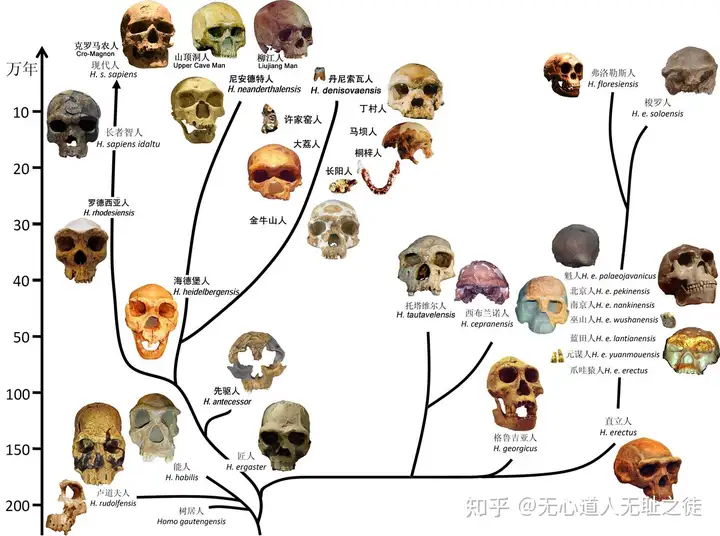
图示:直立人和智人是真人属后期的两大分支(参考自:李辉(2013)遗传学对人科谱系的重构.从基因中重新认识人类进化历程.现代人类学通讯 7:1-11)
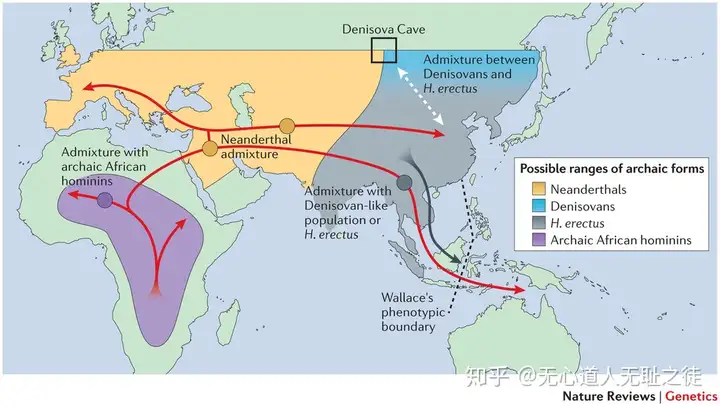
图示:现代人起源、迁徙以及与尼安德特和丹尼索瓦等古人类的混合(参考自:Veeramah, K. R., & Hammer, M. F. (2014)Nature Reviews Genetics, 15(3), 149-162)
2.展示较为完整的人类迁徙史和中国人祖先迁徙史,包括所有的重要节点(迁徙时间、路线、迁徙原因)
这是一个很宏大的命题,人类的迁徙较之于人类起源更复杂、更难以推断,因为人类的迁徙具有层次性、反复性,也就是多次迁徙与人群回流,对于特定人群、特定迁徙路线和事件的解释有很多,当然争议更多,来自考古学、语言学、民族历史学、遗传学等多学科不同学说纷繁复杂,我这里仅讨论遗传学方面得出最新成果。
人群的迁徙和分布与气候的变迁有着密切的关系,为便于从不同角度探索和认识人群演变规律,这里先介绍一些近10 万年来的气象学的材料。在距今约 11 万-1 万之间,也就是考古学上的旧石器时代到中石器时代,地球处于末次冰 期,那段时间的海平面远低于现在,许多现在的岛屿与大陆相连,成为了人 类迁徙的重要通道。距今 2.65 万年到 1.9-2 万年是末次冰盛期,是末次冰期中气 候最寒冷、冰川规模最大的时期,亚洲的绝大部分、北欧和北美都被冰雪覆盖, 人类的生存空间也随冰川蔓延而逐渐缩小。大约 1.5 万年前,气温开始转暖,冰川也开始退却,现代人才迎来了迁徙的黄金时期。
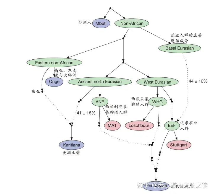
图示:从常染色体角度看人类的迁徙和混合(参考自:Lazaridis I, et al. Nature, 2014, 513(7518): 409-413)
首先,从常染色上来看, 世界人群可分为两大类,一类是非洲人群,另一类是走出非洲后的欧亚人群,欧亚人群又分为遗传差异很大的欧亚西部人群和欧亚东部人群,欧亚西部人群主要包括欧洲、中东等,欧亚东部人群主要包括东亚、东南亚、大洋洲等,而中亚、南亚和部分西伯利亚人群基本可以看作是东西两方混合的结果。
在欧亚西部,又分为三类人群:西欧的采集狩猎人群、西伯利亚采集狩猎人群(比如贝加尔湖两万多年前的古人MA1)以及近东的农业人群。近东的农业人群与采集狩猎人群的区别在于他们有着一种来自欧亚人群底层的古老遗传成分,这一成分和欧亚人群是兄弟支系。而1万5千多年前到达的美洲的美洲土著是由西伯利亚采集狩猎人群和东亚人群混合而成的,东亚成分占到60%-70%。在欧亚东部,主要分为两类人群:一类是东亚人群(主要是中国人、日韩、部分中南半岛人群),另一类是南亚和东南亚、大洋洲岛屿上的土著,比如安达曼人、巴布亚人、澳大利亚人等。现在学界争论的焦点是这些岛屿上的土著是按“南方路线”先于欧亚人群到来的吗?还是仅仅由于适应当地环境才形成了独特的体质特征(身体矮小、肤色棕深等)?
其次,从父系Y染色体的角度来看,全世界的男性都可以追溯到二十多万年前的一个东非晚期智人男子。进而,全世界又可以分为20种主干类型,称为单倍群,编号从A到T。最古老的A和B单倍群都没有走出非洲,C和D单倍群最早来到了澳洲和亚洲,E单倍群来到了亚洲又回到非洲 (图a),F单倍群衍生出GHIJ等单倍群在西方形成欧罗巴人种,衍生出K单倍群并形成NOPQ等单倍群在东方形成蒙古人种(图b),其中O单倍群成为了中国人的主流,而Q单倍群成为美洲土著印第安人的主流。
在DE/CF和C/F分支之间只发现了很少的SNP位点,这表明DE、C和F很可能是在一千年内相继产生的。自单倍群F和C分开之后,在1.8万年的时间内我们都没有看到F支系里有大的分支事件,表明F支系经历了强烈的瓶颈效应。值得注意的是全部的初级单倍群,也就是G, J, N, O, Q和R都是在末次冰期前(约2万年前)分支出来的,并且大部分现在已知的欧亚大陆东部支系是在旧石器时代晚期(1万年前)产生的。进化树上7千年前的分支都是二叉的,这表明在旧石器时代缓慢的群体增长率、瓶颈效应或遗传漂变淘汰了大部分曾经存在过的支系 (图c)。
末次冰期之后,尤其是进入新石器时代有了农业之后,人群开始了大量增长,表现在Y染色体上就是出现了大量的下游分支节点。最惊人是在O-M324下发现了三个星状扩张,既是在M117下游、M134xM117复合单倍群的下游以及002611下游,我们将其依次命名为Oα、Oβ和Oγ (图d),这些父系支系在很短的时间内(500年内)成功扩张。这三个支系在现在的大部分东亚族群里的频率都很高,总共占到了现今全部汉族的40%,其中Oα占到16%、Oβ占11%、Oγ能占到14%,也就是说现在大约有3亿男性是新石器时代晚期三个男人的父系后裔。这三个支系的扩张时间分别是5400、6500和6800年前,而中国北方全面转入农业阶段的时间也正好是6800年前,也与黄河中游的6900-4900年前的仰韶文化、黄河上游6000-4900年的马家窑文化以及黄河下游7400-6200年前的北辛-6200-4600年前的大汶口文化等的时间相契合。由此,我们认为这三个在新石器时代晚期快速扩张的支系奠定了东亚的父系遗传基础。与狩猎、采集相比,农业提供了更稳定的食物供给,足以养活更多的人口,而且使男性远离危险的狩猎活动,所以狩猎相关的男性死亡率的降低。
末次冰期之后,也就是万年左右的时间尺度内,这些支系(图d)就能很好地和语系族群对应了,比如说O-M119在中国东南沿海、侗傣族群、台湾原住民中集中分布。O-M95在华南、南方少数民族、中南半岛及印度Munda人群中分布较多。O-M176则最主要集中于朝鲜半岛、朝鲜族和日本人中。O-M7在苗瑶和孟高棉人群中高频出现,但在汉族中却不足5%。在历史时期,也就是距今千百年的时间尺度里,Y染色体还可以追溯家族的源流。Y染色体类型(C-star cluster 星簇)可能是成吉思汗或者其近亲宗族的父系类型,出现在了从太平洋一直延伸到里海广阔地域,占到了全世界男性的0.5%。爱新觉罗家族的类型可能属于C-M401这一类型。
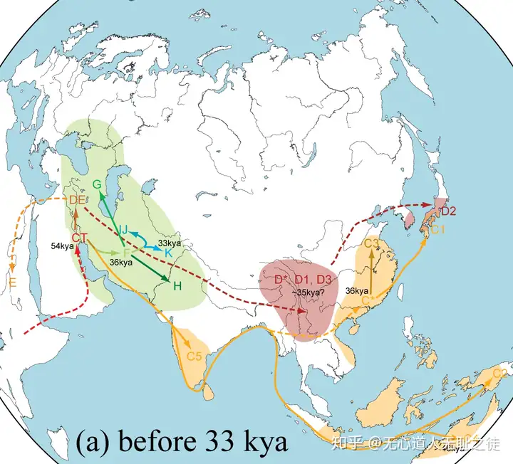
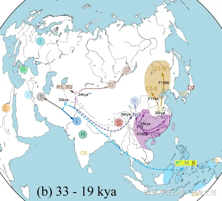
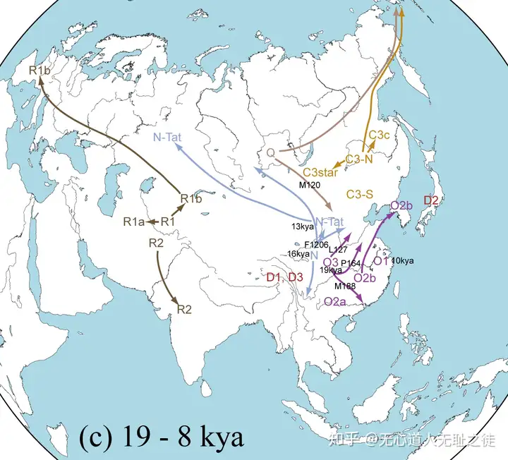
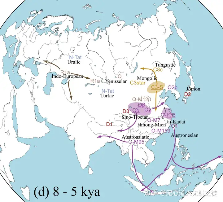
最后,从母系线粒体DNA(mtDNA)来看,mtDNA 的支系分布也是很有地域特异性的,例如非洲大陆特异地单倍群 L 比欧亚人群中发现的类型都要古老,L 单倍群被分成 L0,L1,L2, L3, L4,L5 和 L6 这几支, 产生于13-20多万年前,其中 L3 是欧亚人群中的 mtDNA 的祖先类型。非洲以外的所有 mtDNA 分为 由L3单倍群在大约6-7万年前衍生而来的M 和 N 两大超级单倍群,其中 N 包括了所有欧亚西部特异的谱系 H、I、J、K、T、U、V、W 和 X,东亚特异的 A、B、R9,N9 以及大洋州特异 的 P 单倍群也属于 N 分枝;M 单倍群的下游分支有分布在东亚 C、D、G、M7、 M8、M9 等以及在南亚和东南亚常见的 M 根部支系。美洲土著人群的分析则表明他们大多只属于 A、B、C、D 这 4 种单倍群,很少的个体属于 X 单倍群。
我们前面提到父系Y染色体在新石器时代有了农业之后开始了大规模的扩张,而母系mtDNA则是在末次冰期刚结束,也就是1万5千多年前就已经开始了人口膨胀,各类型的地理分布差异也就愈发明显。在东亚北方和南方的mtDNA单倍群分布非常不同,东亚北方主要由A,C,D4,D5, G, M8, M9, N9, Z支系组成,而南方为B4, B5a,F, M7, R9等单倍群组成。
北方谱系中的C、D、G、M8、M9都是M单倍群的下游分枝,M单倍群只存在于东非、南亚、大洋州,东亚和中亚群体中,而在欧亚西部地区几乎完全缺乏。北亚主要的mtDNA单倍群是C, D, A, B4, G及N9等一些在东亚也高频出现的单倍群,另外混有一些末次盛冰期之后从欧亚西部流入的以H、J、U为主的支系。东亚来源的北亚单倍群有M下的 C, D, G, M3, M7-M11, M13和Z单倍群, N支系下的 A, N9a 和 Y,以及R支系下的 B, F, R9, R11。单倍群C和D在东北亚非常多,在某些群体中所占比例超过50%,甚至能达80%以上。通过对单倍群C和D的样本进行全测序,发现C和D的祖先支系早在3-5万年之前就已经在东亚诞生,并且随即进入南西伯利亚,而大多数的北亚C和D支系都是在末次冰盛期之后才扩张。虽然北亚的主流单倍群是C和D,而单倍群A也在某些群体中高频分布,比如占到了楚克其人的73%。北亚的单倍群B的支系主要是B4和B5,这两个支系分布在偏南的朝鲜和蒙古地区。mtDNA单倍群A在藏族中占到了相当高的比例,平均能达到10%-14%,同时在门巴族(23.5%)和珞巴族(15%)中的频率更高。单倍群D所占比例比A还要高,能达到10%-20%,在珞巴中甚至高达30%。单倍群C在西藏群体中也能占到5%左右。青藏高原藏族中的单倍群A、C、D极可能是由1-2万年前从东亚北方向南进入高原的人群带入的。
而在南方,壮侗和南岛语系同时具有高频率的M7,南亚语系的F单倍型频率也比其它语系高出许多。壮侗群体中,频率最高的单倍群是B4a, F1a, M7b1, B5a, M7b*, M*, R9a, R9b, 这些单倍群的频率总和占到了约一半。苗瑶族群与壮侗族群相似,单倍群B5a, B4a, M*,M7b*, C, B4b1, M7b1, F1a, B4*, R9b也能占到一半,而南亚群体中,频率较高的有F1a, M*, D*, F1b, N*, C, M7b*, M7b1, F1a1a, 前三种占到50.8%,与壮侗和苗瑶略有不同。单倍群B, M7, F, R的总频率在台湾原住民中能占到70%,在壮侗中也达到了66.4%,比苗瑶的58.9%和南亚的48.9%更高,而越往北的类群这一数值就越小,例如占汉族40.8%, 占藏缅族群的37.5%, 而仅占到阿尔泰族群的16.3%,由此可见,B, M7, F, R这四类单倍群是可以代表中国南方的特征单倍群。
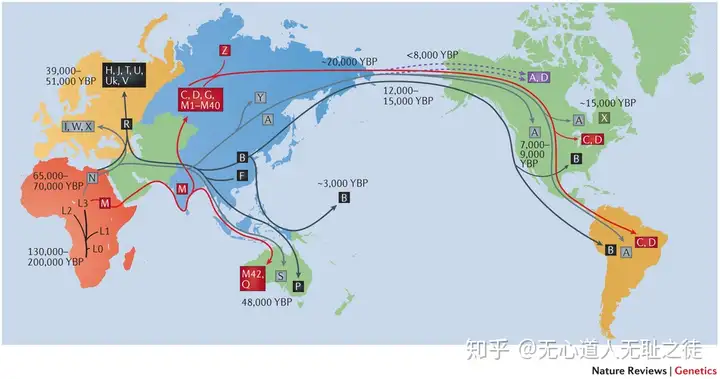
图示mtDNA揭示的人类起源和迁徙时间和路线(参考自:Stewart, J. B., & Chinnery, P. F. (2015).Nature Reviews Genetics, 16(9), 530-542)
==========================
新研究揭示前所未知的史前人类大扩张
2012年10月30日 10:56 来源于 财新网
一项最新基因研究显示,在约5万年到4万年前,还存在一次前所未知的大规模扩张,从人口意义上讲比“走出非洲”的规模要大得多
据新华社10月30日消息,在史前人类的扩张历程中,许多人都听说过著名的“走出非洲”,但一项最新基因研究显示,在约5万年到4万年前,还存在一次前所未知的大规模扩张,从人口意义上讲比“走出非洲”的规模要大得多。
英国桑格研究所29日发布公告说,该机构研究人员对来自非洲、欧洲、亚洲和美洲各地的男性Y染色体进行了基因分析。由于Y染色体为男性独有,只通过父系单线遗传,其遗传和进化的历史也就相对容易分析。
结果显示,在约5万年到4万年前,男性Y染色体上基因的多样性突然大幅增加,这说明当时出现了一次大规模的人口膨胀,因为只有人口增加了,基因才会更有多样性。
此前考古证据曾显示,古人类在约7万年到6万年前有一次“走出非洲”的大扩张,在地理上分散到世界各地,是人类历史上的重要事件。而本次研究显示,新发现的史前人类大扩张,规模要比“走出非洲”那次大得多。
研究人员卡西姆·阿尤布认为,人类走出非洲的路线主要是沿海,到达各大洲后也先是在沿海地带活动,而海边的条件不足以支撑大量人口。在那之后一两万年,人类逐渐进入并适应了内陆地区,大陆上充足的空间和食物导致了人口的迅速增长。
这项研究报告已经发表在美国《基因组研究》杂志上。(新华社记者黄堃)
======================================
第一个可靠的古埃及木乃伊DNA研究透露了哪些信息?
2017年05月31日 13:10 来源于 财新网
实验条件的进步,将开拓木乃伊基因组研究的新领域

最近,一份关于古埃及木乃伊DNA的研究显示,虽然古埃及屡受外族的入侵及统治,但这些历史事件对当地人群遗传成分的影响却颇为有限。
撰文 | 汪鸿儒 (遗传学博士、《知识分子》特约撰稿人)
古埃及,位于非洲东北部,处在欧亚非三大洲的交接地带,历来是兵家必争之地,也是跨国贸易频繁之所。独特的地理和历史因素,使得埃及成为研究历史上人群动态的范本。大约公元前1000年开始,埃及不断遭受外族的入侵和统治,这其中包括希腊人建立的托勒密王朝(公元前332年—公元前30年)和罗马人建立的罗马帝国(公元前30年—公元395年)。然而,这些重大的外族入侵和统治的历史事件,在多大程度上影响了本地人群的遗传成分,仍然是一个未解之谜。
最近,一份关于古埃及木乃伊DNA的研究显示,虽然古埃及屡受外族的入侵及统治,但这些历史事件对当地人群遗传成分的影响却颇为有限。5月30日,《自然-通讯》(Nature Communication)杂志在线发表了这一研究。
木乃伊样本来自于埃及的小镇Abusir el-Meleq(图1),该镇位于尼罗河西岸一块狭长的河谷地带。经放射性碳元素测年,这些木乃伊时间跨度为公元前1388年至公元426年,其中就包括托勒密王朝与罗马帝国时期。
德国马普人类历史科学研究所和图宾根大学的研究人员分析了90具埃及木乃伊的线粒体基因组和三个核基因组数据,发现在超过13个世纪的时间里,这一地区的人群遗传成分表现出了很大的延续性,并没有随着王朝的更迭而出现了较大的震荡。希腊和罗马人等外来人群对古埃及人遗传成分的影响,可能在殖民比较集中的地区或古埃及的上层社会才会比较明显,研究人员在论文中写道。
研究人员进一步比较木乃伊的基因组和今天的埃及人的基因组后,发现一个显著的特征:现代埃及人基因组中的非洲人遗传成分比木乃伊多了约8%左右,“这是研究中最有趣的发现之一”,该研究的通讯作者、德国马普人类历史科学研究所所长Johannes Krause说。
群体遗传学分析将这一非洲人遗传成分的来源指向了撒哈拉以南地区。“这很可能和公元8到9世纪加剧的跨撒哈拉奴隶贸易有关”,Johannes解释道。事实上,在长达1250年的时间里,曾有着超过6百万的奴隶从撒哈拉以南地区被转移到非洲北部。
这一研究为我们展示了一个生动事例,显示了历史人类学家也可以通过木乃伊的基因组研究,解开一些历史谜团。“这是第一个可靠的古埃及木乃伊的古DNA研究,” Johannes强调,“这一先驱性的研究将会开拓一个新的木乃伊基因组研究领域”。
不过,鉴于研究采用的木乃伊样本均来自于Abusir el-Meleq地区,该研究的作者表示,采用的遗传数据来自于单一的地点,很可能不能代表古埃及的所有种群。
最近几年,随着古DNA研究的重要技术突破,分子遗传学已经为世界上不同地区不同时期的人类历史研究提供了重要的证据和结论。值得一提的是,埃及木乃伊和古DNA研究的诞生还有着有趣的渊源:这一研究的主要负责人Johannes Krause曾跟随德国马普演化人类学研究所的演化遗传学家Svante Pääbo从事古DNA研究,而后者是这一领域的主要开创者之一。Svante教授曾在他的自传中称,正是神秘的埃及木乃伊吸引着他投身这一领域并不断深耕,实现着一个又一个的技术突破
================================
人类走出非洲的时间再次被改写
2018年01月31日 14:37 来源于 财新网
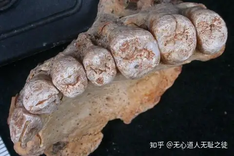
近日,以色列出土非洲以外最古老的现代人类遗骸,为遗传学研究推测提供了证据,即人类迁徙出非洲的时间比之前想象的要早得多。图/视觉中国
相关报道周大地:化石能源终将退出舞台,中国应该发展核电等低碳能源横贯西藏 | 高原化石考察记(三)三顾吉隆|高原化石考察记(一)古生物学家首次在琥珀中发现雏鸟化石
作者:郭林
作品来源:《知识分子》(微信公号:The-Intellectual)
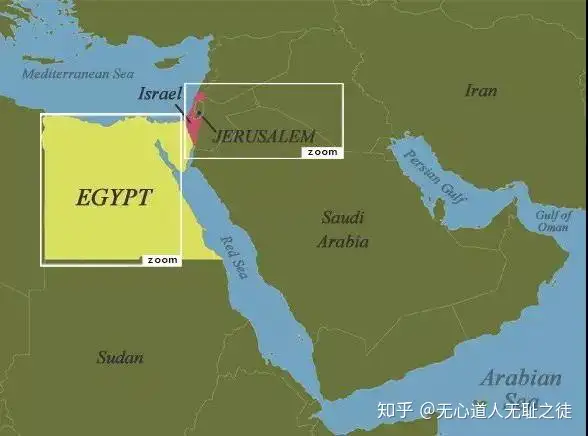
非洲与以色列的位置(图片来自http://learner.org)
智人何时走出非洲,又是途经哪条路线呢?解答这些问题,是理解人类演化过程的关键。以前在非洲以外发现最早的智人化石,是位于东地中海沿岸、现今以色列的斯虎尔(Skhul)和卡夫扎(Qafzeh)地区。该地出土了若干头骨,时代为中更新世晚期,最早能追溯到距今12万年。
最近,以色列的史前洞穴又出土了一块带有齿列的上颌骨,经形态学分析,它属于现代智人,化石距今有17.7万年到19.4万年。这一证据表明,智人走出非洲的时间,可能比我们以前推算的时间还早,相关研究发表在上周的Science杂志上。
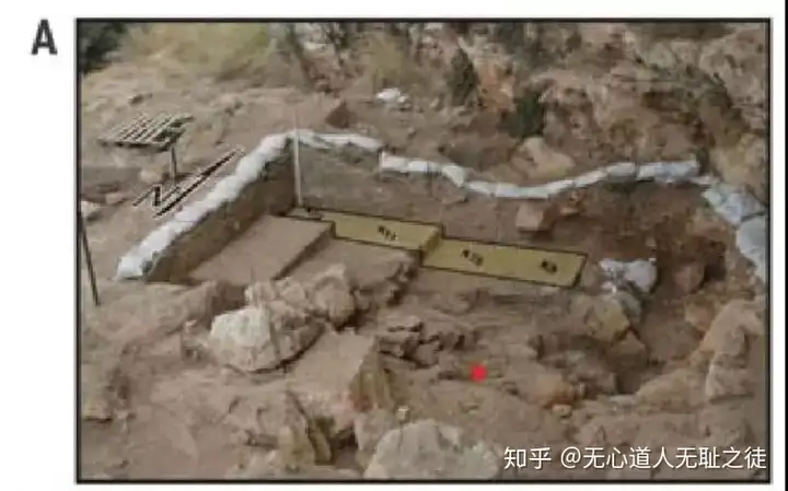
图 A 红点即为上颌骨化石出土位置
在以色列的米斯利亚洞穴中,考古学家发现了一个成年人的左侧半个上颌骨(编号为Misliya-1) ,出土于旧石器时代中早期的层位,一起出土的还有莫斯特文化(塔篷D类型)的石器堆积。此次发现的上颌骨保存了大部分的牙槽骨、颧突,一部分颚骨和鼻孔底,同时左侧的齿列(从第一门齿到第三臼齿)也保存完整(除了第一门齿破损只剩下了牙根)。
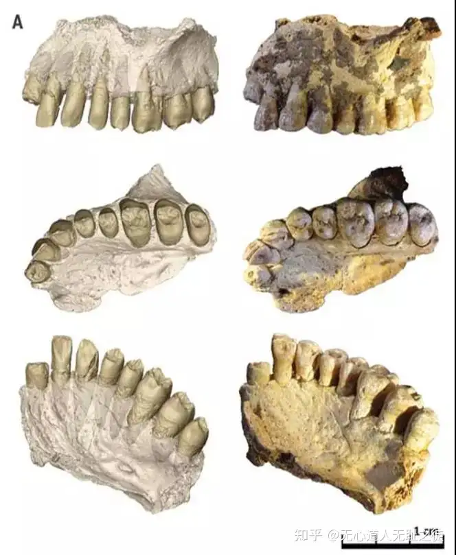
此次出土的上颌骨侧面和咀嚼面,左侧是虚拟3D重建(除去了牙釉质和周围基岩),右侧是化石实物照。
研究者分别在三个独立的实验室里通过三种测年手段对其进行年代推断:对遗址出土的火石进行热释光测年,对其第二门齿的牙本质进行铀-钍测年以及对该牙牙釉质进行的电子自旋共振测年,都得到了相近的测年结果——其距今为17.7万年到19.4万年之间。与该地区旧石器中早期的时间范围较为吻合。
科研人员对上颌骨及其牙齿做了从形态上的观察和主成分分析,发现上颌骨颧根处的肌肉附着点相对靠前(接近第一臼齿位置),犬齿窝以及鼻孔底的形态都与现代人更接近。前臼齿有智人样子的、高而窄的齿冠。臼齿的原尖、次尖的大小与现代人一致,而与尼安德特人不同。
第一到第三臼齿的次尖减小,这在智人中非常常见。整个齿列的大小处于现代人范围的最大值,牙根的大小和形态也都落在现代人变异范围内。对牙釉质本质交界面和牙骨质釉质交界面的3D形态分析,也落在智人的范围内。
总体来说,此次发现的上颌骨的牙齿与中更新世同时代的亚欧非大陆出土的化石形态上都不一致,比起尼安德特人来说,它和现代人更接近。
在人类演化史中,西南亚的地理位置像是一条走廊,以色列该处遗址与非洲有非常靠近的地缘关系,因此出土的化石很可能反映了智人种在环境压力下的扩张。
这项新研究改变了我们曾认为的智人走出非洲的时间,而且本项研究与最近的基因学检测相符。DNA提出的新证据认为,智人种可能在22万年以前就已经走出了非洲。
此外,在以色列米斯利亚洞穴出土该上颌骨化石的位置,还出土有成熟的勒瓦娄哇技术制造的石器,这一制造石器技术的兴起,也很可能与智人的到来有关。
=============================
==============================
人类第一次从东非出走是大约30万年前(Home Erectus, 直立人)。
他们从东非北上到达中东,然后兵分两支:
向西到达了今天欧洲的大部,成为考古学上称为古人类尼安德特人(Neanderthal) ;
向东到达了西伯利亚,成为考古学称为古人类丹尼索瓦人(Denisovan) 。
中国科学院古脊椎生物研究所最近在湖南道县发现的古人类牙齿测定年代为距今8-12万年前(见2015年10月15日英国《自然》杂志),这些古人类很可能是于30万年前走出非洲的后代。
我们身上是否有道县古人类的遗传还需要进一步的测试才知道。
但不论是尼安德特人还是丹尼索瓦人,都在3万年前灭绝了,他们并不是今天现代人的祖先。
今天现代人的祖先是大约7万年前又一次从东非出发走出非洲的现代人(或称智人Homo Sapiens)。
他们又一次北上通过今天埃及或红海南部最狭窄处到达中东。
然后兵分两路,向西去欧洲,向东来亚洲。
虽然古人类灭绝了,但我们每个人身上还流着他们的血。
当我们的现代人祖先走出非洲到达欧亚大陆时,遇见了他们相隔了20万年的“远亲们”,由于长时间各自演化,他们已经是完全不同的人种了。
现代人的身体没有古人类高大,但脑子比他们灵光,在约三万年的相处过程中,古人类通过被征服和交配彻底消失在历史的黑暗隧道中。
由于古人类和我们祖先的交配,今天除了呆在非洲老家的人之外的全世界所有的人身上都有1%-4%的古人类的基因。
我也不例外,如图1:
我身上有1.3%的尼安德特人基因和1.6%的丹尼索瓦人基因,参加测试的75万人的平均是分别是2.1%和2.1%。
我低于平均的原因在于尼人主要在欧洲和中东一带活动,我的祖先在约6万年前就离开那里了,而尼人到3万年前才灭绝。
所以留在那里没走的人们后来还有三万年的机会和尼人交配,那里的土著身上的尼人基因就会更高。
丹尼索瓦人目前只在西伯利亚发现,我的祖先是从南方进入中国,因而我身上丹尼索瓦人基因也小于平均值。
图1 我身上的古人类基因占比小于人类平均
2. 现代人(Homo Sapiens) 从哪里进入中国?
现代人进入中国有三条路线。
如图2 (图中标有“East Asia” 周围即是中国):
第一支 南线: 缅甸-云南入境
从中东向东的一路经过西南亚(伊朗,伊拉克)进入南亚。
有一支走到喀喇昆仑-喜马拉雅山时被挡住了,他们沿着山脉的西南麓绕过喜马拉雅山从缅甸和越南进入云南广西一带,一拨沿海向东然后向北(当时海平面比现在低100米,海岸线大大外延)
另一拨再继续北上进入四川甘肃,然后又兵分两路,西路上了青藏高原,东路从黄土高原进入中原。
中原的一支一直北上到朝鲜和西伯利亚。 这一支目前被认为是最“主流”的中国人。
第二支 北线: 蒙古-内蒙入境
这一支从伊朗向北走入中亚,从土库曼斯坦,乌兹别克斯坦进入哈萨克斯坦大草原,然后一路向西到蒙古,一支折向南从内蒙进入中国。
另一支继续向东在大约1万五千年前从白令海峡路桥(当时海水浅)跨到美洲,沿着美洲的西海岸一路从阿拉斯加走到智利的最南端。(鄂伦春族有点像美洲印第安人有木有?)
第三支 东线: 日本-东北入境
这一支是第一支从云南入境时,分出一拨继续南下印支半岛,渡海到了印度尼西亚,然后从海路北上经菲律宾到台湾,日本,然后从海路(也可能有从俄国萨哈林半岛)进入东北或渤海沿岸。
像第二支一样,也有一拨继续北上从白令海峡进入美洲。
图2 现代人迁徙路线
3. 我的祖先走的哪一条?
测试结果分为父系的迁徙路线和母系路线。
只有男人有Y染色体,是父系单传下来的,男女都有线粒体DNA是母系单传下来的。
测男子Y染色体中的基因变异就可以知道父系迁徙路线;测男女的线粒体DNA就可以知道母系。
测试的简单粗暴原理是这样的: 基因在遗传时会发生变异,这个变异会一代代稳定地传下去。
人类在数万年的迁徙过程中不断产生变异, 这些变异会被迁徙者带到下一个地区。
到了新环境的人又会有新的变异,而呆在原来地方的人的后代身上新的变异就和迁走的不同。
呆在原地的由于历史悠久,基因的多样性就高(即人群中基因差别大),分出去的一小支大家带着相同的基因到新地点后时间相对短,他们基因的多样性就低。
所以今天非洲人基因的多样性最高,美洲印第安人多样性最低(印第安人大批死于登陆美洲的欧洲人带来的细菌,几乎绝种, 是否和他们基因多样性低有关?)
根据这些区域基因多样性特征,再加上考古的佐证,就可以拼出一张大致的迁徙路线来。
估计是参加测试的男子多,所以父系的结果更为详细。
那我们就来看看我的父系是如何一步步从埃塞俄比亚走来的吧:
第一程10万年前, 出发地 非洲
图3 “亚当”的“儿子”P305 从东非出发到达红海南端
今天世界上所有男子的共同祖先是生活在15-30万年前一位东非的帅哥。
他其实不是当时唯一的一位男子,更不是开天辟地的第一人,但只有他的后代传到了今天。
“亚当”之后,大约10万年前一个东非男子的身上发生了被标记为P305的基因变异。
这个变异是今天已知的最早的一个不被全地球男子共享的基因变异。
地球上大约有99.9%的人是他的后代。
图3 就是从东非的出发图,分为三支,向北的一支抵达红海南端,今天埃塞俄比亚和也门隔海相望的地方(当时也许两边陆地相连),另一个能从非洲到亚洲的地方就是走到红海的最北头,从埃及过来。
第二程 7万年前,出发地 东非
图4 第一拨走出非洲的M168分支
当人类走出非洲,在迁徙的过程中不断分支,每个分支都有自己独特的基因变异标记。
第一个走出非洲的分支的基因标记就是M168. 发生M168变异的男子可能生活在7万年前东北非大裂谷一带,也即今天埃塞俄比亚,肯尼亚,或坦桑尼亚。
今天除非洲之外的世界上所有男人身上都带有M168 标记。
虽然今天我们还不能确定他们迁徙的精确路线, 但我们的居无定所的祖先会跟着好天气和他们能狩猎到的动物而迁徙。
科学家们相信,在当时除了给力的气候,人类的智力有了飞跃的进步,特别是语言的出现给了我们祖先很大的优势,让他们能够更容易合作来狩猎和打败其他古人类如尼安德特人。
从图4上可以看出,有两支跨过红海,到达了欧亚大陆。
他们最可能渡过红海的地方是红海的最南端最狭窄处(当时可能是陆地)
即在今天埃塞俄比亚和也门相望的曼德海峡(Bab-al Mandeb strait)
答案是跟着吃的走。
从非洲出走并非是一个连续流,而是一波一波的。
当气候湿润时撒哈拉沙漠就变成了稀树草原,可以通行;而当冰河期来临,撒哈拉变得不可通过,迁徙的大门就暂时关闭。
有时一关闭就可能上万年。
第三程 6万年前, 出发地 西南亚:
图5 从中东兵分两路
143变异标识是人类走出非洲后最古老的一支,人类在跨过红海到达亚洲后,兵分两路,图中向东的箭头进入西南亚,即今天伊拉克,伊朗地区。
他们沿着海岸线一路向东到达了印度和东南亚,在大约5万年前到达了澳大利亚。
这些到达澳洲的人很可能是今天澳洲原著民的直系祖先。
第四程 5万年前,出发地 西南亚
图6 非洲老家回不去啦;一路下南洋
祖先们在西南亚生活了几千年后,开始向各个方向迁徙:
向东南去印度洋,向北去安纳托利(土耳其),黑海和里海。
M578 变异发生在从西南亚迁徙之前。
在约4万年前,气候再次变冷和干旱。
非洲和中东一片大旱,草原变为沙漠。
这个干旱一直持续到2万年前。
这两万年中祖先们无法退回非洲老家,他们只有两条路:要么呆在中东,要么离开。
第五程 三万五千年前,出发地 中亚
图7 M214 支兵分三路:南下,北上,西回
M214支兵分三路:北上进入中亚大草原(经土库曼斯坦,乌兹别克斯坦入哈萨克斯坦。
这一支在北上后又分两支:
一支向东经西伯利亚进入东亚(中国)
另一只掉头向西到了欧洲斯堪的纳维亚半岛。
另一支继续向东南去南亚,这一支中间又分出一支从云南进入中国。
第六程 4万1千年前到 2万8千年前, 出发地 东南亚:
图8 欢迎额的祖先来到中国!
186这一支太重要了,因为他们在约四万年前进入了中国。
图8中那个大弧线就是从南亚往西遇到不可逾越的喀喇昆仑山脉和喜马拉雅山脉。
这两支山脉是印度大陆板块从印度洋北漂上来挤进欧亚大陆板块形成的皱褶。
喜马拉雅山每年还在增长一厘米,4万年前,这些大山只比现在低不到四百米。
这两支山脉包括了世界上最高的几十座7000米和8000米的高峰,在这个海拔高度,氧气只有海平面的1/3。
祖先们只能绕道而行,北边要绕到天山-祁连山以北,南面要顺着喜马拉雅山南麓一直走到缅甸和越南(历史形成的中国边界有木有道理?) 。
这一支是最早进入中国的吗?
我不知道,如果有更多的中国人参加测试,一定能发现从蒙古高原北线和日本东线进入中国的。
看他们的迁徙路线和时间才能知道哪一支最早。
今天P186 这一支的血统也出现在南亚。
印度男性有23%的人属于这支血统。
在东北亚,这个血统出现的频率就高得多。
在日本不同地区有这个血统的比例为47%到65%; 韩国人70%-82%, 中国汉族69%-86%。
所以P186是典型的东北亚血统。
第七程 3万8千年前到2万1千年前, 出发地 东亚
图9 发明了稻米的南中国先民遍布南洋
祖先们进入中国云南广西后,一支(M119)沿着海岸线向东然后向北(当时的海平面比现在低100米,海岸线远得多),这支可能就是后来南方的古百越族,和东方的古夷人。
另一支变异M122 (及 后来的M197)又分为两支:
一支继续北上四川甘肃陕西河南河北东北最后到达朝鲜, 日本和西伯利亚(很可能一部分也去了美洲, 北上半道在四川甘肃又分一支向西成为藏羌人);
另一支掉头南下进入印支半岛, 继续到印尼,巴布亚新几内亚。
两万年前是上一次冰河期的高峰,大量的海水被冻结在南北极和陆地冰川里,海平面比今天低130米,中国大陆的东海海岸线在今天冲绳海沟一带,东南亚许多岛屿都是连成一片的大陆。
所以当时“下南洋”很多就是走过去。
可以推测,在冰河期时,北方寒冷干旱,热带和亚热带非常适宜生存,所以冰河期应当有大量人口向南的迁徙,而天气变暖后才会向北迁徙。
大约在1万年前,当冰河期高峰过去后,地球变暖,在中国南方的祖先和在西南亚新月沃地区的人几乎同时开始了农业。
新月沃地区(今天伊拉克,叙利亚, 黎巴嫩,约旦等地区)从野麦中第一个培育出了小麦和其他大部分今天的粮食种类,而中国南方的先民则第一个培育出了稻米。
从河南舞阳县贾湖遗址(约9000年前)中发现了稻壳。
稻米的种植使得食物变得富裕且可控,人口因而爆炸式增加,密集的人口加剧了迁徙。
今天印支半岛和东南亚的土著大多是过去一万年中从中国南方迁徙过去的。
今天在中国汉族人身上有57% 的人有M122 血统,在波里尼西亚(南太平洋岛国)人有32%。
我的“表亲”哪里最多?
图10是一张和我基因类似的人的分布图,颜色越深的地方,和我基因相近的人越多。
图10 俺的“表亲”都生活在哪里?
图10的左上角标出颜色和对应的百分比。
这个百分比是和我同一基因分支的人在各地人口中的占比。
(分支:Haplogroup,我这个分支的最后一个变异P197距今至少两万年。所以这些分支目前都还比较粗,如参加测试的人增多,就发现更晚近的变异,因而分支可以越分越细)
可以看出,我的“表亲”分布最密集的地方前三位是(i) 京津/内蒙东部 (ii)东北和朝鲜 (iii)云南和四川。
比较有意思的是在西藏和哈萨克斯坦也有我不少的“表亲”。
我最远的“表亲”东到日本,西到里海,南到马来西亚,印度尼西亚,北到西伯利亚。
4. 我的种有多纯?
上面是通过测试Y染色体得到的我的父系的迁徙图。
另外一个测试是把我基因中除了Y染色体之外的所有的变异标记和各地区典型的变异相比较,看我的近代祖先(几百年到一千年)的迁徙婚配史。
美国国家地理这个基因地理测试计划把世界分为9个典型区域。
他们找出这9个典型区域的最有代表性的变异标记(即该组变异在该地区出现频率最高)。
该计划还建立了60个国家的标准样本,也即从各国采样,用采样的平均值作为标准样本。
当你的结果出来时,他们给出两个和你最接近的国家。
由于迁徙和婚配,每个人的基因都有多个区域属性, 图11 是我的区域属性以及和中国标准样本的比较。
上面是在北京采样的中国标准样本,下面是我的测试结果。
图11中红色的是“东北亚”, 黄色的是“东南亚”, 棕色的是西南亚。
图11 我的基因区域属性和标准中国人样本的比较
我的基因区域属性中东北亚占69%, 东南亚占29%, 西南亚占2%。
也即在我所有的被测试的变异标记中,属于东北亚的那些变异占69%,以此类推。
这什么意思?
这意思是说我的“表亲“大部分分布在东北亚,东南亚是稍远点的表亲。
西南亚是第三远的表亲,世界其他6个区域的人就和我更远了或者没关系了。
中国人身上为什么会有这么多东南亚特征(28%)?
原因在于目前东南亚的大部分土著都是稻米农业革命后从中国南方迁徙过去的。
我身上有29%的东南亚属性并非一定是我父母或祖父母中有一人是东南亚人,而是我父母,祖父母,太祖父母,依次上推每个人身上都有这些东南亚属性。
和我最接近的国家样本不出意料地是中国. 我的东北亚属性略少于中国标准样本。
最有意思的是比中国标准样本多出了2个百分点的西南亚。
回到图10 的“表亲分布图“能看到在里海的北端,哈萨克斯坦的西端还有一点点我的表亲。
我猜测可能是中国标准采样在北京,而我的血统在西北,离西南亚更近。
我的祖母也出生在甘肃天水,她是卷发。
我小时候去过她出生的村庄,她的亲戚们眼眶颧骨似乎比当地的汉人要高。
这也许是我的2%的西南亚血统的来源。
这个分析还提供第二个最接近的参照国家,是日本人.
图12 我的基因区域属性和标准日本人样本的比较
可以看出,日本人的东北亚基因比中国人更多,因而东南亚更少。
因为在这次研究中没有把韩国作为一个样本国,否则我的基因和韩国一定比和日本更接近。
在东北亚的样本国里,除了中国和日本,还有蒙古。
下面是蒙古人的标准样本
图13 蒙古人的基因地区属性标准样本
蒙古人的基因区域分布比中国人和日本人都复杂的多。
除了东北亚属性和我们类似外,他们的东南亚区域基因不到我们的一半,12%。
这说明他们是从中亚草原向西进入东亚的。
他们和我们和北上的祖先(他们中一部分去了东南亚)婚配就只有一半的东南亚基因。
他们有9%的西南亚这也解释了他们从中亚过来的路径。
看到这里,我推测我身上的2%的西南亚基因很可能是蒙古人的基因,毕竟元朝大批蒙古人进入中原。
最有意思的是他们有4%的美洲印第安人的基因,这说明他们是印第安人的祖先。
最后他们还有6%的北欧人基因,这肿么回事?
这是在前苏联时期来自欧洲的俄国人和当地人婚配留下的现代印记。
结束语
这个研究是个现在进行时。
每过一段时间,随着测试样本的增大,就会发现新的变异和信息,每个人的结果就会有一点更新。
目前有一些结果还不是特别一致,有些分析的表述也不那么严格。
一个重要遗憾是由于这个研究是人类在全球的迁徙路线,中国部分就难免粗疏。
复旦大学生命学院及现代人类学研究中心也加入了这次全球测试合作计划。
复旦大学有更多在中国的采样和更多的关于在中国内部迁徙分支的信息。
未来希望能在复旦再测试一次,看到自己祖先在来到中国后的迁徙路线。
但总的来说,这次测试提供的信息量极大,是一次颠覆三观的震撼经历。
==========================================
西欧亚人群如何扩散到中亚和西伯利亚的?
本文使用多重变量分析的方法, 对 220组欧亚大陆新石器时代和青铜时代的男性颅骨数据进行了分析。 结果支持以下观点,即洞室墓文化人群对阿凡那谢沃文化的起源有重大的影响。此外,以下人群主要是西伯利亚本土起源:米奴辛斯克盆地的奥库涅夫文化人群,与喀拉库文化、乌斯特-塔尔塔斯文化和科洛托夫文化相关的人群以及在车尔诺-奥泽耶和叶洛夫卡和流域发现的阿凡那谢沃类型墓地中的人群。 Samu组颅骨与波尔塔夫卡墓地的遗骨最为接近。图瓦地区的奥库涅夫人群,也可能包括Yelunino墓地人群,很可能是乌克兰地区的竖穴墓文化人群(颜那亚文化)和早期洞室墓人群的直接后裔。哈萨克斯坦西部的阿拉库文化人群也是这些人群的后裔。阿拉库文化人群与大量的中欧和西欧的新石器时代和青铜时代人群有相似性。创造典型费德罗夫文化遗存的人群,是阿尔泰山区的阿凡那谢沃部落的后裔,而其他费德罗夫文化人群很明显是北高加索和里海西北岸的晚期竖穴墓文化和洞室墓文化人群的后裔。古墓沟人群与哈萨克东北部和阿尔泰-鲁德内地区的费德罗夫文化人群最为接近,暗示高加索文化人群是从北部,而不是从西部进入新疆的。将西伯利亚和中亚东部地区的高加索类型颅骨描述为“地中海类型”是容易让人误解的--这些人群在颅型学数据上与中东,中亚西南部和外高加索地区的人群没有直接联系。所有的证据均证明,他们属于高加索人群的Noridc类型。
Kozintsev对颅骨数据的整理和分析,还是花了很大的精力的。这篇文章还是有不少新的发现的。
比如,这篇文章指出了 “创造典型费德罗沃文化遗存的人群,是阿尔泰山区的阿凡那谢沃部落的后裔,而其他费德罗沃文化人群很明显是北高加索和里海西北岸的晚期竖穴墓文化和洞室墓文化人群的后裔。” 这一点和 郭物先生多考古资料的分析是非常一致的。 郭物先生认为,小河文化的草篓的形制,与费德罗沃文化的陶器非常接近。 结合其他证据,认为小河文化与费德罗沃文化最为接近,而不是切木尔切克文化。
另外,安德罗诺沃文化共同体是一组彼此接近的考古文化,但内部文化的差异显示它们并非同一起源。 之前也的普遍观点认为 安德罗诺沃文化共同体就是 现代说印度-伊朗语的人群的祖先创造的。但实际可能并不是这样的。 总之,对于安德罗诺沃文化共同体之下的各种文化的来源,及其与现代人群的关系,还没有一个准确的、清晰的结论。有待继续研究。
小河墓地墓葬上下分五层布列,早晚之间遗迹遗物变化明显,可大致分为早晚两期。吴小红等对取自小河墓地不同层位的植物种子、动物毛皮等近30个样品进行了测年,经数据拟合所得年代范围为1950 BC~1400BC,早晚期分界约在1700BC前后;对位于塔克拉玛干腹地与小河墓地文化面貌一致的克里雅北方墓地的5个样本测年,结果为1880BC~1700BC;对采自罗布泊北岸小河文化遗存的4个样本测年,结果为2200BC~1880BC 。此外,结合环境考古,还对墓地附近采集的枯胡杨树皮、芦苇、螺壳样本做了测年,结果显示距今3000年、1500年、1000年左右及19世纪50年代,小河区域都有水资源存在。
根据这些测年数据,小河文化早期是 1950BC~1700BC, 晚期是1700BC~1400BC。
但是,费德罗沃文化(Fedorovo)存在于 1500BC~1300BC,主要分布哈萨克东北部地区直至阿尔泰山西北麓。这样的年代范围,无论如何也不能影响到 小河文化的形成。
以推断费德罗沃文化整体上很可能是早先的阿凡纳羡沃文化与稍晚的安德罗诺沃文化合流产生的。
而从韩康信的研究看:小河墓地不是一种文化,而是早期接近阿凡纳羡沃文化,晚期接近安德罗诺沃文化。
所以最有可能的情形是,费德罗沃文化和小河文化都是阿和安文化在不同地方共同作用产生的,两者是并列的关系而不是谁承继谁的关系。
另外,从地形和水系分布来分析,从北路跨越阿尔泰山的迁徙比从西路的迁徙要困难很多。
从逻辑上来说:不是两种文化有相似的成分,就一定是父与子,或者子与父的承继关系。也有可能是共祖的兄弟关系,或者两种文化之间还存在一定的互动交流。
另外,阿尔泰山的自然环境实在是太过恶劣了。人类没有可能不走相对容易的西部路线,而是先从更困难的北部路线突破。
“石峁遗址发现的石人和新疆北疆的石人也有相似之处。新疆类似的石人一般认为属于切木尔切克文化(约公元前2500~前1500年?)。切木尔切克文化的特点之一是:多数墓建有块石围成的矩形坟院,坟院的东侧栽立石人,人像表现方式的特点是脸部周围被圈起来。人形石雕近于腰的位置,正面有的刻有牛的形象,有的一头,有的两头,有一例刻有双轮牛车。石雕人像根据是否有胡须、胸部特征能分出男性和女性,女性胸部为倒长三角形,表示乳房。牛一般刻于男性的石雕人像上。可能晚一阶段,出现了一种简化的石人,有点近似奥库涅夫文化的小型随葬石人,即简单地在一石柱的上部浅浅雕出一个人面。在阿勒泰地区博物馆收藏有一个完整的长方形石棺,由四块石板围成,在窄的一侧的石棺板上刻着四个人面。从人面的特征看,切木尔切克文化晚期的石人像比较接近石峁遗址发现的石人。”
“这个时期最为壮观的石人流行于南西伯利亚的奥库涅夫文化(约公元前2500~前1700年),根据文化因素的类比,有人推测奥库涅夫文化来自北方森林地带。有学者认为整个奥库涅夫文化可能来源于叶尼塞河中游的乌斯特-别拉雅文化(Ust-Belaya) ,可以分为四个阶段:第一阶段属于铜石并用时代,文化上更多保留了乌斯特-别拉雅文化的传统;第二阶段与阿凡纳谢沃文化共存;第三阶段则完全是自身的传统;第四阶段逐渐融入了安德罗诺沃文化中。
那么,四个阶段的年代分别是:
第一阶段属于铜石并用时代,2500BC~2300BC。
第二阶段与阿凡纳谢沃文化共存,2300BC~2100BC。
第三阶段完全是自身的传统,2100BC~1900BC。 这一阶段是典型的奥库涅夫文化。
第四阶段逐渐融入了安德罗诺沃文化中,1900BC~1700BC。
切木尔切克墓地的早期遗存,包括第一组和第二组遗存,属于切木尔切克文化。以M16为代表的遗存,年代范围“可能在公元前2千纪初至公元前两千纪中叶之间”, 即 ~2000BC~1500BC。 此外,部分遗存可能延续到了公元前2千纪后半段,即1500BC~1300BC(?)。
切木尔切克墓地的第三组,与前两组的年代差别很大,进入了铁器时代,不属于切木尔切克文化。
切木尔切克文化之后,阿尔泰地区存在的考古遗存是 库希遗址,其考古资料非常薄弱。据论证,库希遗址 是在卡拉苏克文化的影响下产生的,年代范围应该接近,即上限不早于1300BC, 下限为1000BC。
*************
此外,郭物先生在《新疆史前晚期社会的考古学研究》一书中比较详细地论证了 三道海子文化的兴起和扩散。
三道海子文化兴起与蒙古国西北部和图瓦地区,在 1000BC~500BC之间向西南部强势扩张,覆盖了北疆的准噶尔盆地东西。
500BC之后,已经接近进入文字记载时代。在500BC~200BC的这个时间段里,北疆地区从东向西一次分布以下人群:
1, 东天山东部的月氏人。
2,东天山西部-乌鲁木齐附近是 乌孙。
3,伊犁河流域是塞人。
4,吐鲁番盆地是 车师/姑师人。
5,阿尔泰山地区是 呼揭。
之后的历史,大致都有文字记载了。
总结,阿尔泰-北疆地区的考古文化:
切木尔切克文化早期,~2000BC~1500BC。
切木尔切克文化晚期,~1500BC~1200BC。
类卡拉苏克的库希遗址,~1200BC~1000BC。
三道海子文化, ~1000BC~500BC。
安德罗诺沃共同体的三个阶段:
1,第一阶段是 1700BC~1600BC。以彼得罗夫卡类型Petrovka为代表,分布于南乌拉尔,哈萨克北部和中部地区。是兴起期。
2,第二阶段是 1600BC~1300BC。以 阿拉库类型(Alaku)和费德罗沃类型(Fedorovo)为代表。是繁荣期。扩散到了 叶尼塞河流域和中亚南部。
3,第三阶段是 1200BC~900BC。在东欧的木椁墓和西伯利亚的卡拉苏克文化兴起的影响下衰落。以 哈萨克斯坦中部的阿列克谢耶夫卡类型(Alekseevka)和七河地区的七河类型为代表。
突厥阿史那氏的葬俗是石人石围石棺墓,这种类型也正是 切木尔切克文化的典型墓葬类型。 这种类型,在切木尔切克衰落之后,过了近一千年后重新兴起,绝对不是偶然的现象。
而奥库涅夫文化,卡拉苏克文化和三道海子文化,是以蒙古人种为优势族群,向西扩散的强大文化。
由于父系 C3下的各个支系都是在非常晚的时候才扩散开来的,因此,从远古至距今2500年的时间里,在阿尔泰周围发生的 东西方人群的融合,东方成分应 以 Q为主,N为辅。
在南疆和新疆东部,东方成分就只有汉藏系人群了。
小河-古墓沟墓地可以分成以下三期:
1,第一期为 小河文化早期,年代为 1950BC~1700BC。
2,第二期为 小河文化晚期,年代为 1700BC~1400BC。
3,第三期为三道海子文化,年代为 1000BC~500BC(?)。
部分证据显示 小河文化的形成与切木尔切克文化有关,而同时又有证据小河文化部分遗物与 安德罗诺沃共同体的 费德罗沃类型最为接近。 而切木尔切克文化本身是 阿凡那谢沃文化和奥库涅夫文化结合的产物,切木尔切克文化的晚期起观察到了 安德罗诺沃文化的影响。
由此,对于这一地区复杂的考古文化源流关系,我个人粗浅的想法是这样的:
1,阿凡那谢沃文化人群从东欧向东方迁徙,最后到达米奴辛斯克盆地。这个时期,这一类型文化,及其亲族,同化了迁徙途中遇到各种土著,包括 阿尔泰山地区的土著。
2,阿凡那谢沃文化后期,奥库涅夫文化兴起,并强势扩张。在西南方向的阿尔泰山地区,融合当地的阿凡那谢沃文化,形成切木尔切克文化。此文化采用奥库涅夫的特殊葬式和阿凡那谢沃类型的陶器,应视为 外来的奥库涅夫居民征服当地,采用了当地原有的一些文化因素。
3,切木尔切克文化扩散到整个北疆地区。在东部,到达哈密地区,直接参与以下文化的形成:当地天山北部文化,焉不拉克文化寒气沟类型以及更晚的 巴里坤草原的南湾类型遗存。 在南方,到达孔雀河下游,形成小河文化。 哈萨克东北部存在与切木尔切克很接近的考古遗存(资料待细查)。
安德罗诺沃共同体中的费德罗沃文化的东方因素的来源, 很可能与切木尔切克文化的形成的原因是一样的。
4,阿尔泰山西麓的居民(阿凡那谢沃文化居民和奥库涅夫文化居民的融合,状态和 切木尔切克文化人群一样),接收了从西部传来的的安德罗诺沃文化因素(彼得罗夫卡类型),形成了典型费德罗沃文化。 但此文化迅速崛起,形成安德罗诺沃共同体中的一大强势文化。
费德罗沃文化作为安德罗诺沃共同体的一部分,向东影响到阿尔泰山地区的切木尔切克晚期文化(铜铃的出现)。而小河文化晚期中与费德罗沃文化相似的因素,可以是源于共同的起源,而不是费德罗沃文化人群迁徙的结果(小河文化晚期的年代早于费德罗沃文化)。
奥库涅夫人原本是Q为主的北亚族群。仅从头骨测量推断文化人群的原初起源是有问题的,比如“图瓦地区的奥库涅夫人群,……很可能是乌克兰地区的竖穴墓文化人群(颜那亚文化)和早期洞室墓人群的直接后裔。”
还有从你转贴的《西南西伯利亚青铜时代古mtDNA》,以及之前有关乌克兰新石器墓葬中发现mt-c来分析,安德罗诺沃人其实不是纯粹的原欧人种,而是已经混杂了一些东部欧亚的母系成分。安德罗诺沃类型相对阿凡纳羡沃类型头型更圆可能就是因为这个原因。
至于你说“安德罗诺沃文化共同体是一组彼此接近的考古文化,但内部文化的差异显示它们并非同一起源”,这个我是不赞同的。我的观点是:安德罗诺沃文化肯定是有共同起源的,只是安文化的形成过程中,就已经有其他人种和文化的影响存在,而在向东发展的过程中,进一步的同化融合使得安文化的种族和面貌变得更加多样化而已。一个很好的例证就是我在《西南西伯利亚青铜时代古mtDNA》中写的:
(从mtDNA来看)安德罗诺沃文化人似乎和晚期Krotovo文化的母系成分非常接近,也许晚期Krotovo文化人就是接受了土著文化的安德罗诺沃人群的先头部队也说不定。
就是说文化和种族最初肯定是有比较明确对应关系的,只是在后期的融合与冲突中,文化和种族的对应关系才会被逐渐打乱,这是一个动态变化的规律。所以,在分析一种文化的时候,要注意不能静态地看问题,不同时期的变异类型是不能等量齐观的。
=================================
北亚的游牧骑马文化
[日]藤川繁彦 高浜秀 林俊雄 雪宏一
从蒙古高原到多瑙河下游连绵不断的欧亚草原地带,直到近代一直是游牧民族活跃的舞台。游牧民族把羊、山羊、马、牛、骆驼等驯化为家畜,并在学会骑马技术和管理家畜群的同时,经历了无数次由冬季营地到夏季营地的季节性迁徙,从而创造了独特的游牧骑马文化。他们与南部的农耕定居
民族及北部的森林狩猎民族进行交易,或进行战争,甚至曾统领相邻部族组成过强有力的部族联盟性质的国家。古代以勇敢驰名于蒙古高原的匈奴、中亚的塞卡、黑海北岸的斯基泰以及中世纪初期的突厥等,都是该民族共同体中的佼佼者,其特有的动物纹饰和颇具特色的武器、石人等,竟跨越时代延续下去,从而构成了相互类似的文化系列。
这一草原地带东部的南西伯利亚是最早发现游牧骑马文化遗迹的区域之一。18世纪前半叶,已有文献记载这方面的情况,19世纪后半叶则正式开始进行学术调查,20世纪初,位于叶尼塞河中游的米奴辛斯克盆地奠定了从青铜时代到铁器时代诸文化的研究基础,从而形成了当今草原地带考古学研究的中心。与此同时,对邻近的鄂毕河上中游、阿尔泰、图瓦、贝加尔湖东南岸等地也进行了调查,并发掘了巴泽雷克古墓群等,致使游牧骑马文化的研究出现了飞跃的进展。
畜牧文化的形成与变迁
以米奴辛斯克为中心的南西伯利亚,在游牧骑马文化形成以前,理所当然曾诞生过以畜牧为主体的诸文化。
米奴辛斯克的古代遗迹和遗物尤其应做世界性介绍,因为作为草原地带东西方的中心点,它曾给文化交流史专家提供了很多资料。目前,关于畜牧文化的摇篮期,一般认为是以阿凡纳谢沃(公元前3000年中叶至末叶)、奥库涅夫(公元前2000年上半叶)、安德罗诺沃(公元前2000年中叶)为顺序而进行文化交替,其初期阶段就已经进入了铜或青铜器时代。在上述各文化遗迹中,几乎没有发现遗址,所以研究也只能以墓葬为中心进行。阿凡纳谢沃文化的墓葬有两种类型,一种是在方形或椭圆形的墓穴周围用板石砌成石垣,另一种则只是用石块堆积。出土的铜制品中有针、锥、小刀形薄铜片,还有线状、小板状装饰品和木制容器上的饰件。虽然也有金、银耳环等饰物出土,但是,实用利器仍然依赖于石制品和骨角制品。墓葬中出土的动物遗骨除羊、牛、马以外,还有鹿类野生动物以及鸟、鱼类等,而且还出土了石镞或骨角镞和石刮刀等,可见当时曾进行过狩猎。阿凡纳谢沃人属欧罗巴人种,至于其畜牧及其使用的金属器则存在着当地起源说和外地传入说两种意见。奥库涅夫文化的墓葬与阿凡纳谢沃文化的墓葬有异,墓葬石垣平面呈方形,墓穴用石板砌成箱形石棺。
奥库涅夫文化与阿凡纳谢沃文化在文化性质方面差异较大。与其说奥库涅夫文化是以包括捕捞业在内的狩猎业为主体,基本不依靠畜牧业,不如说该文化中新石器文化因素仍占有较大的比重。实际上奥库涅夫文化墓葬出土极少的羊、牛、马遗骨和较多的熊、狼、麋、鹿、黑豹、狐等野生动物遗骨,而且还有用野生动物牙齿制作的护符、饰物和颇具特色的石像及其他石雕作品,另外,还有较多的石镞和鱼镖。这些情况都说明:奥库涅夫人被认为属于蒙古人种。
安德罗诺沃文化的墓葬有多种形制。因而被认为带有早期葬制方面的特征,其中石垣相互接衔者也较多。该文化的畜牧经济已处于定居阶段,以饲养牛、羊为主,也饲养马和山羊。鹿类骨骼也有出土,但也有人认为这类狩猎的目的只是为了获得制作骨角器的原料。
安德罗诺沃文化的分布地域:东起米奴辛斯克,西到乌拉尔,南起土耳其斯坦,北达森林草原地带,被认为是这一广阔区域内的畜牧农耕文化。这一时期,也出土了较多的铸模、斧、剑、枪头、刀等实用利器和手镯,喇叭形耳环等装饰品,显示了熟练的青铜冶金技术。安德罗诺沃人被认为属于欧罗巴人种。在西伯利亚至今尚未发现农耕方面的确证。
游牧骑马文化的发展进程
在米奴辛斯克、安德罗诺沃文化的后续者是卡拉苏克文化。这一时期的主要遗迹是墓葬,而且数量较多,但也发掘过遗址。遗物除陶器外,还有较多的短剑、刀、饰物等青铜器。关于卡拉苏克文化,目前还存在着起源、系统
关系等较多尚未解决的问题。该文化中带几何形纹饰的弯刀和短剑,与贝加尔湖东南地区、蒙古以及中国北部殷周时代的同类器物相类似,而中国出土的用途不明的青铜弓形器在这一地区也有发现。因而,有人认为这是西伯利亚地区受中国北方文化影响的证据。但是,另一方面从卡拉苏克文化葬制、陶器等方面反映出来的对自身前期文化传统的继承,也是应该重视的。该文化的短剑、刀等在乌拉尔地区和东欧也有发现,可见交流关系相当广泛。卡拉苏克文化又被区分为卡拉苏克类型和石峡类型(或称鲁加夫卡文化——作者注)。关于石峡类型有多种说法,但研究者多将其看成是卡拉苏克类型的后续阶段。
类似于卡拉苏克文化者,在米奴辛斯克盆地以外也有所知。分布西伯利亚森林地带、鄂毕河流域的新西伯利亚附近之伊尔缅尼文化就是其中之一。
关于游牧骑马文化的形成,近年在米奴辛斯克之南、叶尼塞河上游的图瓦已有重要发现,这就是被称之为“金钱”的直径达120米的大型古墓。该墓出土了斯基泰、西伯利亚式动物牌饰、饰物等,随葬马数量多达160匹。发掘者根据出土的马具、镞等推定其年代为纪元前7~前8世纪。如果此说不误,那么在黑海沿岸的斯基泰文化之前,图瓦地区就已经形成了典型的游牧骑马文化。
在图瓦西部的阿尔泰山地,繁荣的游牧骑马文化为巴泽雷克文化。其代表性遗迹有巴泽雷克、托克塔、巴沙达尔等古墓群。在那里,由于封冻而保存了完好的墓室,从中出土了木制品、纤维制品和木乃伊尸体。在墓室外部还发现有随葬的马匹,马匹身上带有施动物纹饰的马具。在木制品和纤维制品中,饰有与斯基泰文化相同的动物纹、动物争斗纹。该文化已经是相当发达的游牧骑马文化。这种用马随葬、用木乃伊方法保存族长遗体以及为吸大麻而设帐篷等,都与希腊历史学家希罗多德叙述的斯基泰风俗一致。被认为是阿肯美尼斯王朝在波斯制作的丝织品和从中国战国时代输入的青铜镜以及刺绣品也有出土,说明这种国际交易可以追溯到“丝绸之路”开辟以前。在阿尔泰山地,除了这批古墓群之外,近年还在尤斯托德、乌兰多尔克等地发掘了古墓群,并出土了带有动物纹饰的木制品。
在米奴辛斯克,继卡拉苏克文化之后,又兴起了塔加尔文化。该文化初期还保留着较多的卡拉苏克文化的特征,但同时已渐次向流行于欧亚大陆的斯基泰和西伯利亚文化范畴之中汇入。斯基泰文化中颇具特色的动物纹饰在塔加尔文化中很流行。青铜器数量较大,以三翼镞、有格首的短剑以及刀为多。但与其他地区的斯基泰系文化有异,即马具较少。相反,却发现了农耕灌溉方面的痕迹。而且这一时期已经引入了铁,并开始制成利器使用。以墓葬形制为基础,塔加尔文化被分为四期,在最晚期,盛行青铜牌饰,其式样与中国北部西汉时期匈奴人使用的相同。
匈奴时代以后的北亚
在北亚,最初完成国家统一者是游牧骑马民族匈奴。那是公元前3世纪,很难设想,竟与其南部中国诞生的统一国家——汉代同时存在。以后,亚细亚东部的历史,则是以北方的骑马民族国家与南方的中华帝国相对峙的形式而发展起来。
匈奴是什么民族?虽然对此众说纷纭,但是,以其为土耳其语系的说法较为可靠。总之,当时西起多瑙河、东到蒙古高原这一广阔的欧西草原地带上,曾经活跃着游牧骑马民族,而匈奴的文化、社会当与此民族有着较多的共同点。
匈奴依仗其强大的骑马军团对周边的游牧民族进行征服,其统治已达“丝绸之路”的绿洲地带,从而独享东西方贸易之利。此外,匈奴还屡屡对中同进行掠夺性远征,并让掠夺来的中国人进行农耕。有人认为贝加尔湖东南的伊包尔康集落遗址是定居的匈奴人留下的,但也有可能是被强行迁来的中国人留下的。
公元2世纪汉代灭匈奴后,北亚再没有出现过像匈奴那样强大的游牧国家,但在公元6世纪中叶,出现了土耳其系的突厥,建立了远达里海的大帝国。不久,突厥又分裂为东、西两部分,虽然势力没有进一步扩大,但在文化方面却取得了较大的进步。作为游牧民族,他们首先创造了文字,以突厥文字铭刻的碑文在蒙古高原和西伯利亚南部都有较多的发现。
突厥时代具有代表性的遗迹是石人墓。四面用板石竖立,砌成方形,中间塌陷,埋有石柱或木柱,有炭灰等出土。墓葬东部外侧,多有面东而立的石人(石制雕像),因此被称为石人墓。对这类遗存的解释有诸多说法,仅就石人来说,表现的恐怕就是葬于此处的死者。石人均手捧杯类容器,大概是表示在追悼死者的宴会上,死者本人也来参加的状况。继突厥之后统治北亚的是维吾尔国,作为游牧国家,它首次建立了城市,在其周围开垦农田,以图定居。但是草原地带不可能给农耕以基础。为了取得农产品供给,除了确保适于农耕的土地外,别无它策。至于契丹族建立的辽、女真族建立的金,也都是以获取南方的土地为目标,到了蒙古族建立的元帝国,则进而征服了全中国。
===========================
=================================
中国北方:长白山区-蒙古高原-河套地区的气候变迁
泥炭记录的长白山区中-晚全新世以来的气候变化
刘佳
注:B.P.(before the present,现在以前,距今……年;距1950年前……年)
【摘要】:全新世作为与人类文明最为密切的时期,掌握其气候演变模式及规律能够对预测未来气候提供可靠依据。东北长白山地区地处全球变化的敏感区域,因其独特的气候水文条件,泥炭沼泽发育较广泛,是我国泥炭沼泽大面积分布的区域之一。该区泥炭沼泽具有沉积连续、保存完好的特点,是研究古气候变化的理想载体。
本文选自长白山地区东方红和锦北泥炭地的两个泥炭剖面为研究对象,分析了东方红137个泥炭样品和锦北157个泥炭样品的植物大化石、腐殖化度和烧失量的变化特征,结合AMS~(14)C测年技术,重建了长白山地区6800yr BP以来的气候变化历史,并初步探讨了长白山地区的气候变化驱动机制。得出以下主要结论:
(1)东方红和锦北泥炭剖面植物大化石分布特征显示:两个泥炭剖面的植物残体主要以草本为主,且主要类型为莎草科。泥炭藓主要集中在表层,木本则主要分布在剖面底层。对东方红和锦北植物大化石进行DCA分析,结果表明DCA1轴得分可作为沼泽地表湿度的代用指标。根据DCA1轴得分、腐殖化度和烧失量的指示意义,分析了东方红和锦北泥炭沼泽的地表湿度变化。
东方红泥炭沼泽6800yr BP以来的地表湿度变化过程为:湿润阶段-干湿交替阶段-湿润阶段-干燥阶段。
锦北泥炭沼泽6000yr BP以来的地表湿度变化过程为:湿润阶段-干湿交替阶段-湿润向干燥发展阶段。
(2)通过东方红和锦北两个剖面的地表湿度推出,
中晚全新世以来长白山地区的气候变化主要经历了以下四个阶段:
6800-3600yr BP,偏湿润期。
3600-1400yr BP,湿润期。
1400-400yr BP,干湿波动期。
400-0yr BP,湿润向干燥过渡期。
(3)东方红和锦北泥炭记录了全新世以来北大西洋浮冰事件中的“5.9Ka BP”事件、“4.2Ka BP”事件、“2.8Ka BP”事件和“1.4Ka BP”事件。
东方红泥炭剖面记录了发生在公元1014-1019年间的一次火山大喷发事件,因此缺失中世纪温暖期的记录,而对小冰期事件记录不明显。锦北泥炭剖面对中世纪温暖期和小冰期的体现也并不明显。
(4)由东方红和锦北泥炭剖面重建的长白山区中晚全新世的气候变化,不仅受东亚夏季风的影响,还与太阳活动变化有关。除此之外,北大西洋冰筏事件可能也对该区气候演变产生了影响。
蒙古高原全新世气候与环境变化研究
翟新伟
【摘要】过去全球变化研究重点之一是全新世气候变化研究。作为对全新世气候变化响应敏感的关键区域—蒙古高原,深具中东亚大陆内部、受三个气候子系统影响,其全新世的研究具有不可替代的作用。
然而,迄今为止蒙古高原全新世研究仍相当薄弱,匮乏可靠测年控制的高精度气候变化序列。蒙古高原全新世气候变化的研究将有助于加深全球气候变化过程和机制的理解。
为此,本论文选取蒙古高原北部Gun Nuur和蒙古高原南部鄂尔多斯的柒盖淖尔湖泊沉积为研究对象,通过对两个剖面的地球物理指标和地球化学指标的分析,并结合AMS ~(14)C年代的控制,重建蒙古高原全新世以来的气候环境变化历史。
本研究的主要结论和认识如下:
1、通过对蒙古高原北部Gun Nuur 9.28m湖芯的研究得出蒙古高原北部全新世温度和湿度变化如下:
9.27-8.46ka BP,为冷干气候环境;
8.4-7.1ka BP,为温和湿润的气候环境;
6.9-5.6ka BP,为暖干的气候环境;
5.6-4.9ka BP,为冷(凉)湿气候环境;
4.9-4.1ka BP,暖干;
4.1-3.65 ka BP,气候凉湿;
3.65ka BP以来,蒙古高原北部地区气候波动较大,发生多次相对冷(凉)湿和暖干的气候波动,其中,3.2-2.7ka,1.8-1.4ka,0.8-0.55ka BP为相对冷湿期。
2、通过对蒙古高原南部柒盖淖尔8.2m湖芯研究得出12ka BP以来鄂尔多斯高原气候变迁如下:
12-11.4ka BP气候相对湿润,温度不高,气候凉湿;
11.4-10.2ka BP,气候湿润,温度较高;
10.2-9.2ka BP,气候非常恶劣,寒冷干燥,对应Younger Dryas(YD)事件;
9.2-6.8ka BP,气候频繁变化,相对较冷,降水较少;
6.8-5.6ka BP:凉偏干;
5.6-2.9ka BP气候温暖湿润,为全新世气候最适宜期;
2.9-0.7ka ~(14)C yr BP,气候干冷;
0.7-0.4ka BP:偏凉干;
0.4ka BP以来,气候总体暖干。
3、蒙古高原南部和北部气候具有可比性,但气候变化并不完全同步。
Bolling/Allerod事件在蒙古高原北部大致在15-13ka BP,而南部鄂尔多斯高原大致在12-11ka BP,
蒙古高原北部气候变暖早于南部;
YD事件,蒙古北部表现并不明显,而南部相当显著;
8.2ka事件在蒙古高原南北均有体现;蒙古高原北部全新世环境变化主要表现为暖干—冷湿的水热组合,
而南部为暖湿-冷干的气候组合。
4、GunNuur湖芯显示的气候湿润期和蒙古高原北部Shaamar风尘沉积在0.6,1.4-1.6,3,3.8,4.7,8.3ka发育的古土壤可以相比。
蒙古高原南部鄂尔多斯高原分别在9.56ka BP、8-5ka BP、4.8ka BP、4.4-3.5ka BP、2.8-2.3ka BP和1.6-1.1kaBP发育6层古土壤,其中8-5ka BP古土壤最为发育,对应柒盖淖尔湖芯揭示8.36-7.9、7.6-7.25、7-6.8kaBP气候相对湿润,6.6-2.9kaBP气候最为适宜,2.6-1.9kaBP气候略湿润。
5、Gun Nuur湖芯底部的砂质沉积反映蒙古北部早全新世气候恶劣,此后温度升高。
柒盖淖尔湖芯显示鄂尔多斯高原全新世始于9.2ka BP,与邻近风成-湿地沉积记录并不一致,晚于其他记录。
6、蒙古高原北部Gun Nuur湖芯显示湖泊形成于8.4kaBP,而此时柒盖淖尔湖芯显示气候相对湿润。
、
西辽河上游地区更新世末期和全新世史前时期古环境和人地关系研究
作者:有雅琴
摘要:
西辽河流域位于内蒙古东南部,地处东亚季风区的北缘。西辽河地区史前和历史时期文化发达,分别发育了小河西文化-兴隆洼文化-赵宝沟文化-红山文化-小河沿文化-夏家店下层文化-夏家店上层文化,这些文化的兴衰同环境的演变密不可分,旱作农业的起源有可能在西辽河地区。
西辽河地区古代环境、与人类文明发生以及演变关系一直是研究的热点,本研究分别对采自赤峰地区红山水库和其甘湖钻孔样品进行测年、孢粉、粒度等一系列的环境指标分析,获得了晚更新世末期以及全新世早、中期西辽河地区古植被以及古环境资料。
红山水库自然剖面厚度为155cm,粒... 展开 西辽河流域位于内蒙古东南部,地处东亚季风区的北缘。西辽河地区史前和历史时期文化发达,分别发育了小河西文化-兴隆洼文化-赵宝沟文化-红山文化-小河沿文化-夏家店下层文化-夏家店上层文化,这些文化的兴衰同环境的演变密不可分,旱作农业的起源有可能在西辽河地区。
西辽河地区古代环境、与人类文明发生以及演变关系一直是研究的热点,本研究分别对采自赤峰地区红山水库和其甘湖钻孔样品进行测年、孢粉、粒度等一系列的环境指标分析,获得了晚更新世末期以及全新世早、中期西辽河地区古植被以及古环境资料。
红山水库自然剖面厚度为155cm,粒度分析说明沉积环境可能为河漫滩。孢粉分析结果
河套地区(内蒙古磴口)晚冰期以来古气候演化初步研究
张小瑾
【摘要】:在环境问题成为人类密切关注的背景下,人类迫切需要预见未来的环境变迁状况。研究地质历史时期的环境变迁,尤其第四纪以来的气候旋回,可以为预测未来全球变化提供一个方法和参照。论文是以内蒙古巴彦淖尔国土资源局项目“河套地区(内蒙古磴口)黄河演化与环境变迁研究”项目为依托,通过对剖面的碳酸钙含量、有机碳同位素的分析,主要得出以下结论:
1.通过野外观察和样品测试分析,认为剖面沉积物是以河湖相沉积为主,夹有风成砂沉积。
2.建立了河套地区晚冰期以来的古气候演化序列。
第一阶段(12.2ka BP-11.5ka BP):自12.2ka以来河套平原气候较为干冷,在11.5ka BP左右出现了一次急剧的降温过程,气候变得极其干冷,这次短暂的寒冷时期可能与新仙女木事件有关;
第二阶段(11.5ka BP-10ka BP):在此时期气候略有所回暖;
第三阶段(10ka-8.8 ka):气候变得暖湿,在此环境下适宜植物的生长;
第四阶段(8.8ka-6.3ka):有降温现象,这可能与气候恶化有关;
第五阶段(6.3ka以来):气候逐渐变暖,并出现明显的波动,这种气候变化可能是受到人类活动的影响。
3.通过与区域气候变化对比,新仙女木时期气候变冷,全新世暖期事件有较好的一致性。该地区气候变化特点是寒冷与干旱相伴随,潮湿与温暖相存。在冷期,气候干旱植被稀少;在暖期,气候湿润植被生长茂盛。
4.将建立的古气候演化序列与黄河演化建立了对应关系,得到在全新世早中期气候湿润,而在此时期存在河套统一古大湖,黄河是一条内陆河;在全新世晚期,气候干冷,黄河在这个阶段改道由北向南迁移。
==========================
华南气候变化史
华南北热带11.5-2.5 ka B.P.温度集成重建与特征分析
万智巍 贾玉连 蒋梅鑫 2018.5
【摘要】:基于"综合-比例法"(Composite Plus Scale,CPS),利用近年来已发表的数据集成重建我国华南北热带地区11.5-2.5 ka B.P.温度变化序列。
结果表明,该地区冷暖变化可以分为三大阶段:
11 500-9 500 a B.P.为全新世早期阶段;
9 500-4 000 a B.P.为全新世大暖期阶段;
4 000-2 500 a B.P.开始出现降温过程。
功率谱和小波分析表明:华南北热带气候变化具有多时段、多尺度冷暖周期变化特征,
在千年尺度上,1.3 ka和3.3~3.9 ka是其冷暖变化的主要周期。
序列中可以识别出一系列气候波动事件,如8.2 ka、7.9 ka、7.1 ka、4.1 ka气候事件。
交叉小波谱分析表明:ENSO对华南北热带地区温度变化有着显著影响,特别是7 ka B.P.以来其影响进一步加强。
通过与其他序列的对比发现:华南北热带地区的气候变化是对全球变化的响应,但也同样存在区域差异。
【作者单位】: 江西师范大学地理与环境学院鄱阳湖湿地与流域研究教育部重点实验室
【基金】:鄱阳湖湿地与流域研究教育部重点实验室开放基金(PK2015003) 江西省自然科学基金(20161BAB213075)
注:华南北热带:
?大概就是广东茂名以南一线沿海,海南北部,广西北海,东兴,云南南部低海拔地区;穿越台湾省中央。?
南亚热带,亚热带下面的一个分区,气候带上位于中亚热带和北热带(边缘热带)之间。
气候学上的特征是:无霜期300天以上,最冷月均温在10摄氏度以上,10摄氏度以上年积温大于6500,基本没有气候学上的冬天,普遍种植荔枝、龙眼、菠萝、香蕉等中亚热带难于种植之作物。
在我国华南境内,北线是福州、韶关、柳州、田林,南线是台湾南部、雷州半岛北部、北部湾沿岸。
此外,我国存在大面积南亚热带区域的省份还有云南和四川,主要分布于金沙江、雅砻江、元江等河谷地带。
这张图(注:可勉强看看)是广义的中国热区图(准南亚热带、南亚热带一直到北热带的分布,统一用红色标识)不知为什么,没有标出藏南,另外一张图以温度带的形式标识了藏南,与这张图的范围不尽一致。
http://imgsrc.baidu.com/forum/w=580/sign=9902539b367adab43dd01b4bbbd5b36b/53390cd7912397ddc05f78b75982b2b7d0a28764.jpg
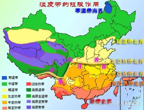
北部湾北部记录的全新世气候变化
陆岸青
【摘要】:北部湾是由中国的广西沿海、广东雷州半岛、海南西部,以及越南的东北部所围成的天然半封闭浅水海湾,是受东亚季风与西南季风影响的气候敏感区。由于海南岛的屏障作用,受南海海流作用影响小,适合开展气候变化研究,也有助于理解季风气候变化过程,快速气候变化事件及其驱动机制。
当前,对北部湾古气候的研究比较少,且年代控制精度不高。北部湾北部具有较高的沉积速率,可以实现较高分辨率的气候变化恢复研究。
本文首先对表层沉积物进行粒度和孢粉分析,获得孢粉分布规律与沉积环境的关系。对Q24孔(岩芯长6.25 m)和Q43孔(岩芯长5.13 m)的柱状样品进行孢粉、粒度、碳屑、C/N、δ13C和XRF全芯扫描等分析,将表层样品中获得的气候代用指标与沉积环境代用指标的关系应该到钻孔数据的综合解译中,在210pb和AMS14C年代框架下,重建了北部湾北部8.50 cal. kyr BP以来的古环境和古气候。
主要研究内容及结果如下.
(1)表层孢粉分布规律 对表层沉积物的粒度和孢粉分析结果表明,孢粉浓度与沉积物的粒径具有一定的正相关;蕨类孢子和松属花粉含量随离岸距离增加而增加,而草本植物花粉含量则随离岸距离的增加而减少。
(2.)气候变化过程和模式 本研究利用粒度参数作为沉积环境水动力的代用指标,C/N、δ13C和Al/Ti值指示陆源输送变化,孢粉及碳屑为主要气候代用指标,通过校正沉积环境变迁及陆源输送变化对孢粉分布的影响来提取气候变化信息,获得气候变化过程。
约8.50 cal. kyr BP琼州海峡的完全开通,现代北部湾基本形成,研究区处于相对稳定的浅海环境,环境对气候代用指标的影响相对较弱。根据沉积相分析及AMS14C年代框架,Q24孔在8.5-4.0 cal. kyr BP期间沉积连续,Q43孔主要为4.0 cal. kyr BP之后的沉积,综合两个钻孔的气候及沉积环境多代用指标的测试结果,恢复
8.50 cal. kyr BP以来的气候变化过程:
7.84 cal. kyr BP之前,反映比现代温暖湿润的气候特征;
7.84~7.36 cal. kyr BP期间,较上一阶段偏凉偏干的气候所致;
7.36~6.51 cal. kyr BP期间,变凉变湿的气候特征;
6.51~4.09 cal. kyr BP期间,总体上Quercus和湿生草本类型均增加,粒径参数及δ13C值较稳定,反映总体上呈现偏凉湿的气候特征,但结合粒度参数及其它沉积环境指标的变化校正,可以识别出三个亚阶段:
6.51~6.00 cal. kyr BP,偏凉湿的气候;
6.00-5.80 cal.kyr BP,尚需进一步分离研究气候变化信息;
5.80~4.09 cal. kyr BP,反映出气候略偏暖。
4.09-1.84 cal. kyr BP期间,由于Q43孔在该阶段取样扰动,记录缺失,仅由一个未扰动样品无法实现高分辨率研究,迄待今后进一步研究;
2.20-1.84 cal. kyr BP期间,说明了变凉变干的气候特征;
1.84~1.40 cal. kyr BP期间,比上一阶段更加变凉变干;
1.40-0.33cal. kyr BP期间,指示了变暖变湿的气候特征。
(3)北部湾北部记录的突发性气候冷事件及其驱动机制 北部湾北部记录的8.50 cal. kyr BP以来突发性气候冷事件分别为7.8-8.0 cal. kyr BP、8-6.0 cal. kyr BP、1.4-1.8 cal. kyr BP,通过与不同地区和区域记录的冷事件对比,认为这些事件可能太阳辐射和温盐环流有关。
========================
山西柿子滩遗址:距今2.3万~1万年,细石器
柿子滩遗址群田野资料的石制品组合特征呈现了中国旧石器文化的西部风格,代表了旧石器时代晚期之末广泛分布于黄土高原和黄河中游 一种独特的区域文化。柿子滩课题的深入开展对建立西部史前文化的时空构架, 探索中国细石器文化的区系类型以及华北旧石器时代晚期向新石器时代早期过渡 等,都有着重要的学术意义。
2000—2001年的田野工作分3个阶段进行:2000年,在清水河下游两岸进行大规模调查,15公里范围内发现了25处旧石器和动物化石地点,包括高楼河沟口附近的中心遗址区;2000—2001年选择了20个地点进行了定量阶梯式探沟发掘,水平清理、出土物的三维空间记录以及文化层沉积物的过筛和淘洗,基本搞清了遗址群内石器文化的分布范围、分布高程、分布密度、地质成因和遗址的埋藏性质。第14地点发现一处比较完整的篝火遗迹;2001年,发掘了高楼河附近的第9地点、第12A地点和第12B地点,发现了距今2万—1万年间3个层面的古人类活动遗址,清理出4个用火遗迹、修整石器的工作区、2000余件石制品、动物化石以及制作精美的蚌质穿孔装饰品。
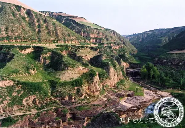
吉县柿子滩旧石器遗址环境地貌
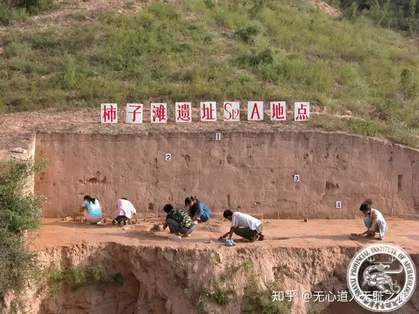
2005年柿子滩旧石器时代遗址发掘现场
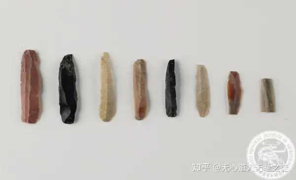
细石叶
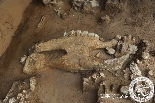
犀牛骨化石
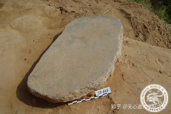
石磨盘
山西柿子滩遗址“S14地点(距今23000至19500年)出土磨制石器上发现了小麦族、黍族、豇豆属、薯蓣属、栝楼属等淀粉粒,表明当时黍族植物已被人类开发,人类逐渐掌握其习性,对橡子、栝楼属的磨制加工方式可追溯到距今23000年。这种加工方式可能意味着粉食的出现。”[4]
柿子滩遗址还出土了两幅非常有名的岩画(图1-12),到目前为止,世界上还没有任何先进的方法能够直接测定岩画的绝对年代。柿子滩遗址的最晚年代可能处于旧石器时代晚期之末甚至更晚,S9地点2002年的碳14测年数据为8340±120BP[5]。笔者窃以为这两幅岩画距今大约9000年,在第六章会有对此岩画更多详细说明。[6]
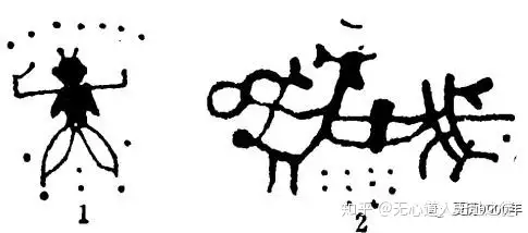
图1-12 柿子滩岩画
————————————————--
柿子滩旧石器时代遗址位于山西省吉县,分布在清水河两岸从西村到大田窝村15公里范围内的二级阶地上。1980年发现并进行试掘,发现了以柿子滩S1地点为中心的原始人类活动中心营地;2000~2007年发掘了以高楼河沟口为中心的第二处原始人类活动中心营地,以S14、S24、S12和S9地点为代表;2009~2010年,又发掘了以狮子河村为中心的第三处更为丰富的原始人类活动中心营地,以S5和S29地点为代表,此处营地为中国目前发掘规模较大,埋藏也较为丰富的一处旧石器时代晚期露天营地遗址。经过多年连续、系统地科学发掘,发现用火遗迹百余处,三万余件石制品和动物化石,以及石磨盘、石磨棒、鸵鸟蛋壳饰品和蚌质穿孔装饰品等重要遗物。
柿子滩遗址群是中国目前距今2~1万年现存面积最大、堆积最厚、内涵最丰富的一处原地埋藏遗址,为探讨旧石器时代晚期黄土高原南缘人类行为、细石器工业起源、北方旱作农业起源、华北旧石器时代晚期向新石器时代早期过渡等课题提供了可靠详尽的实物资料。2001年,柿子滩遗址被列为“第五批全国重点文物保护单位”,并于当年荣获“2001年度全国十大考古新发现奖”。2003年,又获得国家文物局“田野考古三等奖”。
山西吉县柿子滩旧石器时代遗址是中国目前距今2万至1万年间现存面积最大、堆积最厚、内涵最丰富的一处原地埋藏遗址。
柿子滩遗址位于山西省吉县东城乡西村,该遗址是中国目前距今2万至1万年间现存面积最大、堆积最厚、内涵最丰富的一处原地埋藏遗址;柿子滩遗址群田野资料的石制品组合特征呈现了中国旧石器文化的西部风格,代表了旧石器时代晚期之末广泛分布于黄土高原和黄河中游一种独特的区域文化。
2000至2001年,在15公里的范围内新发现25处旧石器地点以及一个中心遗址区,组成了柿子滩遗址群。2001年至今进行了连续发掘,新发现10余处人类用火遗迹,上万件石制品动物化石、石磨盘、石磨棒和蚌质穿孔装饰品。这是中国目前发现距今2-1万年前面积最大、堆积最厚、内涵最丰富的一处原地埋藏遗址。
遗址文化遗物有石制品和岩画两部分。石制品大部分以石英岩为原料,器形有削状器、尖状器、锥钻、石锯、琢背石片等。岩画发现于遗址西北侧石崖南端“岩棚”下,这两方岩画虽因年深日久风化严重,但赤铁矿的赭红色及所绘形象,尚能依稀可见。
柿子滩遗址是以典型细石器为主体的旧石器时代晚期文化遗存。其文化层的石制品虽然分为细石器和石片石器两类,它具有中国西部风格,代表了旧石器时代晚期之末广泛分布于黄土高原和黄河中游一种独特的区域文化,而且可以与欧洲旧石器时代晚期文化作对比;其次它还是具有可靠年代证据的典型细石器文化,成熟的细石器工艺和技术是探索中国北方旧、新石器时代过渡的珍贵资料。柿子滩遗址是中国已发现的旧石器时代晚期现存面积最大、堆积最厚、内涵最丰富的一处遗址。
尤其让人惊喜的是,在这里还发现了两处以赭红赤铁矿绘制的、表现当时人们精神生活与信仰崇拜的岩画。这些看似稚气然而却形态生动、技法简练的作品,是人类最早的绘画遗迹之一。它反映了人类在物质生活中寄寓的精神追求。
===================================
几何形细石器源流初探
考古学家依据石器的形态特征,把细石器分为几何形细石器和非几何形细石器两大类。其中,几何形细石器呈三角形、半月形、梯形等几何形状,主要分布在西亚、北非、欧洲一带;非几何形细石器的形状不规则,主要分布在东北亚和美国西北部(也称西北美);那么,几何形细石器是何时何地产生的?如何传播的?
中亚,是华夏先民西迁最大一个集散地。其最大的文化特点就是不典型性。似乎东、西方文化因素存在,但两种文化都不特别突出。如中亚旧石器中期文化考古,有人曾在中亚寻找欧洲和西亚莫斯特文化的石器类型,可是,“最近30年来的研究成果越来越清楚地表明,中亚的不少地区都能见到大致上可相比较的石器技术和石器类型序列,但是没有一种序列与西欧的完全一致(《中亚文明史·第1卷》法国丹尼,马松主编;芮传明译)”。这东、西方文化因素并蓄之地,恰恰正是探索几何形细石器源流一个可楔入的地方。
1980年秋,陕西大荔人化石地点进行了第二次发掘,在含大荔人化石的地层中找到了384件石制品,其中石器116件,属小长梁——东谷坨类型。张森水研究员等发现,大荔人遗址石器具有一些独特的特点,一是石器多用燧石制成;二是大量使用断片制作石器;三是石器以刮削器为主体,凹刮削器占的比例较高;四是出现三角形和梯形石片,这些特点正是欧洲中石器时代几何形细石器的基本特征。由此看来几何形细石器与勒瓦娄哇技术一样,原始人很早就掌握了这一技术,只不过在合适的环境和经济活动中才会应用它。
《中亚文明史·第1卷》认为:“蒙古高原东部的旧石器时代文化之形成曾受到两个地区的影响:蒙古高原西部(勒瓦娄哇-莫斯特砾石器加工业),从其锯齿工具所展示的西伯利亚风格来看,则还受到叶尼塞河与安加拉河地区文化的影响。”这就是说在蒙古高原,莫斯特文化由西向东,依次变弱,至少中部,存在有莫斯特文化,但相对要弱一些。
蒙古高原中部旧石器时代晚期最为重要的的遗址是鄂尔浑河左岸穆伊尔廷谷(彻尔郁穆科瓦雅峡谷)的多层居住地。位于蒙古古都哈喇和林废墟的对面,1949年由A.D.奥克拉德尼科夫发现。发现有五个文化层,从旧石器时代最早阶段至最后阶段,石器形成与制作的整个发展过程。奥克拉德尼科夫结论是:穆伊尔廷谷的所有文化层都体现了完全的一致性,贯穿了同一条发展线索。这一延续性由下列事实加以证实:五个文化层都包括了勒瓦娄哇传统的石核(圆盘形、砾石形和棱柱形),以及抓扒器、刮削器、石锥和其他器具。这反映了这一地区勒瓦娄哇技术产生早,相对于西部或西方,还不够典型的特征。“非常有意义的是,随着文化层的向上移动,用刀形石叶制作的石器数量也越来越多。石叶的形状固定不变,但是其尺寸则逐步减小,于是,石制工具便趋向于变成细石器。更有甚者,最上面的文化层显示出,仔细修整和进行两次剥片的石器越来越多,以改善石器的形状。……最顶层属于旧石器时代的最后阶段,奥克拉德尼科夫将它定在距今15,000年与12,000至10,000年之间(《中亚文明史·第1卷》)”。从这里几乎可以看出几何形细石器诞生的全过程:继续延用勒瓦娄哇技术,保持形状不变,使原有石叶石器成为缩小版,又注重器形,仔细修理,于是,比较讲究的几何形细石器,大概就是这样形成的。
阴山以南,随着气候的变化,存在着时好时差的采集农业,属于非典型游猎文化区。华夏先民北上进入阴山以北,则是纯粹的游猎文化区,生活环境和生产环境不同,生产、生活工具必然要发生变化。通过上述基本可以看出,叶尼塞河一带大约是一个北部集散点,从此东、西扩散,形成不同的东、西两类草原文化。这一带的几何形细石器文化相当微弱,较难捕捉。但这一文化因子在向西扩散中逐渐得到加强和完善,这就是为什么典型的奥瑞纳文化和马格德林文化总是出现在西欧。由于西欧处于迁徙的末端,也是各种石器文化发展到了巅峰时期,也是东、西文化差异性最大的地方。
“中亚北部地区(蒙古、南西伯利亚、哈萨克斯坦)的新石器文化通常继承了旧石器时代晚期工具的装柄石叶技术传统。在中石器时代就开始出现的一个新生事物,乃是大规模地使用细石器,尤其是几何形石器(《中亚文明史·第1卷》)”。
根据《中亚文明史·第1卷》的相关描述,中亚是存在几何形细石器的,并且普及较晚,这符合中亚石器特征。却造成一个错觉,似乎是从欧洲传播过来的,其实不然。就和莫斯特文化一样,在中亚是存在的,但不典型。几何形细石器的产生与流变的过程大致是:当华夏先民北上阴山以北地区,新的生存环境使其在工具上进行了相应的改变,产生了一个新的类型几何形细石器。由此西迁过程中不断强化。过中亚西迁路径是:一路沿东欧大草原向西、向北扩散,一路过伊郞高原到今叙利亚一带,再环地中海扩散。伊比利亚半岛是一个十分重要的末端聚集点,许多远古文明信息都在那里得以保存。苏联考古学家发现,克里米亚最初出现的是半月形细石器,与莫斯特文化在一起,随后出现了柳叶形石镞;乌克兰最初出现的是梯形细石器;德斯纳河流域出现的是三角形细石器;白俄罗斯和立陶宛出现的是柳叶形石镞和三角形细石器。相反,西欧细石器遗址同时出现几种几何形细石器,而西欧呈现的是一种多文化融合现象。而中亚自身,很早就有了这种几何形细石器因素存在,但不典型,直到中石器时代,才发挥出来。
裴文中先生在《中国史前时期之研究》中说:“在西伯利亚境内,已发现旧石器时代晚期之遗物,与欧洲之奥纳瑞文化者及马格德林文化者,均甚相似。在贝加尔湖附近,此种旧石器时代晚期之文化,更渐次演变而为中石器时代之文化,其遗物中如扁平多齿之鱼叉及短小之圆刮器等,均与欧洲阿奇利文化者相似。此种文化,分布于亚洲之北部及欧洲之中北部,成为一独立之系统。时间前进,此系统之文化更向中国境内移动,因地理环境之限制,演变而为细石器文化。中国之细石器文化虽与欧洲所发现之同时代之文化,稍有不同,但此为地方性质,实均为同一之系统。”能将欧洲几何形细石器聚焦于贝加尔湖一带,认识是独到的。无论几何形,还是非几何形细石器皆为同一文化系统的认识也是正确的,只是在流变迁移方向上还没有参透,这是在没有搞清人类起源与迁徙流变情况下,史家常见的一种错误。
===================================
洛南盆地发现“阿舍利手斧”能说明什么?
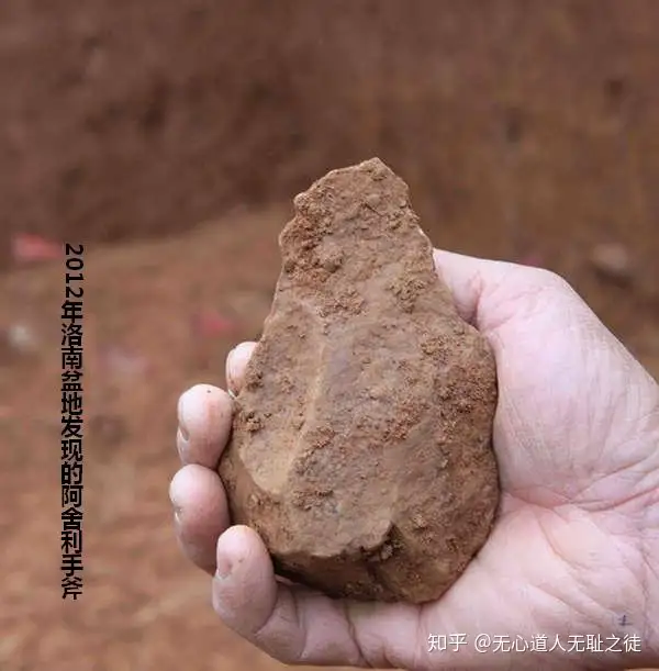
据2013年01月28日《化石网》雷恺《陕西洛南盆地发现旧石器时代早期的“阿舍利”手斧》一文报道,“2012年9—12月,陕西省考古研究院、中国科学院古脊椎动物与古人类研究所、洛南县博物馆和南京大学在配合省道S202线洛南过境公路建设中,对线路穿越的第二级阶地“四十里梁塬”东部的郭塬、十字路口、延岭、鹤眼岭、柳树洼和张豁口南等6个旧石器遗址进行了抢救性发掘,清理遗址面积1300余平方米,发掘过程中还同步采集了古环境变迁分析和年代测试样品1500余份,出土石制品18000余件。”“确定该遗址年代确定在70万年至3到5万年之间”。是继2011年商南张豁口出土了20000件原始人类石器,发现了包括手斧、手镐、薄刃斧、砍砸器、大型石刀等阿舍利石器组合之后。“本次抢救性发掘中,再次从郭塬地点和张豁口附近几个地点发现了流行于非洲和欧亚大陆西侧阿舍利工业的手斧、薄刃斧和手镐等典型器物组合。这是迄今在我国甚至整个东亚地区阿舍利工业器物最为集中的发现,充分说明以往在洛南盆地发现阿舍利类型工具组合不是偶然的,这里保存着数量惊人的该类遗址”。
这次抢救性发掘成就,主要有两点:一是大规模集中发现了包括手斧、薄刃斧和手镐等阿舍利石器组合。二是通过对出土阿舍利石器周围土层年代的测定,判定石器的年代距今从25万年至7.5万年左右,确定该遗址年代确定在70万年至3到5万年之间。这次考古发现,其意义甚为重大,为人类起源及人类起源与现代人类起源的衔接挠开了一线缝隙。
关于“阿舍利手斧”与“阿舍利石器文化”,简要叙述如下:
阿舍利手斧一端较尖较薄,另一端略宽略厚,这是史前时代第一种两面打制、加工精细的标准化重型工具,它代表了直立人时期石器加工制作的最高技术境界。和早期相比,这时的手斧、薄刃斧、手镐等多种类型,都表明当时直立人双手已非常灵巧,而且具备了一定的认知和思维水平。阿舍利石器文化是旧石器文化中的一个阶段,因最早发现于法国亚眠市郊的圣阿舍尔而得名。它的一个集中体现,就是左右对称的石器,多类型组合,例如:手斧、手镐、薄刃斧、砍砸器、大型石刀等。
埃塞俄比亚南部的Konso地层中发现的阿舍利石器群的年代与在肯尼亚北部发现的石器的年代相同——大约是在175万年前,是目前发现的最早的阿舍利石器文化。手斧(hand-axe)是旧大陆旧石器时代初期阿舍利文化(Acheulean Tradition)代表性的石器。其分布范围东至印度,西达英伦,包括整个非洲、近东及西欧大部份的地区,一直延续到晚更新世。
1944年美国考古学家莫维士在研究泰国北部伊洛瓦底河的安雅特旧石器文化之后发表著名平行两种文化假说(Parallel Phyla Hypothesis),认为早期旧石器时代,存在两个技术传统不同的文化圈,一个是砍斫器文化圈(The Great Chopper-tool Complex),包括东亚、南亚巴次大陆北部;一是手斧文化圈(The Great Hand-axe Complex),包括全非洲、欧洲的南、中、西部以及中东和印度半岛(Movius,1944,1948)。莫维士的理论影响很大,按照这个理论,旧大陆在过去200万年的绝大部分的时间里,生活在非洲、欧洲和西亚的的直立人掌握着先进的阿修尔或“模式Ⅱ”技术,能够打制程序规范、技术复杂的手斧等两面打制工具;而他们的智商较低的亚洲其他地区的直立人则缺少这样的能力,只能使用“模式Ⅰ”技术,打制简单的工具,如砍砸器和未经加工的石片。莫维士用后来被称为“莫氏线”的这种技术将大陆分割成两半:西面的“手斧文化圈”代表人类文化发展的主流;而东面的“砍斫器文化圈”则相对落后,是一个文化落后的边缘地区,他将整个东亚及东南亚划分为文化滞后的范围。
在这一学术背景下,洛南盆地“阿舍利手斧”的发现,能说明什么呢?本文认为,至少能够为两个问题提供支持性证据。
一、下山来,爷拿着锋刃利器
这一题目有点秦腔的味道,以示对这一考古成就的祝贺。作为论文,再换个文一点的。
第一个问题:东亚有没有“阿舍利石器文化”?
1954年中科院古脊椎动物研究所的贾兰坡根据丁村遗址资料在1956年《科学通报》上,发表了《在中国发现的手斧》一文,较早提出过“手斧”。
1978年美军军人Greg Bowen在韩国京畿道全谷里发现手斧类石器。美国旧石器研究权威者J.Desmond Clark在参观全谷里石器后亦指出,全谷里石器并不表现典型阿舍利文化特征,反而与非洲“Sangoan facies”重型石工具有相似之处,年代在旧石器时代前期到中期的阶段。目前全谷里石器群在年代上未能有更确实的认识,石器类型学上该遗址发掘出土石器亦不包涵典型手斧石器。
在二十世纪六十年代越南Thanh Hoa省度山遗址发现过数以千计的大石片及手斧石器(quasi-bifaces)。
近年黄慰文先生依据广西百色发掘出土的手斧石器,曾在世界著名《科学》杂志上发表了《南中国百色盘地中更新世阿舍利型石器工艺》。
蒙古国就出土过阿舍利的手斧石器。在Okaladnikov与Derev’anko的努力下,蒙古迄今发现数百处石器时代的遗址。其中1987至1989年发掘的Tsagan-Agui洞穴遗址,堆积三米多深,出土一件相当典型的宽刃手斧。发掘者Derev’anko认为这里的石器与阿舍利文化相当。
广东地区的旧石器时代遗址也很丰富。粤东揭阳发现的这两件燧石两面修整石器,从石器器形正面形状、刃沿及修整技术,都与欧洲所见到的典型手斧相当一致。
祝恒富《概述鄂西北发现的砾石工业》一文说:“鄂西北地区在七十年代就先后在郧县、郧西发现古人类化石及少量旧石器,……在九四年为配合南水北调工程,古脊椎所对丹江库区沿岸进行了一次调查,共发现旧石器遗址或地点50余处其中鄂西北境内有40余处。此后十堰市博物馆及所属各县市博物馆的工作人员又先后发现数十处地点,现累计发现旧石器时代遗址或地点达70余处,获得石制品数千件”。“鄂西北手斧是近年来发现的,多不被人所知。手斧的原料基本为河滩的砾石,石质多为灰岩和石英岩。其形状平面有扁桃体形、梨形和三角形,以扁桃体形为主……手斧的加工方法是先将砾石打制成初坯,再对二侧边缘加工成刃,一般加工都较细致,刃缘均较长,基本都超过一半,大部分在三分之二左右,个别的等于或略小于石器的某一边。鄂西北手斧是用硬锤打制而成,所以片疤较深,刃缘不平。手斧在石器中所占的比例不大”。
由以上举例子可以看出,其实,东亚还是存在“手斧”文化的。据陕西省考古研究院对外公布:在陕西省商洛市洛南盆地郭塬、十字路口和张豁口南等6个旷野型旧石器地点的发掘过程中,再次发现西方旧石器时代早期流行的阿舍利石器工业类型的手斧、薄刃斧和手镐等工具组合,这是迄今在我国甚至整个东亚地区阿舍利工业器物最为集中的发现。至此,至少美国哈佛大学人类学家莫维士所提出“两个文化圈”理论已经不能成立。
洛南盆地阿舍利手斧的发现,基本可以确认,阿舍利手斧文化是一个全球性旧石器中后期文化,并非欧、非及西亚所特有。这种文化被公认为人类历史上第一种标准化加工的重型工具,它代表了古人类进化在直立人时期石器加工制作的最高技术境界。也就是说,全球范围内的直立人能够制造出如此“标准化”、高度一致的石器,于是就产生第二个问题:在所知170万年到10万年之间扩散到全球各地的直立人,有可能出自同一个种群。有些类似于全球惊人相似的大洪水传说实为同一个故事传播到世界各地相同的效应。或者说,人类起源与现代人类起源相同,都是一源所出。
那么,高度一致的“手斧文化”产生了人类同源的可能。第三个问题:如果人类同源,其源何在?
考古学家在肯尼亚托卡纳湖附近的古老沉积层中发现了176万年前的手斧,这是迄今发现的阿舍利石器技术的最古老证据。按照一般思维,由于东非发现了最古老的手斧,人类起源在东非应是无疑。况且东非起源说已是目前的主流认识。
这一主流认识可能还要持续一、二百年,但是这是建立在一个不正确思维模式下的结论。一般来说,作为源,由于变革较快,覆盖强度大,往往很难发现早期遗存,而处于边缘地带却覆盖频次低,扰动小,最易保存早期遗存。所以,一种惯性思维,无论是考古学,还是分子人类学,一般认为在哪儿发现最古老的,哪儿就是中心。其实,同时还存在另一种可能:发现最古老的东西的地方,反而离源头更远。有一种可能,青藏高原具有人类之源的条件,可能就是人类起源的源头。
阿舍利石器文化所对应的是本博《华夏之源》第三次自然推动力之后的文化状态。300万年前,喜马拉雅山造山运动,导致青藏高原进一步上升,早期直立人生存环境发生改变,迫使其离开第一起源地,向东部第二阶地寻找新的生存地,同时也在世界更大范围寻找生存空间。
如果人类来自青藏高原,如果将肯尼亚发现的176万年前的手斧为参照点,那么直立人从青藏高原出走时间也在220—250万年前,也就是说,直立人从青藏高原下来时,可能就有了这种利器,或是下山后的创造发明,所以,并不排除青藏高原东侧台地可能是这种手斧的发明地。
人类起源探索的路还很遥远,非洲起源说才开始盛行。无论是洛南盆地阿舍利手斧发现也好,还是历年来发现元谋人、巫山人、郧县人、蓝田人、丁村遗址、泥河湾人,也只是为人类起源探索划了一道缝而已。何时能够揭开人类起源之迷,要看中国史家和考古家的担当,或许百年,或许五百年,甚至更遥远。
二、山那边,也有一群人正在忙活着
这次抢救性发掘,找到了足以证明东亚直立人并不怎么傻的“阿舍利手斧”组合工具,其石器的年代判定为距今从25万年至7.5万年左右。基本对应于有巢氏时期和燧人氏时期。当洛南盆地先民运用先进的“阿舍利手斧”组合工具,幸福生活着的时候,山这边,中华台(蓝田山)的先民也在忙活着造房子、生火取暖、烤肉或捏陶罐。
中华台作为现代人类唯一的起源地,山那边,商洛一带必然也有一个相呼应的聚居区,作为现代人类起源的副区相伴共存。
这涉及一个重要问题的解答:即直立人为什么要选择中华台作为现代人类的起源地,而不是别处?
这是自然力第四次推动的结果——秦岭的抬升。约到了一百万年前,秦岭阻断了直立人在第二阶地的南北通道。然而在今称流峪,古时称流沙的这一峪道留下了一个能够通行的缺口,虽然不怎么好走,但能翻过秦岭,南行或北往。于是。发生了一个挡板效应,致使直立人在这一带秦岭南北开始聚集,逐渐定居下来。定居,是文明积累的必要条件。尽管也有出出进进的流动人口,但保持了有足够数量的种群在秦岭两侧坚守和生活,终于形成了现代人类。
商洛一带无论哪一项考古发现,都是中华台这一现代人类起源地的支撑证据。这次发掘遗址“确定该遗址年代确定在70万年至3到5万年之间”,是一个比较有力的支撑证据。尤其是“阿舍利手斧”组合工具高密度集中发现,不仅证明东亚的直立人不是二傻子,也为中华台现代人类起源与人类起源的衔接,提供了部分证据支持。
附:赵建兰《陕西集中发现“阿舍利”工业器物》(来源:2013年02月01日《中国文化报》)
陕西省考古研究院对外公布,在陕西省商洛市洛南盆地郭塬、十字路口和张豁口南等6个旷野型旧石器地点的发掘过程中,再次发现西方旧石器时代早期流行的阿舍利石器工业类型的手斧、薄刃斧和手镐等工具组合。这是迄今在我国甚至整个东亚地区阿舍利工业器物最为集中的发现。目前,以洛南郭塬和张豁口周围地点为代表的遗址年代学和古人类生活环境、石器工业特征、石制品微痕和残留物分析等研究工作正在进行中。
2011年,考古专家在洛南盆地发现大量旧石器时代的石制品,其中还发现了很多属于非洲和欧亚大陆西侧旧石器时代早期阿舍利文化类型的工具。2012年9月至12月,考古学家们对洛南的6个旷野旧石器地点发掘中,出土石制品1.8万余件。引人注目的是,在郭塬等3个发掘面积较大的地方,再次出土了西方旧石器时代早期流行的阿舍利石器工业类型的手斧、薄刃斧和手镐等工具组合。
“一般来说,阿舍利石器集中在非洲、西欧、西亚等地。之前在韩国、我国百色等地有零星单件发现。”中国科学院古脊椎动物与古人类研究所研究员王社江告诉记者:“发现单个类型可能是偶然的,但两次都发现,且是如此大规模的集中发现,说明阿舍利石器是当时原始人类普遍使用的工具。”经过测年,此次出土的阿舍利文化器物距今有25万年至7.5万年左右。在西方,大约在20万年前阿舍利文化就逐步消失了,而在中国缘何在7.5万年前还有此类器物,专家推测可能与环境等因素有关。
据介绍,阿舍利工业是源自非洲的旧石器文化,至少始于170万年前,因最早发现于法国亚眠市郊的圣阿舍利而得名,也被称为“阿舍利技术”或模式Ⅱ技术。其典型特征是有大的两面器,特别是手斧和薄刃斧,一组比较简单的石刻制品以及经过修整的石片。“阿舍利手斧很先进,它代表了直立人时期石器加工制作的最高技术境界。”王社江说:“这表明当时直立人双手已非常灵巧,而且具备了一定的认知和思维水平。在洛南发现手斧,也说明,80万年前的中国古人类拥有与非洲、欧洲的古人类相类似的先进石器打制技术。”
============================
附:蒙古高原地缘结构图
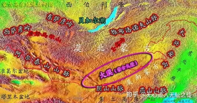
日本民族的父系基因数据,包括日本学者对各Y-SNP的理解。
約38% D2型、日本にしか残されていないシベリア経由で入ってきた縄文人の血
約34% O2b型、ジャポニカ米と共に揚子江から海路渡ってきた長江文明人(弥生人、倭人)の血
約18% O3型、大陸から朝鮮半島から渡来した漢族の血
約 5% C1型、インド経由、南方系海人族の血
約 1% N型、フィリピンに顕著に残り、ツングースも保有する血筋、スンダランドの流れとも
約 1% C3型、樺太から北海道に、アイヌに残るバイカル湖経由のツングース系の血
朝鮮半島から九州に、扶余の血? ルート違いのバイカル湖経由のツングース系の血
その他 1%以下、D1、D3型、チベットに残るテュルク系?の血
O1型、台湾出自の大陸系の血
O2a型、渡来時期、ルートの異なる長江文明人の血
-------------------------
朝鲜民族父系基因数据:
O3, 约占45%
O2b, 约占37.3%,,韩系底层基因,古亚细亚族群(广泛分布于西伯利亚);
其他部分D2、Q1、O1、N*。
==================================
父系Y染色体C、D型人群是老亚洲人,以不准确的称谓,C型被称为“棕种人”,D型称为“矮黑人”。D人群大概6万年前来到东亚,D人群对东亚基因贡献不多;C人群大概5万年前来到东亚,是大部分东亚人的母系远祖。
D2型是日本绳纹时代原住民的基因,也就是现在北海道阿伊努人;O2b型是弥生时代从朝鲜半岛迁移到日本的秽貊人基因。
C3c是极其具有阿尔泰语系标志性的类型,在西伯利亚的南部地区,C3c是最重要的成分。C3c在蒙古草原也有一定的分布,是蒙古语民族的标示性基因类型之一。C3c在我国东北其他阿尔泰语居民中也有一定分布,鄂温克为26.9%、鄂伦春族为41.9%、赫哲族为11.1%、锡伯族为4.9%,岫岩满族为2.8%,达斡尔族为2.6%,C3c在阿尔泰语周边的汉、韩、日民族并不存在。
C1只分布在日本地区的大和族人中,日本之外没有C1发现。日本土著民族阿伊努人中主体是D2,少量C3,并无C1。
O2b是东亚人一常见类型,在东亚地区主要分布在日本和韩国,但在东南亚,则有更广阔的分布,泰国、越南和菲律宾都有不低比例的O2b。不过东南亚的O2主流是O2a,中国南方的许多文化都有O2a的贡献,比如江西吴城文化。O2可以说是南方民族基因。
=================================================
古代东亚人群迁移的背景。在O系新亚洲人到来之前,东亚是C、D系老亚洲人的天下。但是当O系向东亚迁移时,O系开始吞没C、D系的地盘,并且征服、屠杀了老亚洲人,但是对女性老亚洲人有所保留,因而C系对应的母系线粒体基因占据了现代东亚人的重要组成部分。在人类还没有发展出游牧生产方式前,C、D系渔猎-采集技术很难与O系的农耕技术竞争,但是游牧技术发展以后,C系发起了反攻,中国古代中原与北方游牧族群的战争,就是这一历史背景。C、D系除被O系屠杀、融合外,都退守到地理条件很差的环境,保证了对O系的相对优势,比如青藏高原的藏族前身D1和D3,蒙古草原和西伯利亚寒地的C3系,日本列岛原住民D2的阿伊努人。
这个背景对理解日本和朝鲜民族根源极重要,朝鲜民族基因最大的三部分,一是C3,二是O2b,三是O3,其他基因可以相对忽略。而C3正是朝鲜民族韩系底层基因,,朝鲜区分日本的关键之所在。一般人们会忽略看上去比例较小但实际上较高比例的C3。
在O2b人群向东北迁移后,东北亚的C3系向地理条件差的区域退守,O2b占据了东北最好的平原地带,C3系的东胡退守到大兴安岭,C系的肃慎退守到黑龙江和日本海滨海山地,C3系的韩系退守到朝鲜半岛南部。注意东北亚C系基因是C3,可以说北亚和东北亚曾经是C3系基因的天下,并且东胡和肃慎的C3与朝鲜的C3是有区别的,东胡和肃慎、也就是蒙古和通古斯的C3是C3c,而朝鲜的C3是C3a。
================


评论
发表评论